Run the Black Mountain Crest Trail: A Runner’s High Above the Clouds
Black Mountain Crest Trail: A Runner’s High Above the Clouds
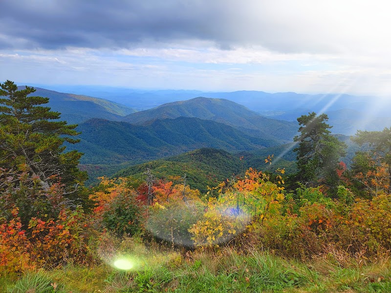
For trail runners seeking the ultimate challenge, the Black Mountain Crest Trail (BMCT) offers a grueling yet awe-inspiring adventure. Stretching across some of the highest peaks east of the Mississippi, this iconic trail in the Black Mountains rewards every grueling climb with jaw-dropping views and a sense of accomplishment few runs can match. Known as one of the toughest trails in the Southeast, it’s a bucket-list experience for those ready to tackle its rugged terrain.
The trail begins at Bowlens Creek near Burnsville, NC, and climbs steeply through dense hardwood forests before breaking onto open ridgelines. From there, it’s a rollercoaster of ascents and descents as you traverse iconic peaks like Celo Knob, Winter Star, and Potato Hill. The highlight, of course, is Mount Mitchell, the highest peak in the eastern United States at 6,684 feet. For those daring enough to take it on, the BMCT offers roughly 12 miles of quad-burning climbs, technical descents, and endless vistas.
Despite its difficulty, the Black Mountain Crest Trail is a spiritual experience for many. The air is cooler, the landscape wilder, and the sense of accomplishment unmatched. If you’re up for the challenge, this trail delivers an unforgettable run through the heart of Appalachia.
Adventure Guide: Running the Black Mountain Crest Trail
Trail Overview
- Length: Approximately 12 miles (point-to-point)
- Terrain: Steep, rocky, and highly technical singletrack
- Difficulty: Extremely challenging
- Location: Black Mountains, near Burnsville and Mount Mitchell, NC
- Best Time to Visit: Late spring through early fall for safer trail conditions and clear views
What to Expect
- Trail Features:
- Strenuous climbs and descents, with exposed ridgelines and rocky terrain.
- Stunning views from peaks like Celo Knob, Winter Star, and Mount Mitchell.
- A mix of shaded forest and open alpine-like environments.
- Highlights:
- Mount Mitchell, the highest peak in the eastern U.S. at 6,684 feet.
- Sweeping panoramas of the Blue Ridge Mountains from the ridgeline.
- A true wilderness experience, with a sense of remoteness and solitude.
Tips for Runners
- Parking:
- Start: Park at Bowlens Creek trailhead in Burnsville.
- Finish: Arrange a shuttle or park a second vehicle at Mount Mitchell State Park.
- What to Bring:
- Trail running shoes with excellent grip for rocky sections.
- Hydration pack and energy snacks—there are no water sources on the trail.
- Trekking poles if you need extra support on the climbs and descents.
- Safety Note:
- The trail is remote and technical. Be prepared for sudden weather changes, especially at higher elevations.
- Cell service is limited—carry a map, compass, and let someone know your plans.
Getting There
From Asheville, take I-26 East to Exit 9 for Burnsville. Follow US-19 East to NC-80 South, then turn onto Bowlens Creek Road to reach the trailhead. The drive takes approximately 1 hour.
Fun Fact
The Black Mountain Crest Trail traverses seven of the 10 highest peaks in the eastern United States, making it one of the most iconic high-elevation routes in the Appalachians. Known locally as the “Death March,” it’s a rite of passage for hardcore trail runners and hikers alike.
Adventure Map
Asheville Info
No GPX info
Reviews