Rock Formations & Mining History at Bachelor Loop
Category
Scenic Drive
Typical Duration
2-4 hours
Difficulty
Moderate
Nearby Experts
Photo Gallery
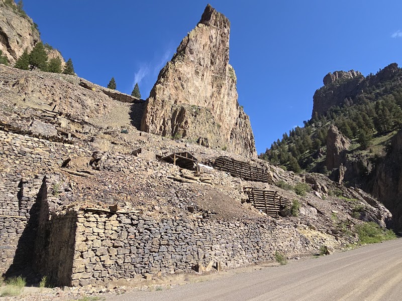
Rock Formations & Mining History at Bachelor Loop - Bachelor Loop Interpretive Site
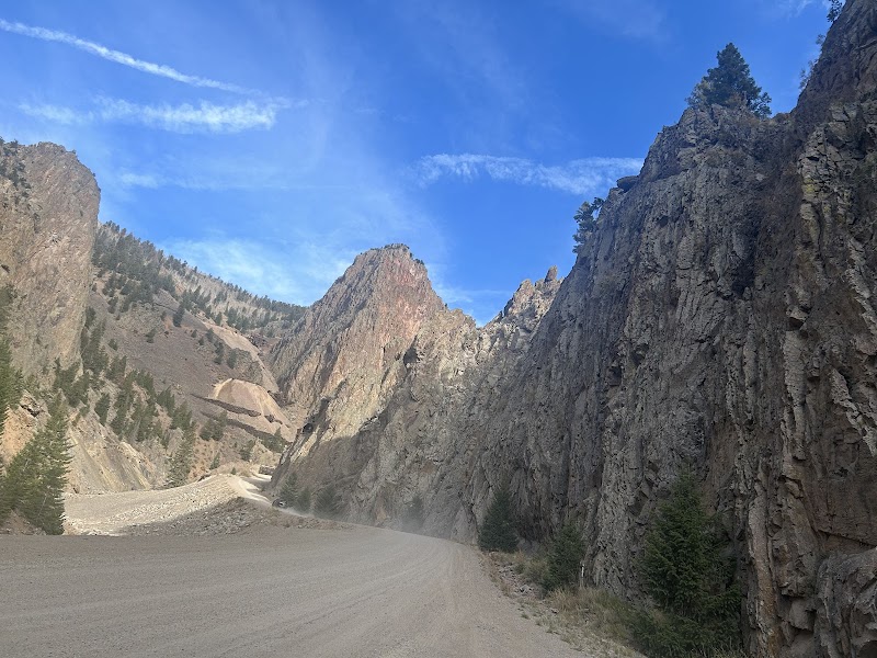
Rock Formations & Mining History at Bachelor Loop - Bachelor Loop Interpretive Site
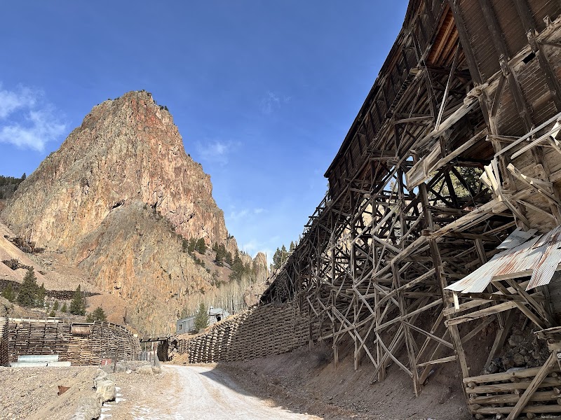
Rock Formations & Mining History at Bachelor Loop - Bachelor Loop Interpretive Site
About This Landmark
Nestled in the San Juan Mountains near Creede, Colorado, the Bachelor Loop Interpretive Site offers a captivating glimpse into both natural beauty and historical intrigue. This scenic loop features remarkable rock formations and landscapes shaped by volcanic activities millions of years ago. The area is dotted with remnants of the rich mining history that once defined Creede, making it a compelling destination for visitors interested in geology and history. Stunning geological features like pinnacles and cliffs rise dramatically, offering a backdrop that is both rugged and picturesque. This unique combination of natural splendor and historical remnants makes the Bachelor Loop a standout destination for adventurers and history enthusiasts alike.
Adventure Guide to Bachelor Loop Interpretive Site
Take a Scenic Drive
- Route: Bachelor Loop Road
- Special Features: This 17-mile scenic drive takes you through beautiful rock formations and historic mining territories.
- Local Insights: Originally a path for miners, it offers interpretive signs that enrich your journey with historical context.
- Visitor Tips: Best visited in the summer months when roads are clear. A 4x4 vehicle is recommended due to rugged terrain.
Hiking Opportunities
- Trail: Wheeler Geologic Area
- Special Aspects: This trail features surreal volcanic formations.
- Historical Fact: This area was formed from volcanic ash flows 25 million years ago.
- Visitor Tips: Bring water and sun protection. It’s a long hike, so start early in the day.
Photography
- Location: Days’ Fork Overlook
- Features: Offers panoramic views of the canyon and rock formations.
- Photography Tip: Sunset provides the best lighting for dramatic shots.
Practical Advice
- Best Times: Summer and early fall
- What to Bring: Sturdy footwear, camera, snacks, water
- Directions: From downtown Creede, drive north on Main Street, then continue onto Bachelor Loop Road; approximately 15 minutes from the town.
Location
Rock Formations & Mining History at Bachelor Loop in Bachelor Loop Interpretive Site
Coordinates: 37.8646, -106.9254
Ratings
Overall
Photography
Reviews
Featured Activities
Primary Activity
Scenic Drive
Also Great For
Essential Information
Nearby City
Creede, CO
Protected Areas
Experience Level
Experience Needed: This natural landmark is recommended for those with some outdoor experience. Good for regular hikers.