THE ADVENTURE COLLECTIVE® · Independent discovery and booking for outdoor travel
Airplane Experiences in Pacifica, California
Pacifica Airplane Guide

Airplane Experiences in Pacifica, California

Perched between coastal cliffs and the sweep of the Pacific, Pacifica isn't an airfield town so much as a vantage point—where the landscape below begs to be seen from the air. Airplane experiences that serve Pacifica range from short scenic flightseeing trips out of nearby airports to charters for aerial photography, coastal surveys, and private transfers. These flights turn the familiar sights—fog-rimmed surf, serrated headlands, and the great urban sweep of the Bay—into cinematic compositions best appreciated from 1,000 to 5,000 feet.

Pacific CoastlinePillar Point & MontaraSan Francisco Bay approaches

Live destination inventory

Top Airplane Trips in Pacifica

18 trips · Book with confidence · Instant confirmation

About The Destination

Why Pacifica Is a Standout Airplane Destination

There is a particular kind of hush that settles when you lift off and arc along a coastline. In Pacifica that hush is edged by surf and wind—an elemental soundtrack for flights that trace the razor edge where land meets water. From the air the sequence of features that define Pacifica becomes legible: a strip of beaches interrupted by the dark notch of rock at Rockaway Beach, the long low slope of Sweeney Ridge in the distance, and the abrupt drop of the old Devil's Slide cliffs where the highway hugs the precipice. These are the compositions pilots and photographers covet. A short morning flight reveals the shifting geometry of fog, how it threads the coves and then unravels into neat fingers over the ocean; an evening sortie can catch the last light setting the surf to molten silver while the Bay glows behind San Francisco’s skyline.

The value of airplane travel here is not only scenic. Aircraft bring access to perspectives that change how you understand the coastline’s scale and connectivity. Scientists and surveyors use light aircraft for coastline monitoring; conservationists track erosion and habitat; photographers and filmmakers use aerial platforms to tell stories that no land-based vantage can. For travelers, that translates into a variety of experiences: 20–60 minute coastal sightseeing flights that give a compact, cinematic overview; tailored aerial photography flights for aspiring and professional shooters; and private charters that serve as efficient and scenic transfers across the Bay Area. Because Pacifica itself lacks a commercial airstrip, most airplane activity is staged from nearby general aviation fields and charter providers—operators who know the local weather patterns and routing constraints around the busy San Francisco airspace.

Season and weather dictate the mood and feasibility of flights more than any other factor. Morning fog often obscures the cliffs and low-lying beaches, burning off into crisp visibility by late morning or afternoon in many months—especially in late summer and fall. Conversely, winter storms and onshore winds can make flights choppy and restrict low-level flying windows. Another key consideration is airspace: the proximity of major airports and controlled approach corridors means flights are routed carefully; reputable operators coordinate with air traffic control and brief passengers on routing, safety, and noise-sensitive areas. For planners, that means being flexible with schedules, favoring clear-weather windows and working with operators who can adapt plans to shifting visibility. Ultimately, airplane experiences around Pacifica distill a big, wild coastline into an intimate, airborne experience—one that rewards anyone who wants to re-see the coast from above.

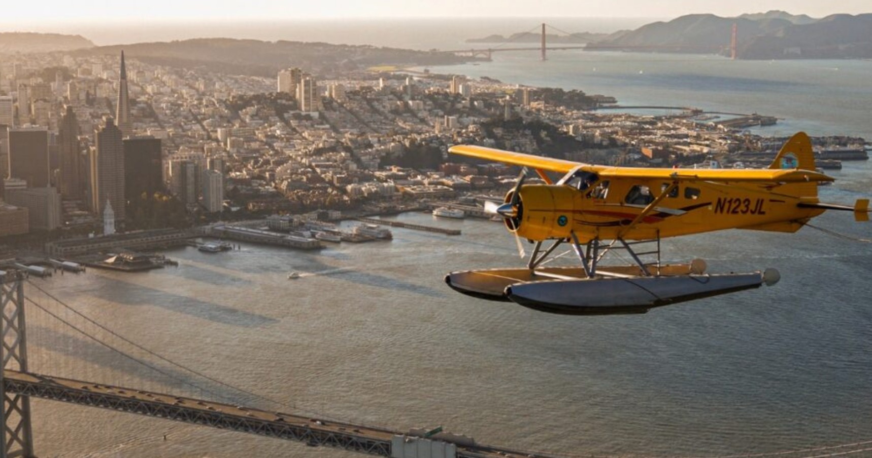
Airplanes here are primarily small general aviation or charter aircraft—single- and twin-engine planes that operate out of nearby airports. They offer intimate windows, slow flight capability for photography, and direct routing along the coast.

Visibility and wind are the two practical currencies of coastal flights. Operators often schedule flights around forecasted morning fog burn-off and afternoon thermals; fall months frequently provide the clearest skies for uninterrupted aerial views.

Because Pacifica sits near busy Bay Area airspace, flights are typically planned with inputs from air traffic control. That routing preserves safety and minimizes disturbance to populated shorelines and protected habitats.

Key Highlights

•Activity focus: Scenic & charter airplane experiences (flightseeing, aerial photography, private transfer)
•Most flights operate from nearby general aviation fields rather than within Pacifica itself
•Visibility is seasonally variable—late summer and fall often offer the clearest flights
•Flights are routed to respect controlled airspace near major Bay Area airports
•Short flights (20–60 minutes) are the most common format for sightseeing

Seasonal planning

Best Time to Visit

Pacific coastal fog is common in spring and early summer mornings; late summer and fall typically offer clearer skies and more predictable flying conditions. Wind and marine layers can change visibility rapidly—book flexible windows and confirm forecasts with your operator.

Airplane Experiences in Pacifica, California
Seasonal Highlights

Peak Season: Late summer and early fall—when fog is least persistent and aerial views are clearest.

Recommended months: September, October, July, August, June

Peak season

Late summer and early fall—when fog is least persistent and aerial views are clearest.

High-demand period with peak activity schedules.

Best months

September – October – July – August – June

Optimal conditions for outdoor activities and tours.

Weather & conditions

Pacific coastal fog is common in spring and early summer mornings; late summer and fall typically offer clearer skies and more predictable flying conditions. Wind and marine layers can change visibility rapidly—book flexible windows and confirm forecasts with your operator.

Off-season & shoulder periods

Winter and early spring flights can be moody and dramatic, with storm fronts and dynamic cloud formations—photographers may prefer the contrast, and operators may offer lower-traffic scheduling.

Match the trip to your comfort

Choose Your Experience Level

Introductory

Beginner

Quick scenic flightseeing experiences designed for travelers who want an easy, low-commitment way to see Pacifica and the nearby coastline from the air.

  • Short coastal sightseeing flight (20–40 minutes)
  • Introductory aerial photography hop
  • Bay-and-coast overview flight
Active outing

Intermediate

Longer photographic or survey-focused flights that involve slower passes and more time over target areas. Suitable for photographers and curious travelers who want prolonged airborne time.

  • Extended aerial photography missions
  • Chartered sightseeing stretch covering Pillar Point and Half Moon Bay
  • Small-group coastal orientation flights
Challenging / Technical

Advanced

Tailored charters and mission-specific flights—survey, film, or logistics work that require operator coordination, flexible routing, and sometimes multi-stop plans across the Bay Area.

  • Private charter for multi-point coastal routing
  • Aerial survey or film production flights
  • Pilot-led discovery flights focusing on advanced aerial composition

Recommended Gear

What to Bring

Essential

Core items

  • Photo ID and any documentation requested by the operator
  • Weather-appropriate layered clothing (it can be cool and windy at low altitudes)
  • Camera with secure strap and lenses for aerial shooting
  • Sunglasses and sunscreen for bright hours
Recommended

Helpful extras

  • Noise-canceling ear protection or headsets provided by the operator
  • Small daypack for personal items
  • Extra memory cards and batteries if shooting photos
  • Motion-sickness remedies if you are prone
Optional

Trip-specific

  • Polarizing filter for photography
  • Compact binoculars for coastline spotting
  • Light windproof jacket for pre- and post-flight waiting
Confirm flight windows and cancellation policies; coastal weather changes fast.

Insider Tips & Local Knowledge

Book flexible time slots that allow operators to pick ideal weather windows—late morning or afternoon in summer and especially September through October often yields the best visibility. Ask the operator about preferred seating for photography (window side, front rows) and whether they provide headsets—good audio improves the experience and safety briefings. If you want to prioritize photography, request a flight plan that minimizes high-speed transit and allows for slow, lower-altitude passes where permitted. Finally, be mindful of noise-sensitive areas and respect operator guidance; pilots route flights to reduce disturbance to wildlife and coastal communities. For travelers balancing land-based adventures, pair a flight with a morning surf or an afternoon hike along the coastal bluffs for a complementary view from both sea level and the air.

Planning questions

Frequently Asked Questions

Passengers do not typically need permits, but operators handle flight planning, airspace clearance, and any necessary permissions. If flights are for commercial filming or surveys, operators may coordinate additional approvals.
Airplane Experiences in Pacifica, California
Ready for your airplane adventure?

Browse 18 verified trips in Pacifica.

Compare current availability and book with instant confirmation.

Explore Pacifica airplane trips →