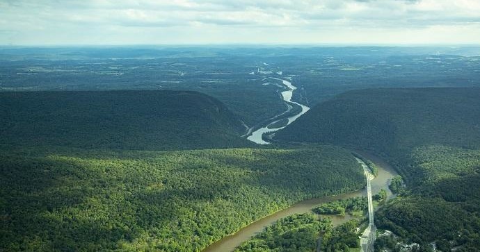
From the seat of a small plane or the glass of a helicopter, Palmerton reads like a layered storybook of human intervention meeting Appalachian geology. The town sits at the toe of Blue Mountain, where ridge and valley rhythms dictate how weather and light move across the land. Air tours here are intimate by necessity: they tend to be shorter, lower-altitude flights that favor clarity over cinematic scale. That makes them ideal for travelers who want to learn the landscape rather than simply admire it. You’ll see the handprints of 20th-century industry — abandoned worksites, slag piles, and company towns — and how contemporary conservation efforts softened those edges with reforestation and habitat restoration. Those juxtapositions are what make aerial viewing in Palmerton distinct: it’s not only about sweeping panoramas but about tracing lines of change across time and terrain.
Seasonality shapes the experience profoundly. Spring and fall deliver crisp visibility and temperate air conditions that stabilize aircraft and sharpen details on the ground. Summer afternoons can bring thermals and haze that lift dramatic cloudscapes but sometimes reduce clarity; winter turns the valley into a minimalist map of ridgelines if operators are running flights at all. Pilots who know the area will route flights along the leeward side of Blue Mountain for steady air, or through the Lehigh Gap to showcase contrasting topography and river meanders. Unlike long coastal or alpine scenic flights, Palmerton air tours reward close attention: a turned head will find a rare bird, a reclaimed meadow, or the roofline of a century-old mill.
Beyond landscape, there’s a cultural layer to airborne exploration here. Pilots often narrate stories of regional industry, migration corridors for raptors, and the small communities tucked into valleys — context that transforms a view into an orientation. For active travelers, an air tour pairs naturally with ground-based pursuits: fly in the morning, hike or bike the ridge in the afternoon, or follow a riverside paddle with an evening balloon or helicopter lift. The result is a compact yet multi-dimensional itinerary that shows why Palmerton punches above its size when seen from above. Practical considerations matter too: operators will advise on the best time of day for stable air, seat selection for optimal views, and how weather can alter routes. Approached thoughtfully, an air tour over Palmerton is both a primer and a highlight — an efficient way to locate yourself in landscape, history, and seasonal cycles all at once.