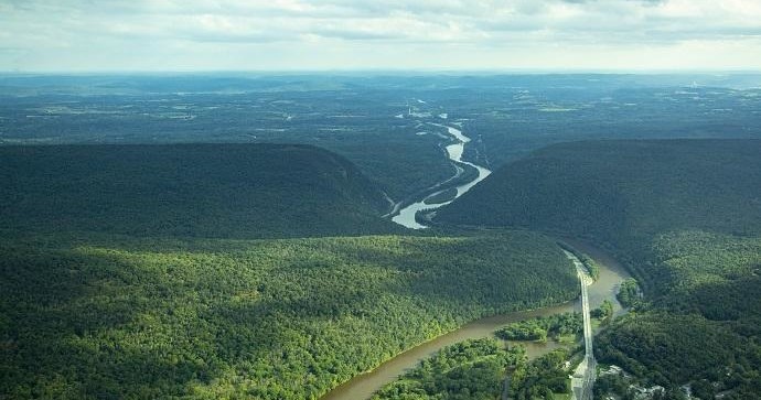
There’s a peculiar intimacy to flying low above a river town: the scale is small enough to read—boat wakes, canal bed ruins, the honeycomb of streets—but high enough to dissolve noise and busyness into patterns. Walnutport sits where the Lehigh River squeezes through the valley floor, and from the air that squeeze becomes an architectural spine. Air tours here do more than promise a view; they reframe how you see the local landscape. Over the course of a single flight you can trace the industrial past—the ribbon of canal towpaths, the brick footprints of former mills, the arc of railroad lines—while the horizon drifts to the soft blue of the Pocono ridgelines and the cultivated patchwork of farmland. The result is a compact, legible landscape that rewards short flights with layered context.
The geography is honest and varied. Flights launched from private airfields or nearby municipal airports skim low over river bends that cut through rock and pasture, then climb to give sweeping panoramas of forested ridges and communities that cluster below. For photographers and storytellers, the light in this region is unusually forgiving: long shadows across the valley in late afternoon, thin, luminous mornings during spring and fall, and the saturated, crunchy colors of autumn that render the ridges as if painted. These are the months when small-aircraft and rotorcraft tours most clearly narrate human and geological history together—eddies in the river, scars of quarrying on the hillsides, and the linear memory of canals and railbeds mapping industrial migration.
Air tours here are also practical. Short durations, often 20–60 minutes, make aerial sightseeing accessible for families, photographers, and travelers who want a high-impact experience without committing a full day. Because Walnutport is not a major tourism hub, flights frequently feel like private moments above a lived-in landscape—pilots often point out landmarks and weave local stories into their commentary. The tight scale of the valley means that even short trips can pass over multiple interest points: river confluences, historic downtown footprints, and nearby natural areas. This makes pairing an air tour with ground activities easy: launch with a morning flight, follow with a riverside paddle or a walk on the Lehigh Canal towpath, and end the day sampling local eateries in nearby towns.
Practical considerations shape the experience here in clear ways. Weather and light matter more than altitude: low clouds, river fog, and gusty winds off the ridgeline can limit options, so the window for ideal flights tends to concentrate around calm mornings and settled late afternoons. Seasonality alters the palette dramatically—spring green, summer canopy, and the explosive color of fall are each distinct—and each offers a different photographic and interpretive payoff. Whether you’re a casual sightseer, an aspiring aerial photographer, or someone seeking a concise orientation to the Lehigh Valley’s natural and industrial story, Walnutport’s air tours deliver a compact, memorable vantage on a landscape where human history and geology run side by side.