THE ADVENTURE COLLECTIVE® · Independent discovery and booking for outdoor travel

Fly into Lukla and follow the Khumbu Valley to Gorak Shep and Kala Patthar on a 12‑day, high‑altitude trek to Everest Base Camp. This guide covers daily elevations, terrain expectations and practical tips to manage altitude and weather.
Fly into Lukla and follow the Khumbu Valley to Gorak Shep and Kala Patthar on a 12‑day, high‑altitude trek to Everest Base Camp. This guide covers daily elevations, terrain expectations and practical tips to manage altitude and weather.
You step off the tiny twin‑otter into thin air and the runway at Lukla shrinks beneath a sky that seems to press you forward. Rhododendron and pine drop away within an hour and the trail begins to climb—wooden bridges creak, prayer flags snap, and the Khumbu Valley opens like a long, stony throat toward the high peaks.
Verified experiences and guided adventures in the surrounding area.
Operated by Nepal Trail Finder Treks & Expedition · Lukla, Province No. 1
You step off the tiny twin‑otter into thin air and the runway at Lukla shrinks beneath a sky that seems to press you forward. Rhododendron and pine drop away within an hour and the trail begins to climb—wooden bridges creak, prayer flags snap, and the Khumbu Valley opens like a long, stony throat toward the high peaks.
This classic 12‑day route threads through Sherpa villages—Phakding, Namche Bazaar, Tengboche, Dingboche—each village a practical hub of teahouses, mani walls and Jokhang‑style prayer wheels. The landscape is young geology: uplifted schist and granite carved by glaciers, with the Khumbu Glacier and moraine fields announcing the approach to Everest. Sagarmatha (Everest) National Park, established in the 1970s and a UNESCO site, protects both the cultural landscape and high‑altitude ecology.
Expect long days (4–8 hours typical), steady elevation gains and two planned acclimatization stops (Namche and Dingboche). Key high points: Lukla (2,860 m), Namche Bazaar (3,440 m), Dingboche (4,410 m), Lobuche (~4,940 m), Gorak Shep (5,164 m), Kala Patthar (~5,600 m) and Everest Base Camp (5,364 m). Terrain shifts from packed dirt and rock steps to boulder fields near Gorak Shep; trails can be icy above 4,000 m.
Practical edge: prioritize gradual ascent, hydrate, and pack a warm down layer and good boots. Flights to/from Lukla are weather‑dependent—build buffer days into travel plans. Guides and porters manage logistics and permits (TIMS, Sagarmatha NP); their local knowledge is the best insurance against altitude and weather. Arrive fit, respect acclimatization, and the ridge‑line views of Everest and its neighbors will repay the effort.
Yes — international trekkers require a TIMS card and a Sagarmatha National Park permit; operators usually handle these before departure.
Spring (March–May) and fall (September–November) offer the most stable weather and clearer mountain views; winter is cold and summer monsoon brings heavy snow and rain.
Very likely — Lukla flights are frequently delayed or canceled due to low clouds and wind; build at least one buffer day into your itinerary.
No — the standard Everest Base Camp trek is a high‑altitude hike on trails; no glacier travel or technical climbing is required for the classic route to Base Camp and Kala Patthar.
Nepal Trail Finder Treks & Expedition operates guided outdoor trips and adventures with an emphasis on safety, stewardship, and memorable experiences.
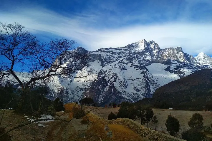
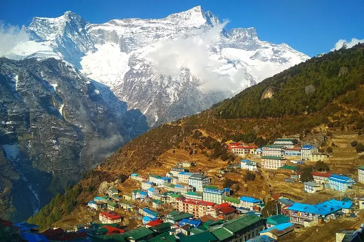
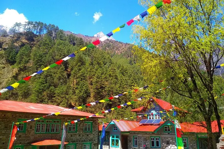
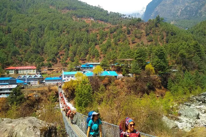
You step off the tiny twin‑otter into thin air and the runway at Lukla shrinks beneath a sky that seems to press you forward. Rhododendron and pine drop away within an hour and the trail begins to climb—wooden bridges creak, prayer flags snap, and the Khumbu Valley opens like a long, stony throat toward the high peaks.
You step off the tiny twin‑otter into thin air and the runway at Lukla shrinks beneath a sky that seems to press you forward. Rhododendron and pine drop away within an hour and the trail begins to climb—wooden bridges creak, prayer flags snap, and the Khumbu Valley opens like a long, stony throat toward the high peaks.
This classic 12‑day route threads through Sherpa villages—Phakding, Namche Bazaar, Tengboche, Dingboche—each village a practical hub of teahouses, mani walls and Jokhang‑style prayer wheels. The landscape is young geology: uplifted schist and granite carved by glaciers, with the Khumbu Glacier and moraine fields announcing the approach to Everest. Sagarmatha (Everest) National Park, established in the 1970s and a UNESCO site, protects both the cultural landscape and high‑altitude ecology.
Expect long days (4–8 hours typical), steady elevation gains and two planned acclimatization stops (Namche and Dingboche). Key high points: Lukla (2,860 m), Namche Bazaar (3,440 m), Dingboche (4,410 m), Lobuche (~4,940 m), Gorak Shep (5,164 m), Kala Patthar (~5,600 m) and Everest Base Camp (5,364 m). Terrain shifts from packed dirt and rock steps to boulder fields near Gorak Shep; trails can be icy above 4,000 m.
Practical edge: prioritize gradual ascent, hydrate, and pack a warm down layer and good boots. Flights to/from Lukla are weather‑dependent—build buffer days into travel plans. Guides and porters manage logistics and permits (TIMS, Sagarmatha NP); their local knowledge is the best insurance against altitude and weather. Arrive fit, respect acclimatization, and the ridge‑line views of Everest and its neighbors will repay the effort.