THE ADVENTURE COLLECTIVE® · Independent discovery and booking for outdoor travel

Cross high passes, pass hidden monasteries and walk through villages that still live by yak and prayer wheel. This 16-day Annapurna Circuit trek pairs raw Himalayan landscapes with staged acclimatization and teahouse support.
Cross high passes, pass hidden monasteries and walk through villages that still live by yak and prayer wheel. This 16-day Annapurna Circuit trek pairs raw Himalayan landscapes with staged acclimatization and teahouse support.
Dawn slices the ridge in palest gold as you climb toward Thorong La, wind skipping stones and the massive peaks of Annapurna and Dhaulagiri watching like slow-moving glaciers. The trail alternates between forested terraces, river-carved gorges and the raw, cold plateau above Manang, where yak bells and prayer flags mark each village as an unspoken waypoint.
Verified experiences and guided adventures in the surrounding area.
Operated by Vyas Treks & Expedition · Manang, Gandaki Province
Dawn slices the ridge in palest gold as you climb toward Thorong La, wind skipping stones and the massive peaks of Annapurna and Dhaulagiri watching like slow-moving glaciers. The trail alternates between forested terraces, river-carved gorges and the raw, cold plateau above Manang, where yak bells and prayer flags mark each village as an unspoken waypoint.
Geologically the circuit traces the collision zone of the Indian and Eurasian plates; granite and limestone cliffs rise abruptly from river valleys carved over millennia. Culturally the route threads Gurung, Manang and Thakali communities—stone houses, mani walls and small gompas (Barge Monastery near Pisang is a memorable stop). Muktinath, at the circuit’s western arc, remains an active pilgrimage site where Hindu and Buddhist traditions meet.
Practically, expect 16–21 days on trail with daily hikes of 4–8 hours, maximum elevation at Thorong La ~5,416 m (17,769 ft), and constant altitude change that demands staged acclimatization. Trails are a mix of wide mule tracks, steep stone staircases and exposed scree near high passes; suspension bridges and waterfalls are common. Permits (ACAP and TIMS) are required; teahouse lodges handle food and simple rooms along most stages. Best windows: pre-monsoon (Mar–May) and post-monsoon (Sep–Nov) for stable weather and clear views.
Hydrate proactively, rotate layers as temperatures swing from humid valley heat to sub-zero pass mornings, and hire a licensed guide if you’re not experienced at 4,000–5,000 m altitudes. Respect village rhythms: buy tea, pack out waste where possible, and keep to marked trails—mountain landscapes here are beautiful and fragile.
You need an ACAP permit (Annapurna Conservation Area Permit) and a TIMS card; guides frequently assist with processing before the trek starts.
Crossing is achievable with staged acclimatization, a licensed guide, and good fitness, but it remains strenuous—any AMS symptoms require immediate descent.
Teahouse accommodation—basic private or shared rooms with shared bathrooms; food is hearty local fare and hot drinks are widely available.
Pre-monsoon (March–May) and post-monsoon (September–November) offer the clearest skies and safest trail conditions.
Vyas Treks & Expedition operates guided outdoor trips and adventures with an emphasis on safety, stewardship, and memorable experiences.
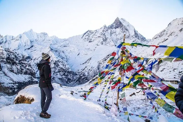
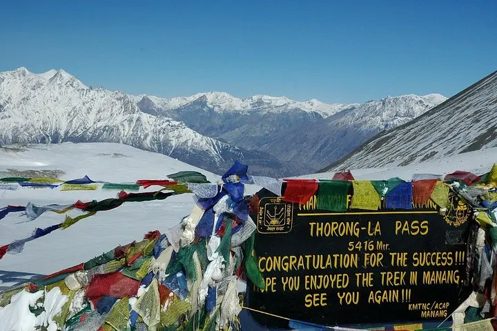
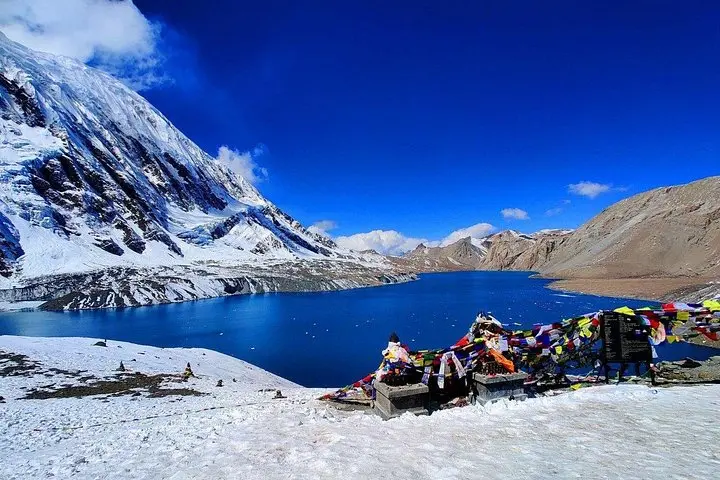
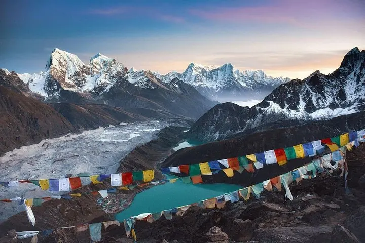
Dawn slices the ridge in palest gold as you climb toward Thorong La, wind skipping stones and the massive peaks of Annapurna and Dhaulagiri watching like slow-moving glaciers. The trail alternates between forested terraces, river-carved gorges and the raw, cold plateau above Manang, where yak bells and prayer flags mark each village as an unspoken waypoint.
Dawn slices the ridge in palest gold as you climb toward Thorong La, wind skipping stones and the massive peaks of Annapurna and Dhaulagiri watching like slow-moving glaciers. The trail alternates between forested terraces, river-carved gorges and the raw, cold plateau above Manang, where yak bells and prayer flags mark each village as an unspoken waypoint.
Geologically the circuit traces the collision zone of the Indian and Eurasian plates; granite and limestone cliffs rise abruptly from river valleys carved over millennia. Culturally the route threads Gurung, Manang and Thakali communities—stone houses, mani walls and small gompas (Barge Monastery near Pisang is a memorable stop). Muktinath, at the circuit’s western arc, remains an active pilgrimage site where Hindu and Buddhist traditions meet.
Practically, expect 16–21 days on trail with daily hikes of 4–8 hours, maximum elevation at Thorong La ~5,416 m (17,769 ft), and constant altitude change that demands staged acclimatization. Trails are a mix of wide mule tracks, steep stone staircases and exposed scree near high passes; suspension bridges and waterfalls are common. Permits (ACAP and TIMS) are required; teahouse lodges handle food and simple rooms along most stages. Best windows: pre-monsoon (Mar–May) and post-monsoon (Sep–Nov) for stable weather and clear views.
Hydrate proactively, rotate layers as temperatures swing from humid valley heat to sub-zero pass mornings, and hire a licensed guide if you’re not experienced at 4,000–5,000 m altitudes. Respect village rhythms: buy tea, pack out waste where possible, and keep to marked trails—mountain landscapes here are beautiful and fragile.