THE ADVENTURE COLLECTIVE® · Independent discovery and booking for outdoor travel

Follow the Marsyangdi valley to Tilicho Lake and cross Mesokanto Pass on a 16-day high‑altitude trek through Thakali villages, moraine ridges, and alpine plateaus. Practical acclimatization, high-pass prep, and tea-house logistics make this a classic Annapurna circuit variant.
Follow the Marsyangdi valley to Tilicho Lake and cross Mesokanto Pass on a 16-day high‑altitude trek through Thakali villages, moraine ridges, and alpine plateaus. Practical acclimatization, high-pass prep, and tea-house logistics make this a classic Annapurna circuit variant.
The first morning on the trail feels like stepping into a high-latitude story: prayer flags snap overhead, yak bells punctuate the air, and the Marsyangdi River dares you onward as the valley narrows into grey cliffs.
Verified experiences and guided adventures in the surrounding area.
Operated by Mega Mount Trekking Expedition P. Ltd · Manang, Gandaki Province
The first morning on the trail feels like stepping into a high-latitude story: prayer flags snap overhead, yak bells punctuate the air, and the Marsyangdi River dares you onward as the valley narrows into grey cliffs.
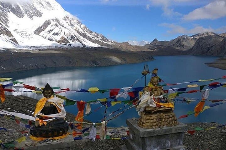
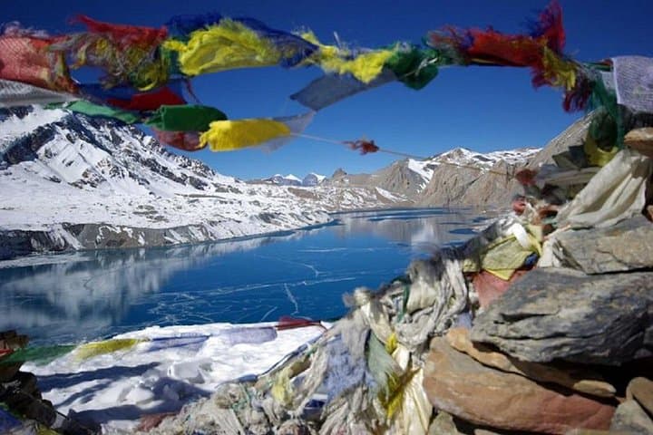
This 16-day route follows the Annapurna northern corridor from Besisahar through Manang to Tilicho Lake (near 4,900–5,000 m) before climbing to Mesokanto Pass and descending toward Jomsom. Geologically the route crosses ancient metamorphic slopes carved by glaciers and river incision; Tilicho itself sits in an uplifted basin below steep moraine walls. Culturally you'll move through Thakali and Gurung villages—stone houses, mani walls, and highland agriculture that reflect centuries of trans‑Himalayan trade.
Expect alpine forests of rhododendron and juniper at lower elevations, then barren scree and wind-swept plateaus above 4,000 m. Wildlife is shy but present: blue sheep and, in rare sightings, Himalayan thar and snow leopard habitat higher on the ridgelines.
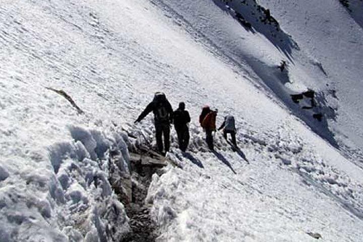
Practical guide: acclimatize with rest days in Manang, carry layered insulation for wide diurnal swings, and be ready for walking on snow or hard-packed moraine near the pass. The longest alt gains occur between Manang, Khangsar, Tilicho Base, and the pass—break these into manageable stages and stay hydrated. Permits include Annapurna Conservation Area entry and TIMS for organized treks; local guides and tea-house accommodations are standard. Flights in/out of Jomsom or Pokhara shorten logistics but expect early mornings and weather delays. The route is a demanding, high-altitude traverse that rewards patience with expansive Tibetan‑style highlands and a close encounter with the massif that shapes this part of Nepal.
Late spring (May) and autumn (mid‑September to November) offer the most stable weather and clear views; pre‑monsoon and post‑monsoon shoulder seasons reduce crowds but can have snow at the pass.
A licensed guide is strongly recommended for acclimatization management, route choices, and local logistics; porters are optional but helpful for comfort and speed.
Tilicho Lake lies near 4,900–5,000 m; Mesokanto Pass climbs above 5,100 m depending on the exact route—both involve significant altitude exposure.
You need an Annapurna Conservation Area permit (ACAP) and a TIMS card for organized treks; guides typically arrange these before departure.
Mega Mount Trekking Expedition P. Ltd operates guided outdoor trips and adventures with an emphasis on safety, stewardship, and memorable experiences.
The first morning on the trail feels like stepping into a high-latitude story: prayer flags snap overhead, yak bells punctuate the air, and the Marsyangdi River dares you onward as the valley narrows into grey cliffs.
The first morning on the trail feels like stepping into a high-latitude story: prayer flags snap overhead, yak bells punctuate the air, and the Marsyangdi River dares you onward as the valley narrows into grey cliffs.
This 16-day route follows the Annapurna northern corridor from Besisahar through Manang to Tilicho Lake (near 4,900–5,000 m) before climbing to Mesokanto Pass and descending toward Jomsom. Geologically the route crosses ancient metamorphic slopes carved by glaciers and river incision; Tilicho itself sits in an uplifted basin below steep moraine walls. Culturally you'll move through Thakali and Gurung villages—stone houses, mani walls, and highland agriculture that reflect centuries of trans‑Himalayan trade.
Expect alpine forests of rhododendron and juniper at lower elevations, then barren scree and wind-swept plateaus above 4,000 m. Wildlife is shy but present: blue sheep and, in rare sightings, Himalayan thar and snow leopard habitat higher on the ridgelines.
Practical guide: acclimatize with rest days in Manang, carry layered insulation for wide diurnal swings, and be ready for walking on snow or hard-packed moraine near the pass. The longest alt gains occur between Manang, Khangsar, Tilicho Base, and the pass—break these into manageable stages and stay hydrated. Permits include Annapurna Conservation Area entry and TIMS for organized treks; local guides and tea-house accommodations are standard. Flights in/out of Jomsom or Pokhara shorten logistics but expect early mornings and weather delays. The route is a demanding, high-altitude traverse that rewards patience with expansive Tibetan‑style highlands and a close encounter with the massif that shapes this part of Nepal.