THE ADVENTURE COLLECTIVE® · Independent discovery and booking for outdoor travel

A fast, well-supported two-day ascent of Jebel Toubkal from Imlil that takes you from terraced Berber valleys to 4,167 m summits. Ideal for hikers with moderate fitness who want a compact high-mountain experience near Marrakech.
A fast, well-supported two-day ascent of Jebel Toubkal from Imlil that takes you from terraced Berber valleys to 4,167 m summits. Ideal for hikers with moderate fitness who want a compact high-mountain experience near Marrakech.
A string of headlamps threads up from the refuge before dawn, each light a small insistence against the cold. You move in step with a mule track that carves through terraces and scrub, the air thinning as villages fall away and the High Atlas opens into broad, wind-scoured bowls. By sunrise the pass at ~3,950 m can throw a light so clear you feel the whole mountain breathe.
Verified experiences and guided adventures in the surrounding area.
Operated by Morocco Tours Services · Imlil, Marrakesh-Safi
A string of headlamps threads up from the refuge before dawn, each light a small insistence against the cold. You move in step with a mule track that carves through terraces and scrub, the air thinning as villages fall away and the High Atlas opens into broad, wind-scoured bowls. By sunrise the pass at ~3,950 m can throw a light so clear you feel the whole mountain breathe.
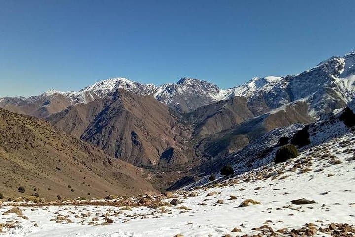
Toubkal is the High Atlas’s highest peak and has long been part of Berber life: pastoral routes, stone terracing, and the Marabout of Sidi Chamharouch mark the cultural route through the range. Geologically the massif rises abruptly from river valleys, shaped by Pleistocene glaciation and ongoing erosion—expect rocky ridgelines, scree channels and compacted mule trails. The Neltner refuge (3,207 m) —built by early European alpinists—serves as the standard base for summit attempts.
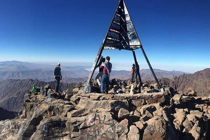
Practically: this is a two-day, moderate trek. Day 1 typically climbs from Imlil (~1,740 m) to the refuge (3,207 m) in 3–5 hours on mixed dirt and stone tracks; day 2 begins around 4:00 a.m., with a 3.5–4 hour push to the 4,167 m summit via Akhbi n’Tizi and the Toubkal ridge, then descent and return to Marrakech. Expect 1,400–1,500 m of ascent over the itinerary, rocky footing, and variable weather —wind and sudden temperature swings are common.
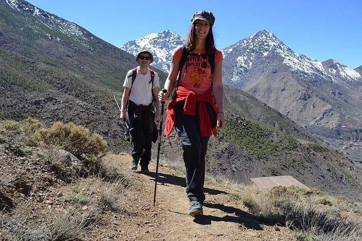
Bring layered clothing, good boots, poles and a headlamp; hydrate and ascend conservatively to reduce altitude effects. Guides manage logistics, mules carry heavy loads, and local meals at the refuge follow Berber mountain tradition. The route rewards patience: open panoramas, close views of traditional villages, and the quiet geometry of high rock and sky.
The route is a non-technical high-mountain hike—no ropes needed—but it involves steep, rocky terrain and significant altitude gain; basic high-altitude hiking experience is strongly recommended.
Fit beginners who prepare, acclimatize and move at a steady pace can complete it, but expect long days and reduced oxygen above 3,000 m.
Yes—acute mountain sickness is possible above 3,000 m; hydrate, avoid alcohol, ascend conservatively, and inform guides if symptoms (headache, nausea) appear.
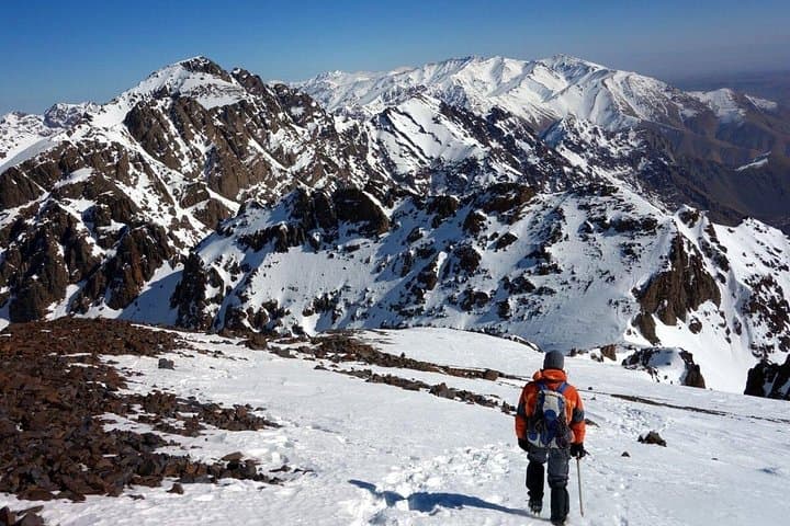
In summer and autumn they are usually unnecessary; in winter or after early/late-season snow, crampons and an ice axe may be required —check conditions with your operator.
Morocco Tours Services operates guided outdoor trips and adventures with an emphasis on safety, stewardship, and memorable experiences.
A string of headlamps threads up from the refuge before dawn, each light a small insistence against the cold. You move in step with a mule track that carves through terraces and scrub, the air thinning as villages fall away and the High Atlas opens into broad, wind-scoured bowls. By sunrise the pass at ~3,950 m can throw a light so clear you feel the whole mountain breathe.
A string of headlamps threads up from the refuge before dawn, each light a small insistence against the cold. You move in step with a mule track that carves through terraces and scrub, the air thinning as villages fall away and the High Atlas opens into broad, wind-scoured bowls. By sunrise the pass at ~3,950 m can throw a light so clear you feel the whole mountain breathe.
Toubkal is the High Atlas’s highest peak and has long been part of Berber life: pastoral routes, stone terracing, and the Marabout of Sidi Chamharouch mark the cultural route through the range. Geologically the massif rises abruptly from river valleys, shaped by Pleistocene glaciation and ongoing erosion—expect rocky ridgelines, scree channels and compacted mule trails. The Neltner refuge (3,207 m) —built by early European alpinists—serves as the standard base for summit attempts.
Practically: this is a two-day, moderate trek. Day 1 typically climbs from Imlil (~1,740 m) to the refuge (3,207 m) in 3–5 hours on mixed dirt and stone tracks; day 2 begins around 4:00 a.m., with a 3.5–4 hour push to the 4,167 m summit via Akhbi n’Tizi and the Toubkal ridge, then descent and return to Marrakech. Expect 1,400–1,500 m of ascent over the itinerary, rocky footing, and variable weather —wind and sudden temperature swings are common.
Bring layered clothing, good boots, poles and a headlamp; hydrate and ascend conservatively to reduce altitude effects. Guides manage logistics, mules carry heavy loads, and local meals at the refuge follow Berber mountain tradition. The route rewards patience: open panoramas, close views of traditional villages, and the quiet geometry of high rock and sky.