THE ADVENTURE COLLECTIVE® · Independent discovery and booking for outdoor travel

Lift off from Barra da Tijuca for a 20-minute helicopter circuit that flies beside Christ the Redeemer and over Sugarloaf, Copacabana and Guanabara Bay. This quick overflight compresses Rio’s geology, history and best viewpoints into one unforgettable aerial snapshot.
Lift off from Barra da Tijuca for a 20-minute helicopter circuit that flies beside Christ the Redeemer and over Sugarloaf, Copacabana and Guanabara Bay. This quick overflight compresses Rio’s geology, history and best viewpoints into one unforgettable aerial snapshot.
A rotor hum builds beneath you as the chopper lifts off from Jacarepaguá Airport in Barra da Tijuca, and Rio spreads out beneath like a living map: ridgelines of Tijuca Forest, the knife-edge of Pão de Açúcar (Sugarloaf), the arc of Copacabana and the crest of Corcovado with Christ the Redeemer standing watch. In twenty minutes the flight stitches together the city’s topography and history—colonial harbors, granite inselbergs, and urban forest reclaimed from ranchland in the 19th century.
Verified experiences and guided adventures in the surrounding area.
Operated by 4FLY RJ · Rio de Janeiro, Rio de Janeiro
A rotor hum builds beneath you as the chopper lifts off from Jacarepaguá Airport in Barra da Tijuca, and Rio spreads out beneath like a living map: ridgelines of Tijuca Forest, the knife-edge of Pão de Açúcar (Sugarloaf), the arc of Copacabana and the crest of Corcovado with Christ the Redeemer standing watch. In twenty minutes the flight stitches together the city’s topography and history—colonial harbors, granite inselbergs, and urban forest reclaimed from ranchland in the 19th century.
The skyline reflects Rio’s geology: granite peaks carved by ancient uplift and erosion, cliffs that once made navigation a hazard and now define the city’s most photographed points. Corcovado’s Art Deco statue, completed in 1931, looms as a cultural icon; Sugarloaf was a strategic naval lookout in the 18th century. The flight offers a compact cultural primer—Guanabara Bay’s inlet pattern, the grid of downtown, and residential slopes that echo decades of migration and samba culture.
Practically, this is an aerial sightseeing hop: arrive at Jacarepaguá, pass a quick safety briefing, and carry only essential camera gear. Mornings often mean better visibility and calmer air; operators cancel in heavy rain and will advise weight limits and passport requirements at booking. Bring sunscreen, secure loose items, and plan for tight time windows—check-in, preflight checks and boarding are timed precisely. For first-time visitors, the helicopter perspective clarifies why Rio’s landscape has shaped its history and why a short airborne circuit can make the city’s geography instantly legible.
The flight time is 20 minutes from takeoff to landing; allow extra time for check-in and briefing.
Flights depart from Jacarepaguá Airport in Barra da Tijuca; operators will confirm exact meeting instructions when you book.
Operators collect passenger weight at booking and infants must sit on an adult's lap; specific limits vary by helicopter model and operator.
Tours are cancelled for heavy rain or unsafe flying conditions and are either refunded or rescheduled according to the operator's policy.
4FLY RJ operates guided outdoor trips and adventures with an emphasis on safety, stewardship, and memorable experiences.
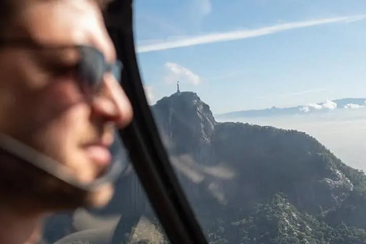



A rotor hum builds beneath you as the chopper lifts off from Jacarepaguá Airport in Barra da Tijuca, and Rio spreads out beneath like a living map: ridgelines of Tijuca Forest, the knife-edge of Pão de Açúcar (Sugarloaf), the arc of Copacabana and the crest of Corcovado with Christ the Redeemer standing watch. In twenty minutes the flight stitches together the city’s topography and history—colonial harbors, granite inselbergs, and urban forest reclaimed from ranchland in the 19th century.
A rotor hum builds beneath you as the chopper lifts off from Jacarepaguá Airport in Barra da Tijuca, and Rio spreads out beneath like a living map: ridgelines of Tijuca Forest, the knife-edge of Pão de Açúcar (Sugarloaf), the arc of Copacabana and the crest of Corcovado with Christ the Redeemer standing watch. In twenty minutes the flight stitches together the city’s topography and history—colonial harbors, granite inselbergs, and urban forest reclaimed from ranchland in the 19th century.
The skyline reflects Rio’s geology: granite peaks carved by ancient uplift and erosion, cliffs that once made navigation a hazard and now define the city’s most photographed points. Corcovado’s Art Deco statue, completed in 1931, looms as a cultural icon; Sugarloaf was a strategic naval lookout in the 18th century. The flight offers a compact cultural primer—Guanabara Bay’s inlet pattern, the grid of downtown, and residential slopes that echo decades of migration and samba culture.
Practically, this is an aerial sightseeing hop: arrive at Jacarepaguá, pass a quick safety briefing, and carry only essential camera gear. Mornings often mean better visibility and calmer air; operators cancel in heavy rain and will advise weight limits and passport requirements at booking. Bring sunscreen, secure loose items, and plan for tight time windows—check-in, preflight checks and boarding are timed precisely. For first-time visitors, the helicopter perspective clarifies why Rio’s landscape has shaped its history and why a short airborne circuit can make the city’s geography instantly legible.