THE ADVENTURE COLLECTIVE® · Independent discovery and booking for outdoor travel

Three days across the Ecuadorian Andes: trek to Cotopaxi’s Jose Rivas refuge, descend into Quilotoa’s emerald crater, then unwind among Baños’ waterfalls and hot springs. A compact high-altitude loop blending volcanic geology, Kichwa culture, and hands-on adventure.
Three days across the Ecuadorian Andes: trek to Cotopaxi’s Jose Rivas refuge, descend into Quilotoa’s emerald crater, then unwind among Baños’ waterfalls and hot springs. A compact high-altitude loop blending volcanic geology, Kichwa culture, and hands-on adventure.
You step out of the van into a thin, cold air that seems to sharpen color: volcanic ash, green paramo grass, and a glacier-bright ring of water far below. On day one the route climbs toward the Jose Rivas refuge on Cotopaxi, where snow begins above roughly 5,000 m and the volcano’s symmetrical cone dominates the sky.
Verified experiences and guided adventures in the surrounding area.
Operated by Real Dreams Tour · Quito, Pichincha
You step out of the van into a thin, cold air that seems to sharpen color: volcanic ash, green paramo grass, and a glacier-bright ring of water far below. On day one the route climbs toward the Jose Rivas refuge on Cotopaxi, where snow begins above roughly 5,000 m and the volcano’s symmetrical cone dominates the sky.
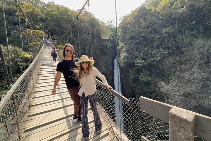
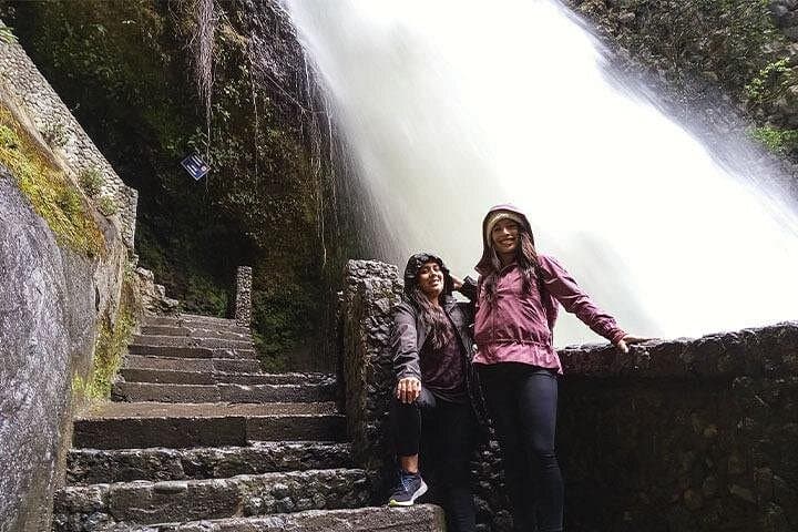
This circuit threads three distinct Andean landscapes. Cotopaxi National Park is high-altitude volcanic country — an 5,897 m stratovolcano with scree slopes and a refuge around 4,800 m. Quilotoa is a collapsed volcanic caldera whose emerald lake sits near 3,900 m; the trail down to the crater floor drops and climbs roughly 400–500 m on loose gravel. Baños, at 1,820 m, flips the script to subtropical valleys, thermal baths and waterfall-fed cliffs below the active Tungurahua.
Culture is visible along the road: Kichwa villages, woven textiles, and Saturday markets selling tubers and hand-carved masks. Geology is immediate — lava flows, ash layers, and crater rims telling a recent, raw volcanic history.
Practical guidance: allow time for altitude adjustment, pace uphill steps deliberately, and pack warm layers for night and wind above 4,000 m. Sturdy boots with good traction are required for loose crater trails; trekking poles help on descents. Hydrate early and often, and schedule quieter morning windows for clearer views. The route mixes short hikes, driving between sites (Quito ≈50 km to Cotopaxi) and relaxed evenings in mountain lodges — expect variable weather and dramatic microclimates on each day.
The access trek to the refuge is a short, steep walk at high altitude — expect thin air; pace yourself and watch for light-headedness.
Glacier travel requires crampons and rope and should only be attempted with mountaineering guides; this 3-day itinerary typically reaches the base refuge only unless an ice trip is arranged separately.
The crater trail is steep and loose in sections; older children who are steady on uneven terrain can manage with supervision, but it’s not ideal for very young kids.
Tungurahua is active and occasionally visible from vantage points; eruptions are unpredictable — follow local guidance and avoid restricted zones.
Real Dreams Tour operates guided outdoor trips and adventures with an emphasis on safety, stewardship, and memorable experiences.


You step out of the van into a thin, cold air that seems to sharpen color: volcanic ash, green paramo grass, and a glacier-bright ring of water far below. On day one the route climbs toward the Jose Rivas refuge on Cotopaxi, where snow begins above roughly 5,000 m and the volcano’s symmetrical cone dominates the sky.
You step out of the van into a thin, cold air that seems to sharpen color: volcanic ash, green paramo grass, and a glacier-bright ring of water far below. On day one the route climbs toward the Jose Rivas refuge on Cotopaxi, where snow begins above roughly 5,000 m and the volcano’s symmetrical cone dominates the sky.
This circuit threads three distinct Andean landscapes. Cotopaxi National Park is high-altitude volcanic country — an 5,897 m stratovolcano with scree slopes and a refuge around 4,800 m. Quilotoa is a collapsed volcanic caldera whose emerald lake sits near 3,900 m; the trail down to the crater floor drops and climbs roughly 400–500 m on loose gravel. Baños, at 1,820 m, flips the script to subtropical valleys, thermal baths and waterfall-fed cliffs below the active Tungurahua.
Culture is visible along the road: Kichwa villages, woven textiles, and Saturday markets selling tubers and hand-carved masks. Geology is immediate — lava flows, ash layers, and crater rims telling a recent, raw volcanic history.
Practical guidance: allow time for altitude adjustment, pace uphill steps deliberately, and pack warm layers for night and wind above 4,000 m. Sturdy boots with good traction are required for loose crater trails; trekking poles help on descents. Hydrate early and often, and schedule quieter morning windows for clearer views. The route mixes short hikes, driving between sites (Quito ≈50 km to Cotopaxi) and relaxed evenings in mountain lodges — expect variable weather and dramatic microclimates on each day.