THE ADVENTURE COLLECTIVE® · Independent discovery and booking for outdoor travel

Three days of highland switchbacks, river-cut canyons and H’mong homestays: ride the Ha Giang loop from Ha Giang city to Dong Van and Ma Pi Leng. Expect mountain passes, unpredictable weather, and cultural stops that reward slow travel.
Three days of highland switchbacks, river-cut canyons and H’mong homestays: ride the Ha Giang loop from Ha Giang city to Dong Van and Ma Pi Leng. Expect mountain passes, unpredictable weather, and cultural stops that reward slow travel.
You kick the engine at first light and the road unfurls—hairpin after hairpin carving into limestone ridges, clouds brushing the saddle of your helmet. On this three-day motorbike loop through Hà Giang province you ride from Ha Giang city up to Quan Bà’s Heaven’s Gate, cross the Ma Pi Leng spine, and descend into the narrow gorge carved by the Nho Quế River.
Verified experiences and guided adventures in the surrounding area.
Operated by Chat Tourist · Ha Giang, Hà Giang
You kick the engine at first light and the road unfurls—hairpin after hairpin carving into limestone ridges, clouds brushing the saddle of your helmet. On this three-day motorbike loop through Hà Giang province you ride from Ha Giang city up to Quan Bà’s Heaven’s Gate, cross the Ma Pi Leng spine, and descend into the narrow gorge carved by the Nho Quế River.
This landscape sits on the Đồng Văn Karst Plateau, a UNESCO Global Geopark shaped by 400+ million years of marine limestone uplift. Villages of H’mong and other ethnic groups scatter across terraced fields; stilt houses, market stalls, and the H’mong King’s palace are living traces of a highland culture that resisted easy change.
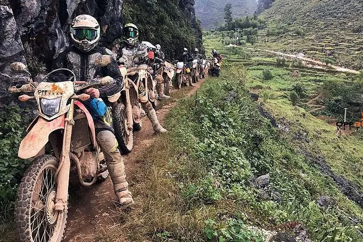
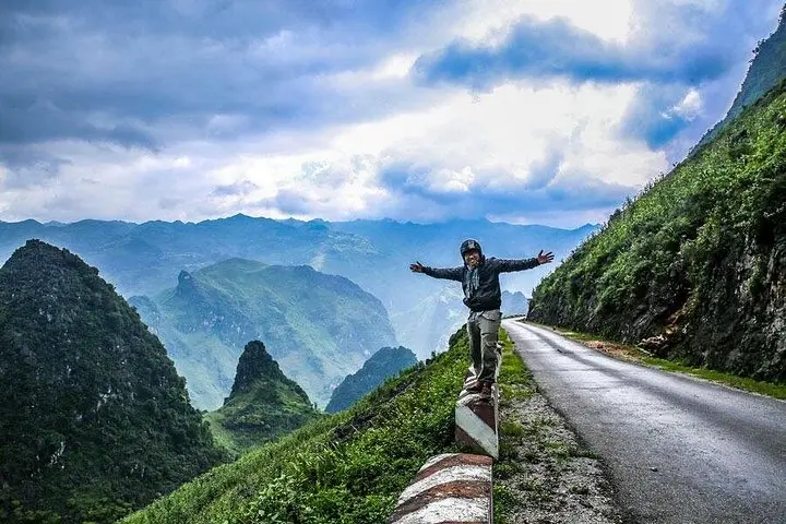
Expect a mix of paved provincial roads, rougher switchbacks, and short dirt stretches. Elevations swing roughly between 300–1,600 m; Ma Pi Leng ridge reaches around 1,200 m with sheer drops to the river canyon below. Weather can flip quickly—fog, wind and afternoon storms are common in summer; clear, cold air clears views in autumn.
Practical guidance: average daily ride time is 5–7 hours including stops, with total distance around 300–350 km. Ride steady on narrow passes, keep fuel topped at small stations, and carry a basic repair kit. Homestays and guesthouses provide local meals and a chance to learn about highland life—bring cash. Hydrate, layer for temperature swings, and factor extra time for photography and market visits; the route rewards patience as much as speed.
Bring a valid motorcycle license recognized in Vietnam; some operators accept local temporary permits but check with the tour provider before booking.
This loop requires confident handling on steep, narrow, and sometimes unpaved mountain roads—prior experience on twisty, highland routes is recommended.
The tour typically provides motorbike, helmet, most meals listed, and local entrance fees; fuel and snacks outside scheduled stops may be at your expense—confirm inclusions with the operator.
You can, but expect wet, muddy sections and reduced visibility; operators may cancel or alter routes in severe weather for safety.
Chat Tourist operates guided outdoor trips and adventures with an emphasis on safety, stewardship, and memorable experiences.
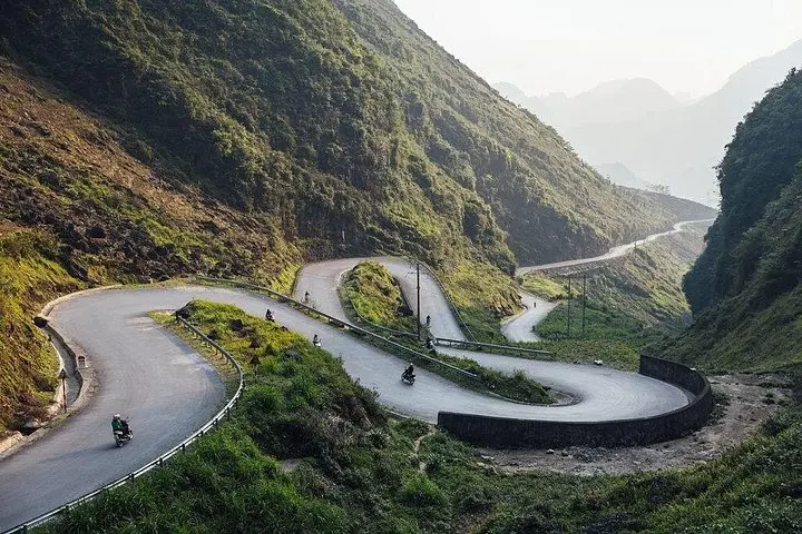
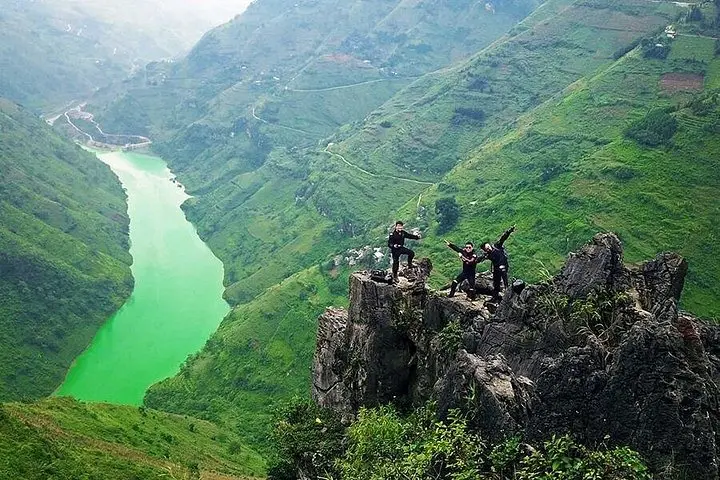
You kick the engine at first light and the road unfurls—hairpin after hairpin carving into limestone ridges, clouds brushing the saddle of your helmet. On this three-day motorbike loop through Hà Giang province you ride from Ha Giang city up to Quan Bà’s Heaven’s Gate, cross the Ma Pi Leng spine, and descend into the narrow gorge carved by the Nho Quế River.
You kick the engine at first light and the road unfurls—hairpin after hairpin carving into limestone ridges, clouds brushing the saddle of your helmet. On this three-day motorbike loop through Hà Giang province you ride from Ha Giang city up to Quan Bà’s Heaven’s Gate, cross the Ma Pi Leng spine, and descend into the narrow gorge carved by the Nho Quế River.
This landscape sits on the Đồng Văn Karst Plateau, a UNESCO Global Geopark shaped by 400+ million years of marine limestone uplift. Villages of H’mong and other ethnic groups scatter across terraced fields; stilt houses, market stalls, and the H’mong King’s palace are living traces of a highland culture that resisted easy change.
Expect a mix of paved provincial roads, rougher switchbacks, and short dirt stretches. Elevations swing roughly between 300–1,600 m; Ma Pi Leng ridge reaches around 1,200 m with sheer drops to the river canyon below. Weather can flip quickly—fog, wind and afternoon storms are common in summer; clear, cold air clears views in autumn.
Practical guidance: average daily ride time is 5–7 hours including stops, with total distance around 300–350 km. Ride steady on narrow passes, keep fuel topped at small stations, and carry a basic repair kit. Homestays and guesthouses provide local meals and a chance to learn about highland life—bring cash. Hydrate, layer for temperature swings, and factor extra time for photography and market visits; the route rewards patience as much as speed.