THE ADVENTURE COLLECTIVE® · Independent discovery and booking for outdoor travel

A compact four-day circuit from Imlil that mixes steady mountain walking with stays in Berber guesthouses, spring-fed picnics and a high pass at about 2,489 m. Ideal for hikers who want cultural contact and sustained alpine scenery without technical climbing.
A compact four-day circuit from Imlil that mixes steady mountain walking with stays in Berber guesthouses, spring-fed picnics and a high pass at about 2,489 m. Ideal for hikers who want cultural contact and sustained alpine scenery without technical climbing.
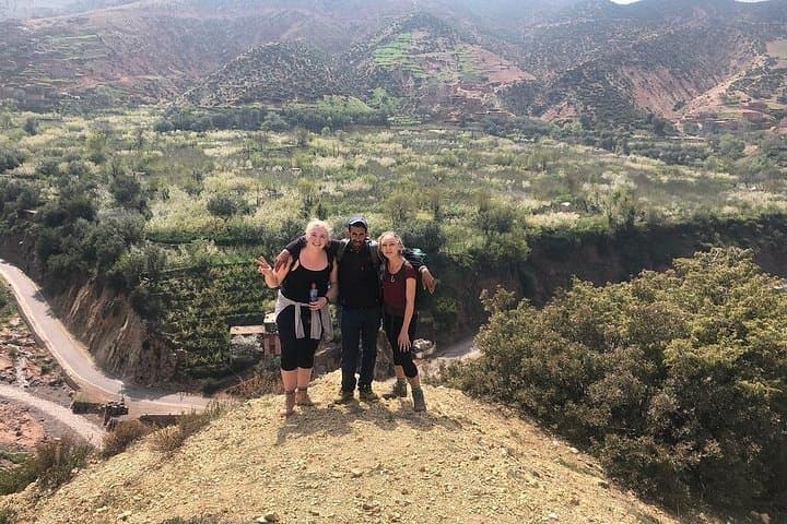
You step out of the shade of a walnut grove into thin, dry air and the track narrows — the valley opens and the peaks of the High Atlas push the sky aside. Over four days the trail moves from Imlil’s cultivated terraces through juniper forests, past trickling springs, and up to a pass at roughly 2,489 m where the world feels pared down to rock, wind and the steady rhythm of your boots.
Verified experiences and guided adventures in the surrounding area.
Operated by Marrakech Tours · Imlil, Marrakech-Safi
You step out of the shade of a walnut grove into thin, dry air and the track narrows — the valley opens and the peaks of the High Atlas push the sky aside. Over four days the trail moves from Imlil’s cultivated terraces through juniper forests, past trickling springs, and up to a pass at roughly 2,489 m where the world feels pared down to rock, wind and the steady rhythm of your boots.
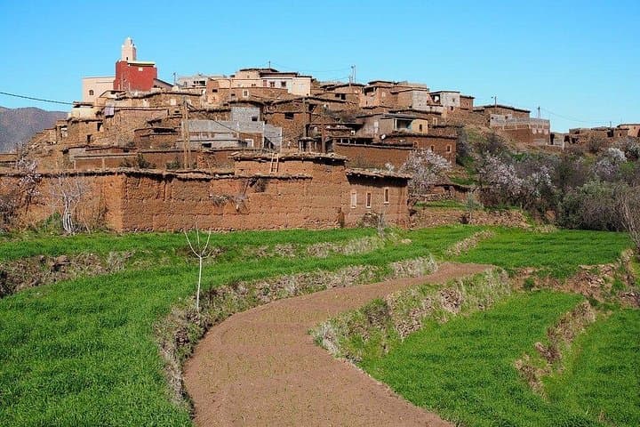
The High Atlas are young mountains geologically: folded and uplifted by the collision of the African and Eurasian plates, their slopes hold layers of red schist and limestone and long-settled terraces where Amazigh (Berber) families have farmed barley and corn for centuries. Villages clustered on ledges use ingenious irrigation channels that still feed fields below. Cultural traces are everywhere — dry-stone walls, mule tracks, and community hammams where evenings are shared.
Expect 4–6 hours of hiking most days, steady ascents and technical-free but rocky paths, and nights in family-run gîtes or simple bivouacs. Water springs appear intermittently; the route favors spring and autumn for comfortable daytime temperatures. Guides and mules commonly support luggage and meals, letting walkers travel light and focus on the landscape and local life.
Practical: bring a warm layer for high passes, sturdy boots for loose scree, and a headlamp for early starts. Pace yourself on ascents, carry purification tabs, and respect village rhythms — ask before photographing people. This is a route that rewards steady feet and curiosity more than speed.
The route is described as slightly challenging with regular ascents and descents; beginners in reasonable shape can complete it with pacing, but expect full days of walking and discuss pace with your guide.
Accommodations are local gîtes or family guesthouses; expect simple rooms, shared facilities and traditional meals — comfort varies by village.
Altitudes approach 2,400–2,500 m; most trekkers handle this without issues, but hydrate, ascend steadily and report symptoms to your guide if you feel unwell.
Yes — local operators commonly provide mules for baggage and most meals (breakfasts, lunches and dinners as listed) with a local guide on the route.
Marrakech Tours operates guided outdoor trips and adventures with an emphasis on safety, stewardship, and memorable experiences.


You step out of the shade of a walnut grove into thin, dry air and the track narrows — the valley opens and the peaks of the High Atlas push the sky aside. Over four days the trail moves from Imlil’s cultivated terraces through juniper forests, past trickling springs, and up to a pass at roughly 2,489 m where the world feels pared down to rock, wind and the steady rhythm of your boots.
You step out of the shade of a walnut grove into thin, dry air and the track narrows — the valley opens and the peaks of the High Atlas push the sky aside. Over four days the trail moves from Imlil’s cultivated terraces through juniper forests, past trickling springs, and up to a pass at roughly 2,489 m where the world feels pared down to rock, wind and the steady rhythm of your boots.
The High Atlas are young mountains geologically: folded and uplifted by the collision of the African and Eurasian plates, their slopes hold layers of red schist and limestone and long-settled terraces where Amazigh (Berber) families have farmed barley and corn for centuries. Villages clustered on ledges use ingenious irrigation channels that still feed fields below. Cultural traces are everywhere — dry-stone walls, mule tracks, and community hammams where evenings are shared.
Expect 4–6 hours of hiking most days, steady ascents and technical-free but rocky paths, and nights in family-run gîtes or simple bivouacs. Water springs appear intermittently; the route favors spring and autumn for comfortable daytime temperatures. Guides and mules commonly support luggage and meals, letting walkers travel light and focus on the landscape and local life.
Practical: bring a warm layer for high passes, sturdy boots for loose scree, and a headlamp for early starts. Pace yourself on ascents, carry purification tabs, and respect village rhythms — ask before photographing people. This is a route that rewards steady feet and curiosity more than speed.