THE ADVENTURE COLLECTIVE® · Independent discovery and booking for outdoor travel

A four-day, permit-regulated trek that mixes high-altitude passes, cloud-forest descents, and Inca ruins before delivering sunrise views at Machu Picchu. Expect long hiking days, stone stairways, and regulated campsites—book early and acclimatize beforehand.
A four-day, permit-regulated trek that mixes high-altitude passes, cloud-forest descents, and Inca ruins before delivering sunrise views at Machu Picchu. Expect long hiking days, stone stairways, and regulated campsites—book early and acclimatize beforehand.
Early before dawn the trail narrows into a corridor of stone and cloud; you step from the dusty bus at Km 82 and feel the Andes answer with cool, thin air. Over four days the path moves you through high puna, rocky passes, and humid cloud forest until the Sun Gate unwraps Machu Picchu at sunrise—an ending earned rather than given.
Verified experiences and guided adventures in the surrounding area.
Operated by Vicuna Expeditions · Aguas Calientes, Cusco Region
Early before dawn the trail narrows into a corridor of stone and cloud; you step from the dusty bus at Km 82 and feel the Andes answer with cool, thin air. Over four days the path moves you through high puna, rocky passes, and humid cloud forest until the Sun Gate unwraps Machu Picchu at sunrise—an ending earned rather than given.
The route follows original Inca causeways and stairways, threading archaeological sites—Llactapata, Runkuracay, Phuyupatamarca and Wiñay Wayna—that reveal how the empire linked ceremonial, agricultural and administrative points across steep terrain. Geologically the trail traverses parts of the Vilcabamba range where glacial carving and volcanic beds create abrupt ridgelines and narrow river valleys; microclimates change rapidly as elevation drops toward the jungle. Along the way local Quechua communities farm potatoes and raise llamas, and lower valleys grow coffee, offering cultural context to the landscape you move through.
Expect sustained days of walking (10–16 km typical), stone stair sections and a summit at Dead Woman’s Pass (4,215 m). Guides and porters manage camp logistics and meals, but acclimatization is non-negotiable—allow time in Cusco beforehand. Pack layered clothing for cold mornings and warm afternoons, waterproofs for cloud-forest wetness, and 2–3 liters of water plus high-calorie snacks. Permits are limited and sold in advance; plan months ahead and pace yourself on steep ascents. When the sunlight finally pours through Inti Punku, the effort, altitude and history align into a clear, lasting view.
Yes. The classic Inca Trail is strictly limited by permit and must be booked in advance through licensed tour operators; independent hiking without a permit is not allowed.
It is the highest and steepest section at 4,215 m with long switchbacks; it requires steady pacing and prior acclimatization but is manageable with proper fitness and rest breaks.
Yes. The tour includes camping equipment, tents, sleeping mattresses, and meals prepared by the trekking crew; participants usually carry a small daypack only.
May–September (dry season) offers the most stable weather and clearer views, but shoulder seasons can have fewer crowds—expect rain from November to March.
Vicuna Expeditions operates guided outdoor trips and adventures with an emphasis on safety, stewardship, and memorable experiences.

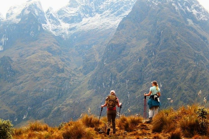

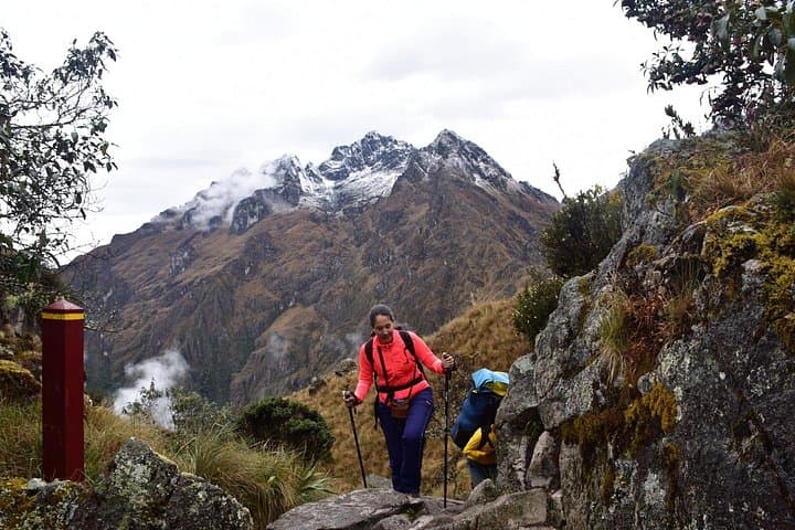
Early before dawn the trail narrows into a corridor of stone and cloud; you step from the dusty bus at Km 82 and feel the Andes answer with cool, thin air. Over four days the path moves you through high puna, rocky passes, and humid cloud forest until the Sun Gate unwraps Machu Picchu at sunrise—an ending earned rather than given.
Early before dawn the trail narrows into a corridor of stone and cloud; you step from the dusty bus at Km 82 and feel the Andes answer with cool, thin air. Over four days the path moves you through high puna, rocky passes, and humid cloud forest until the Sun Gate unwraps Machu Picchu at sunrise—an ending earned rather than given.
The route follows original Inca causeways and stairways, threading archaeological sites—Llactapata, Runkuracay, Phuyupatamarca and Wiñay Wayna—that reveal how the empire linked ceremonial, agricultural and administrative points across steep terrain. Geologically the trail traverses parts of the Vilcabamba range where glacial carving and volcanic beds create abrupt ridgelines and narrow river valleys; microclimates change rapidly as elevation drops toward the jungle. Along the way local Quechua communities farm potatoes and raise llamas, and lower valleys grow coffee, offering cultural context to the landscape you move through.
Expect sustained days of walking (10–16 km typical), stone stair sections and a summit at Dead Woman’s Pass (4,215 m). Guides and porters manage camp logistics and meals, but acclimatization is non-negotiable—allow time in Cusco beforehand. Pack layered clothing for cold mornings and warm afternoons, waterproofs for cloud-forest wetness, and 2–3 liters of water plus high-calorie snacks. Permits are limited and sold in advance; plan months ahead and pace yourself on steep ascents. When the sunlight finally pours through Inti Punku, the effort, altitude and history align into a clear, lasting view.