THE ADVENTURE COLLECTIVE® · Independent discovery and booking for outdoor travel

A five-day, non-technical climb via the Sirimon Route that rises from forest to high moorland and Point Lenana (approx. 4,985 m). Expect long days on varied terrain, glacier-formed scenery and critical acclimatization on day three.
A five-day, non-technical climb via the Sirimon Route that rises from forest to high moorland and Point Lenana (approx. 4,985 m). Expect long days on varied terrain, glacier-formed scenery and critical acclimatization on day three.
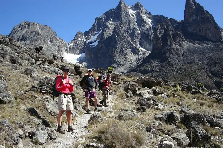
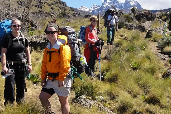
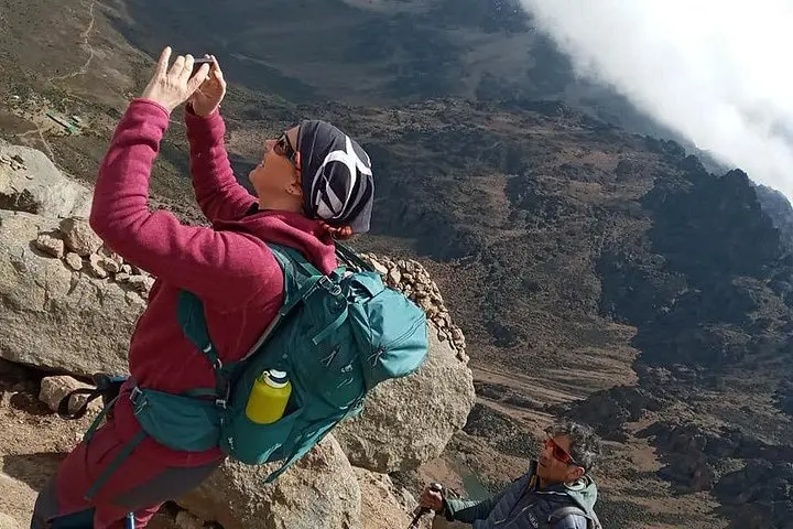
Dawn on the Sirimon flank is thin and cold; headlamps bob like slow-fireflies as groups cut through heather and high moorland toward a ridge that opens onto the main peaks. Over five days the Sirimon Route moves from montane forest at ~2,440 m through moorland and moraine to Point Lenana’s sunrise at about 4,985 m, offering sustained walking, big skies and hard-earned panoramas of the jagged central peaks.
Verified experiences and guided adventures in the surrounding area.
Operated by Sabilom Kenya Tours & Safaris · Nanyuki, Laikipia County
Dawn on the Sirimon flank is thin and cold; headlamps bob like slow-fireflies as groups cut through heather and high moorland toward a ridge that opens onto the main peaks. Over five days the Sirimon Route moves from montane forest at ~2,440 m through moorland and moraine to Point Lenana’s sunrise at about 4,985 m, offering sustained walking, big skies and hard-earned panoramas of the jagged central peaks.
The route follows well-established tracks used by local guides for decades and passes sites shaped by the mountain’s volcanic past: glacial cirques, tarns such as Hauseberg and Nanyuki, and the steep scarred ridgelines carved by ancient ice. The Sirimon side sits on the drier northwest quadrant, historically accessed from Nanyuki and long frequented by Kikuyu and Meru communities for grazing and trade; today park fees and conservation rules protect fragile zones above the forest line.
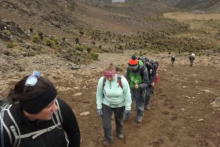
Practical planning: expect 9 km/860 m gain on day 1 to Judmaier/Old Moses Camp (3–4 hrs), then 17 km/900 m to Shipton Camp (6–7 hrs). A day for acclimatizing follows, then a 3:00 am push to Point Lenana and a long descent via Mintos Hut to Meru Bandas and Chogoria. Terrain varies—well-worn dirt tracks, steep stony gullies and boggy moorland. Altitude is the main challenge; hydrate, eat, and let the day-3 acclimatization walk be slow. Layers, a waterproof shell and sturdy boots are non-negotiable. Weather can flip fast—sun that bakes the heath can become sleet on the summit. Guides handle logistics, permits and treated water; bring your own reusable bottle, a warm sleeping liner and respect quiet hours at the camps. The route rewards persistence: an alpine sunrise that feels earned, with the mountain itself pushing you forward at every step.
No; Point Lenana is a trekking summit and does not require ropes or technical climbing gear—good boots and layers suffice.
Night temperatures at Shipton (4,200 m) often drop below freezing; the summit pre-dawn can be well below 0°C with wind chill—bring warm insulation.
Guides typically handle Mount Kenya National Park entry fees and permits; confirm inclusion before booking and carry ID for check-in.
Very important—moderate-to-high fitness is needed and prior high-altitude trekking experience reduces risk of AMS; the itinerary includes an acclimatization day but altitude impacts vary.
Sabilom Kenya Tours & Safaris operates guided outdoor trips and adventures with an emphasis on safety, stewardship, and memorable experiences.
Dawn on the Sirimon flank is thin and cold; headlamps bob like slow-fireflies as groups cut through heather and high moorland toward a ridge that opens onto the main peaks. Over five days the Sirimon Route moves from montane forest at ~2,440 m through moorland and moraine to Point Lenana’s sunrise at about 4,985 m, offering sustained walking, big skies and hard-earned panoramas of the jagged central peaks.
Dawn on the Sirimon flank is thin and cold; headlamps bob like slow-fireflies as groups cut through heather and high moorland toward a ridge that opens onto the main peaks. Over five days the Sirimon Route moves from montane forest at ~2,440 m through moorland and moraine to Point Lenana’s sunrise at about 4,985 m, offering sustained walking, big skies and hard-earned panoramas of the jagged central peaks.
The route follows well-established tracks used by local guides for decades and passes sites shaped by the mountain’s volcanic past: glacial cirques, tarns such as Hauseberg and Nanyuki, and the steep scarred ridgelines carved by ancient ice. The Sirimon side sits on the drier northwest quadrant, historically accessed from Nanyuki and long frequented by Kikuyu and Meru communities for grazing and trade; today park fees and conservation rules protect fragile zones above the forest line.
Practical planning: expect 9 km/860 m gain on day 1 to Judmaier/Old Moses Camp (3–4 hrs), then 17 km/900 m to Shipton Camp (6–7 hrs). A day for acclimatizing follows, then a 3:00 am push to Point Lenana and a long descent via Mintos Hut to Meru Bandas and Chogoria. Terrain varies—well-worn dirt tracks, steep stony gullies and boggy moorland. Altitude is the main challenge; hydrate, eat, and let the day-3 acclimatization walk be slow. Layers, a waterproof shell and sturdy boots are non-negotiable. Weather can flip fast—sun that bakes the heath can become sleet on the summit. Guides handle logistics, permits and treated water; bring your own reusable bottle, a warm sleeping liner and respect quiet hours at the camps. The route rewards persistence: an alpine sunrise that feels earned, with the mountain itself pushing you forward at every step.