THE ADVENTURE COLLECTIVE® · Independent discovery and booking for outdoor travel

Covering roughly 100 km across rolling valleys and sandstone cliffs, this 5-day self-guided hike follows the Forest Trail through Gauja National Park. Expect long days on varied terrain, GPX navigation files, and nightly stays in Sigulda, Līgatne, Cēsis and Caunītes.
Covering roughly 100 km across rolling valleys and sandstone cliffs, this 5-day self-guided hike follows the Forest Trail through Gauja National Park. Expect long days on varied terrain, GPX navigation files, and nightly stays in Sigulda, Līgatne, Cēsis and Caunītes.
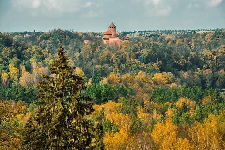
A pre-dawn hush hangs over the Gauja valley as your boots find the first root and stone. Mist lifts from the river and the valley slopes seem to push you forward; the forest trail curves, opens and narrows again, rewarding steady steps with sudden viewpoints of the river below.
Verified experiences and guided adventures in the surrounding area.
Operated by Baltic nature travel · Sigulda, Vidzeme
A pre-dawn hush hangs over the Gauja valley as your boots find the first root and stone. Mist lifts from the river and the valley slopes seem to push you forward; the forest trail curves, opens and narrows again, rewarding steady steps with sudden viewpoints of the river below.
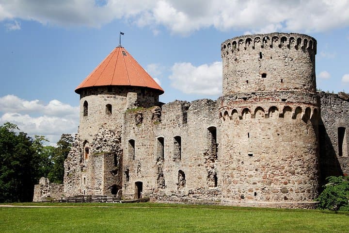
Gauja National Park is Latvia’s largest protected area and a classroom of sandstone geology carved during the Devonian period. Medieval villages and the fortress town of Cēsis sit on ridge lines that once guided traders; the region’s paper mill history and Cold War-era bunkers trace human layers beneath the canopy. Sandstone cliffs, caves and natural springs are constant companions—each outcrop telling a chapter of tectonic and human history.
Over five days you’ll cover roughly 100–110 km of trail, typically 19–26 km per day on rolling, often steep terrain. Expect mixed surfaces: forest paths, small rural roads, exposed rock stairways and occasional wet sections near river crossings. The route passes Velnala Cliffs, Zvārtes Rock and Sietiņiezis viewpoint—places worth extra minutes for photos and water breaks.
Practical edge: the itinerary provides GPX files and prebooked lodging, but navigation and footwear matter—trail markings can be sparse in remote sections. Start early to avoid heat in summer and take waterproof layers for spring and autumn showers. Carry at least 2–3 liters of water daily or treatment options; refills are available in villages. Respect fragile sandstone and nesting birds: stay on marked paths, pack out waste and store food securely. With steady fitness and basic route skills, this self-guided stretch of Gauja rewards persistence with wild panoramas and quiet forest days.
Daily distances are 19–26 km on rolling but often steep terrain—expect 6–8 hours per day depending on pace and breaks.
GPX tracks and local markings guide most sections, but some forest paths are faint—basic map reading and GPS use are recommended.
Yes; the package lists pre-booked guesthouses and hotels in Sigulda, Līgatne, Cēsis, Caunītes with contact details included.
The itinerary includes transfer from Valmiera to Riga on the final day; alternate public transport options exist from Valmiera and Cēsis.
Baltic nature travel operates guided outdoor trips and adventures with an emphasis on safety, stewardship, and memorable experiences.


A pre-dawn hush hangs over the Gauja valley as your boots find the first root and stone. Mist lifts from the river and the valley slopes seem to push you forward; the forest trail curves, opens and narrows again, rewarding steady steps with sudden viewpoints of the river below.
A pre-dawn hush hangs over the Gauja valley as your boots find the first root and stone. Mist lifts from the river and the valley slopes seem to push you forward; the forest trail curves, opens and narrows again, rewarding steady steps with sudden viewpoints of the river below.
Gauja National Park is Latvia’s largest protected area and a classroom of sandstone geology carved during the Devonian period. Medieval villages and the fortress town of Cēsis sit on ridge lines that once guided traders; the region’s paper mill history and Cold War-era bunkers trace human layers beneath the canopy. Sandstone cliffs, caves and natural springs are constant companions—each outcrop telling a chapter of tectonic and human history.
Over five days you’ll cover roughly 100–110 km of trail, typically 19–26 km per day on rolling, often steep terrain. Expect mixed surfaces: forest paths, small rural roads, exposed rock stairways and occasional wet sections near river crossings. The route passes Velnala Cliffs, Zvārtes Rock and Sietiņiezis viewpoint—places worth extra minutes for photos and water breaks.
Practical edge: the itinerary provides GPX files and prebooked lodging, but navigation and footwear matter—trail markings can be sparse in remote sections. Start early to avoid heat in summer and take waterproof layers for spring and autumn showers. Carry at least 2–3 liters of water daily or treatment options; refills are available in villages. Respect fragile sandstone and nesting birds: stay on marked paths, pack out waste and store food securely. With steady fitness and basic route skills, this self-guided stretch of Gauja rewards persistence with wild panoramas and quiet forest days.