THE ADVENTURE COLLECTIVE® · Independent discovery and booking for outdoor travel

A six-day trek from Imlil to Lake Ifni and the summit of Mount Toubkal combines remote Berber villages, alpine meadows and a final high-altitude ascent to North Africa’s highest peak. Expect varied terrain, early starts, and a rewarding summit push supported by local guides and porters.
A six-day trek from Imlil to Lake Ifni and the summit of Mount Toubkal combines remote Berber villages, alpine meadows and a final high-altitude ascent to North Africa’s highest peak. Expect varied terrain, early starts, and a rewarding summit push supported by local guides and porters.
You step off the minivan in Imlil with dust still on your boots and a line of stone houses climbing the valley ahead. The path rises quickly, terraces and walnut trees giving way to open scree and alpine meadows as the High Atlas presses in from every side.
Verified experiences and guided adventures in the surrounding area.
Operated by Morocco Tours Toubkal Trek · Imlil, Marrakesh-Safi
You step off the minivan in Imlil with dust still on your boots and a line of stone houses climbing the valley ahead. The path rises quickly, terraces and walnut trees giving way to open scree and alpine meadows as the High Atlas presses in from every side.
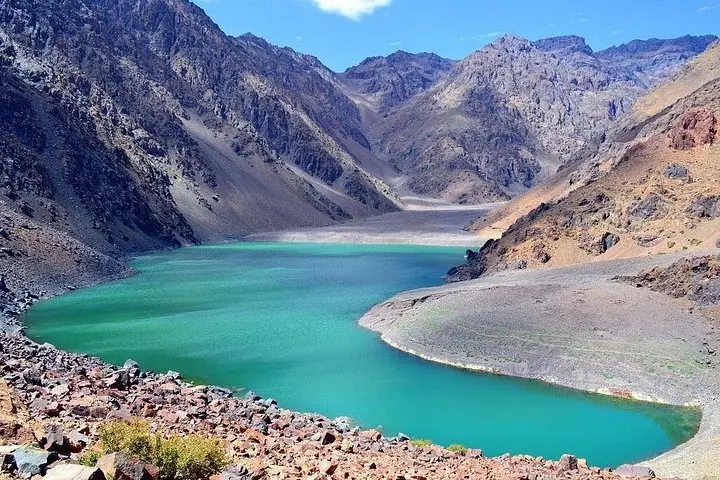
This six-day route threads remote Berber hamlets, the glacial-fed basin of Lake Ifni and the Neltner Refuge before the final push to Mount Toubkal (4,167 m), North Africa’s highest peak. Geologically the range is young and rugged—folded Mesozoic limestone and volcanic intrusions that create steep ridgelines and loose scree fields; culturally the trails follow centuries-old mule tracks and village-to-village routes used by Amazigh communities.
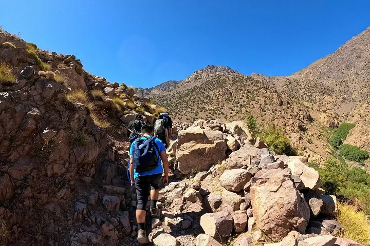
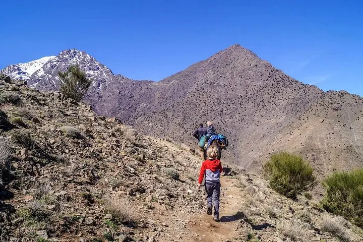
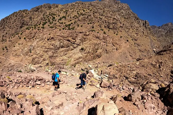
Expect mixed terrain: packed earth through terraced fields, rocky switchbacks, grassy saddles, and high elevation scree. Typical daily distances average 8–14 km with cumulative elevation gain around 2,500–3,000 m over six days; the summit day alone climbs roughly 900–1,000 m from the refuge. Guides and mules carry heavy loads and lodges or tented camps break the nights.
Practical notes: start early to avoid midday sun, layer for large temperature swings (warm days, cold alpine nights), carry 2–3 liters of water and use the provided porters to limit pack weight. Footwear with good ankle support and traction is essential; trekking poles make steep descents easier. With moderate-to-strong fitness and respect for altitude, this trip blends cultural contact with true high-mountain accomplishment.
No technical gear is required in summer; the usual route is a strenuous hike with some scrambling—guides will advise if crampons/ice axe are needed in winter conditions.
Yes—meals listed in the itinerary and overnight stays in mountain lodges or camp are included, with mules or porters to carry heavy bags.
Summit day is the longest and steepest: plan for 6–8 hours round trip from Neltner Refuge with roughly 900–1,000 m of ascent; pacing and early departure are key.
Late spring to early fall (May–October) offers the most stable conditions; winter brings snow and requires mountaineering experience and equipment.
Morocco Tours Toubkal Trek operates guided outdoor trips and adventures with an emphasis on safety, stewardship, and memorable experiences.
You step off the minivan in Imlil with dust still on your boots and a line of stone houses climbing the valley ahead. The path rises quickly, terraces and walnut trees giving way to open scree and alpine meadows as the High Atlas presses in from every side.
You step off the minivan in Imlil with dust still on your boots and a line of stone houses climbing the valley ahead. The path rises quickly, terraces and walnut trees giving way to open scree and alpine meadows as the High Atlas presses in from every side.
This six-day route threads remote Berber hamlets, the glacial-fed basin of Lake Ifni and the Neltner Refuge before the final push to Mount Toubkal (4,167 m), North Africa’s highest peak. Geologically the range is young and rugged—folded Mesozoic limestone and volcanic intrusions that create steep ridgelines and loose scree fields; culturally the trails follow centuries-old mule tracks and village-to-village routes used by Amazigh communities.
Expect mixed terrain: packed earth through terraced fields, rocky switchbacks, grassy saddles, and high elevation scree. Typical daily distances average 8–14 km with cumulative elevation gain around 2,500–3,000 m over six days; the summit day alone climbs roughly 900–1,000 m from the refuge. Guides and mules carry heavy loads and lodges or tented camps break the nights.
Practical notes: start early to avoid midday sun, layer for large temperature swings (warm days, cold alpine nights), carry 2–3 liters of water and use the provided porters to limit pack weight. Footwear with good ankle support and traction is essential; trekking poles make steep descents easier. With moderate-to-strong fitness and respect for altitude, this trip blends cultural contact with true high-mountain accomplishment.