THE ADVENTURE COLLECTIVE® · Independent discovery and booking for outdoor travel

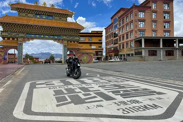
Drive from Chengdu to Lhasa along National Highway 318, crossing high mountain passes, Tibetan towns, and glacial landscapes. Expect long driving days, big altitude changes, and culturally rich stops like Xinduqiao, Litang and Nyingchi.
Drive from Chengdu to Lhasa along National Highway 318, crossing high mountain passes, Tibetan towns, and glacial landscapes. Expect long driving days, big altitude changes, and culturally rich stops like Xinduqiao, Litang and Nyingchi.
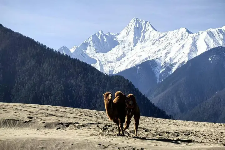
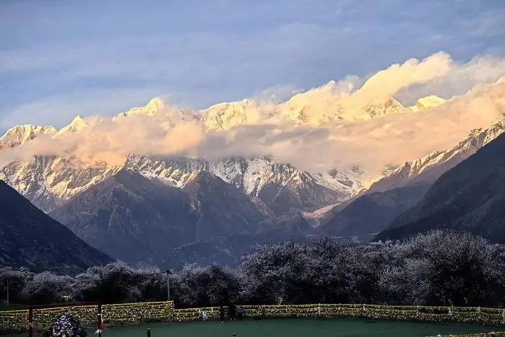
The engine settles into a steady hum as the city grid of Chengdu slips behind you and the road climbs toward thinner air. Prayer flags begin to pepper roadside stalls; terraces and pines give way to jagged passes and wide sky. By dusk the Potala Palace in Lhasa appears like a last great landmark, lit gold against high plain shadows.
Verified experiences and guided adventures in the surrounding area.
Operated by BonQuest China · Chengdu, Sichuan
The engine settles into a steady hum as the city grid of Chengdu slips behind you and the road climbs toward thinner air. Prayer flags begin to pepper roadside stalls; terraces and pines give way to jagged passes and wide sky. By dusk the Potala Palace in Lhasa appears like a last great landmark, lit gold against high plain shadows.
This route follows National Highway 318, a modern artery carved through complex Himalayan geology — folded strata, glacial cirques, and broad river valleys where the Jinsha and Yarlung Tsangpo systems map ancient tectonics. The corridor crosses traditional Kham and Ü-Tsang Tibetan cultural zones: mani walls, chortens, and nomadic summer pastures mark long-standing patterns of life.
Expect long driving days (often 6–8 hours) punctuated by short hikes, monastery visits, high mountain passes above 4,000–5,100 m, and stays in hotels that may offer supplemental oxygen. The trip mixes scenic photography stops (Xinduqiao’s light & shadow, Haizi Mountain twin lakes, Basum Lake) with cultural immersion in towns like Kangding, Litang and Nyingchi.
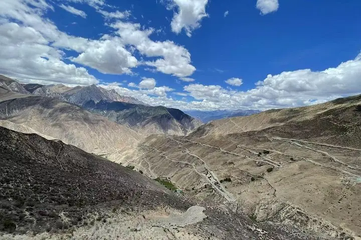
Practical edge: acclimatize slowly, drink water frequently, and avoid heavy exertion on day-one summit passes. Carry a hard copy of your passport and the required Tibet Travel Permit; border checkpoints are strict. Sun is intense at altitude—sunglasses and sunscreen are essential. Motion-sickness remedies help on hairpin sections such as the 72 Turns of Nujiang. Travel with layered clothing, a basic first-aid kit including altitude meds, spare power, and cash for small purchases.
This overland road trip blends rugged landscapes with living culture — plan for variable weather, respect sacred sites, and give yourself time to move with the mountains rather than against them.
Yes — travelers need a Tibet Travel Permit arranged before arrival; the operator should handle this but confirm and provide passport details in advance.
Altitude sickness is a real risk above 3,000 m; symptoms vary—ascend slowly, hydrate, rest, and notify guides if symptoms worsen; supplemental oxygen is often available in hotels and vehicles.
Roads range from paved highway to winding mountain sections with hairpins; weather can affect surfaces, so expect slow sections and occasional maintenance delays.
Service is intermittent outside major towns; plan offline maps, inform family beforehand, and carry extra batteries or a power bank.
BonQuest China operates guided outdoor trips and adventures with an emphasis on safety, stewardship, and memorable experiences.
The engine settles into a steady hum as the city grid of Chengdu slips behind you and the road climbs toward thinner air. Prayer flags begin to pepper roadside stalls; terraces and pines give way to jagged passes and wide sky. By dusk the Potala Palace in Lhasa appears like a last great landmark, lit gold against high plain shadows.
The engine settles into a steady hum as the city grid of Chengdu slips behind you and the road climbs toward thinner air. Prayer flags begin to pepper roadside stalls; terraces and pines give way to jagged passes and wide sky. By dusk the Potala Palace in Lhasa appears like a last great landmark, lit gold against high plain shadows.
This route follows National Highway 318, a modern artery carved through complex Himalayan geology — folded strata, glacial cirques, and broad river valleys where the Jinsha and Yarlung Tsangpo systems map ancient tectonics. The corridor crosses traditional Kham and Ü-Tsang Tibetan cultural zones: mani walls, chortens, and nomadic summer pastures mark long-standing patterns of life.
Expect long driving days (often 6–8 hours) punctuated by short hikes, monastery visits, high mountain passes above 4,000–5,100 m, and stays in hotels that may offer supplemental oxygen. The trip mixes scenic photography stops (Xinduqiao’s light & shadow, Haizi Mountain twin lakes, Basum Lake) with cultural immersion in towns like Kangding, Litang and Nyingchi.
Practical edge: acclimatize slowly, drink water frequently, and avoid heavy exertion on day-one summit passes. Carry a hard copy of your passport and the required Tibet Travel Permit; border checkpoints are strict. Sun is intense at altitude—sunglasses and sunscreen are essential. Motion-sickness remedies help on hairpin sections such as the 72 Turns of Nujiang. Travel with layered clothing, a basic first-aid kit including altitude meds, spare power, and cash for small purchases.
This overland road trip blends rugged landscapes with living culture — plan for variable weather, respect sacred sites, and give yourself time to move with the mountains rather than against them.