THE ADVENTURE COLLECTIVE® · Independent discovery and booking for outdoor travel

An eight‑day loop across Ecuador’s central highlands linking Quito, traditional markets, crater lakes, active volcanoes and Papallacta’s hot springs. Expect high‑altitude hikes, cultural markets, dramatic water features and thermal relaxation—best tackled with layered gear and time to acclimatize.
An eight‑day loop across Ecuador’s central highlands linking Quito, traditional markets, crater lakes, active volcanoes and Papallacta’s hot springs. Expect high‑altitude hikes, cultural markets, dramatic water features and thermal relaxation—best tackled with layered gear and time to acclimatize.
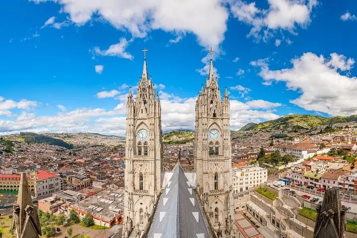
A highland morning unfurls over Quito, where thin air sharpens colors and the city sits like a living map below volcanic shoulders.
Verified experiences and guided adventures in the surrounding area.
Operated by Ecuador Galapagos Travels · Quito, Pichincha
A highland morning unfurls over Quito, where thin air sharpens colors and the city sits like a living map below volcanic shoulders.
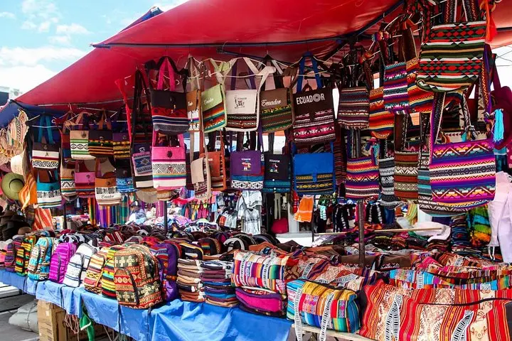
This eight‑day loop moves from Quito’s cobbled Historic Center into the northern Andean valleys—Otavalo’s market stalls and Cotacachi’s leather workshops—then onto crater lakes and steaming thermal pools. Cuicocha’s emerald lagoon lies inside an active caldera at 3,068 m; Quilotoa’s 3 km‑wide crater holds roughly 250 m of mineral‑rich water whose surface glows green under changing light. Cotopaxi’s symmetrical cone (nearly 5,900 m) fills the skyline above Limpiopungo, while Chimborazo—an eroded stratovolcano rising to 6,263 m—claims the title of the point on Earth closest to the sun because of the equatorial bulge.
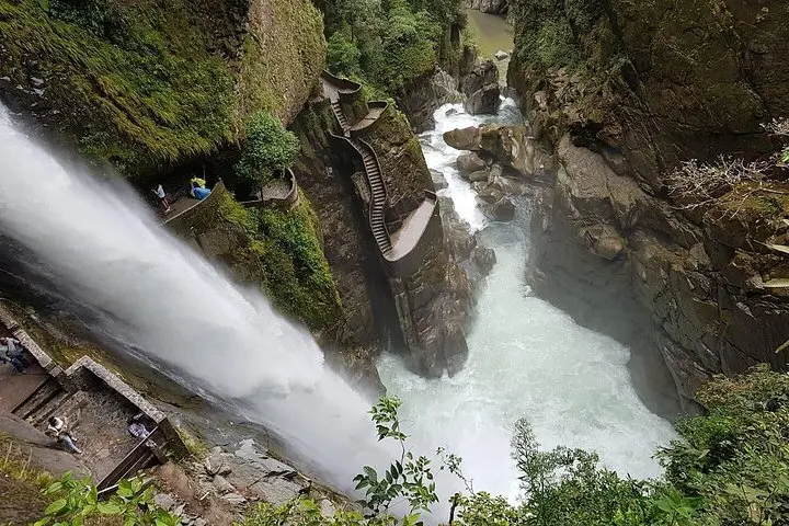
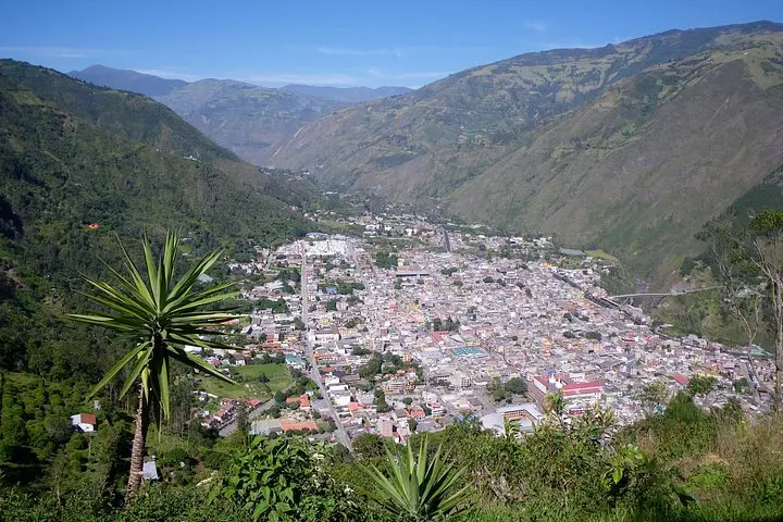
The route threads geology with culture: pre‑Columbian trade routes, colonial churches in Quito (a UNESCO site), and indigenous crafts that still anchor local economies. In Baños the river dares you toward waterfalls; Pailón del Diablo sends spray and thunder through a rainforest gorge. Papallacta’s thermal waters are a volcanic afterword—heat from below easing altitude’s long reach.
Practical notes: plan for altitude changes (Quito ≈2,850 m; excursions reach 4,800–5,000 m), carry water and layered clothing, and allow a day to acclimatize. Trails around crater rims are exposed and can be steep—good boots and sun protection are essential. Transport between highlights is by road; expect several 2–4 hour drives. Expect market bargaining in cash, short hikes at each stop, and a mix of guided walks and free time in Baños. With measured pacing and basic high‑altitude preparation, this itinerary balances culture, volcanic landscapes, and restorative hot springs.
Plan at least 24 hours in Quito before higher‑altitude excursions; if prone to altitude sickness, add an extra rest day or consult a physician.
The itinerary lists breakfasts and some lunches included; additional entrance fees (e.g., certain refuges or hot springs treatments) and some meals may be payable locally—carry cash.
No — the tour reaches refuges near 4,800–5,000 m and offers hikes to higher viewpoints; technical summit attempts require specialized guides and gear.
Ecuador uses the US dollar; Spanish is the common language, with Kichwa spoken in indigenous communities—basic Spanish or a guide helps in markets.
Ecuador Galapagos Travels operates guided outdoor trips and adventures with an emphasis on safety, stewardship, and memorable experiences.
A highland morning unfurls over Quito, where thin air sharpens colors and the city sits like a living map below volcanic shoulders.
A highland morning unfurls over Quito, where thin air sharpens colors and the city sits like a living map below volcanic shoulders.
This eight‑day loop moves from Quito’s cobbled Historic Center into the northern Andean valleys—Otavalo’s market stalls and Cotacachi’s leather workshops—then onto crater lakes and steaming thermal pools. Cuicocha’s emerald lagoon lies inside an active caldera at 3,068 m; Quilotoa’s 3 km‑wide crater holds roughly 250 m of mineral‑rich water whose surface glows green under changing light. Cotopaxi’s symmetrical cone (nearly 5,900 m) fills the skyline above Limpiopungo, while Chimborazo—an eroded stratovolcano rising to 6,263 m—claims the title of the point on Earth closest to the sun because of the equatorial bulge.
The route threads geology with culture: pre‑Columbian trade routes, colonial churches in Quito (a UNESCO site), and indigenous crafts that still anchor local economies. In Baños the river dares you toward waterfalls; Pailón del Diablo sends spray and thunder through a rainforest gorge. Papallacta’s thermal waters are a volcanic afterword—heat from below easing altitude’s long reach.
Practical notes: plan for altitude changes (Quito ≈2,850 m; excursions reach 4,800–5,000 m), carry water and layered clothing, and allow a day to acclimatize. Trails around crater rims are exposed and can be steep—good boots and sun protection are essential. Transport between highlights is by road; expect several 2–4 hour drives. Expect market bargaining in cash, short hikes at each stop, and a mix of guided walks and free time in Baños. With measured pacing and basic high‑altitude preparation, this itinerary balances culture, volcanic landscapes, and restorative hot springs.