THE ADVENTURE COLLECTIVE® · Independent discovery and booking for outdoor travel

On the Lemosho route, Kilimanjaro reveals itself slowly—rain forest to arctic summit—over eight days that prioritize acclimatization and a short rest before the midnight summit push. This private itinerary balances challenge with a proven schedule that improves summit odds.
On the Lemosho route, Kilimanjaro reveals itself slowly—rain forest to arctic summit—over eight days that prioritize acclimatization and a short rest before the midnight summit push. This private itinerary balances challenge with a proven schedule that improves summit odds.
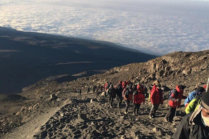
A pre-dawn hush hangs over Barafu Camp. Headlamps cut swaths of light through a horizon that refuses to brighten; the mountain waits like a patient judge. By midnight groups rise from their sleeping bags and begin a slow, breath-steadying shuffle across scree toward Stella Point. The air is thin; every step is deliberate. When the sky finally splits open with sunrise at 18,600 ft, it feels earned.
Verified experiences and guided adventures in the surrounding area.
Operated by Destiny Explorers · Moshi, Kilimanjaro Region
A pre-dawn hush hangs over Barafu Camp. Headlamps cut swaths of light through a horizon that refuses to brighten; the mountain waits like a patient judge. By midnight groups rise from their sleeping bags and begin a slow, breath-steadying shuffle across scree toward Stella Point. The air is thin; every step is deliberate. When the sky finally splits open with sunrise at 18,600 ft, it feels earned.
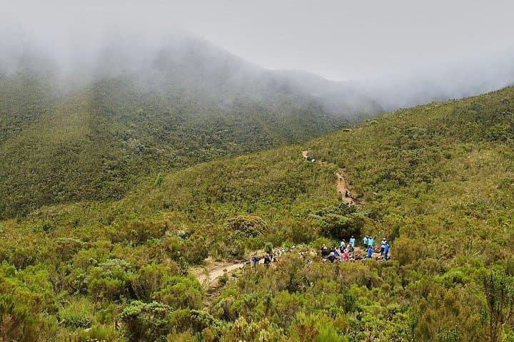
The Lemosho route approaches Kilimanjaro from the west and is prized for its long, gradual acclimatization profile and the variety of habitats it passes through—from rain forest at 7,800 ft to the arctic of Uhuru Peak at 19,345 ft. This eight-day itinerary deliberately breaks the approach to Barafu into an extra short day before summit push, giving climbers a rest window that can be the difference between reaching the crater rim and turning back.
Geologically, Kilimanjaro is a dormant stratovolcano composed of three cones: Shira, Mawenzi and Kibo. The Lemosho traverse crosses ancient lava flows and the high Shira Plateau—one of the highest plateaus on earth—before skirting the “Shark’s Tooth” of Lava Tower at about 16,000 ft. The route’s gradual profile helps bodies adapt to lower oxygen; it also reveals the Chagga people's agricultural terraces on the mountain’s southern flanks and the long human history of trade and high-altitude pastoralism.
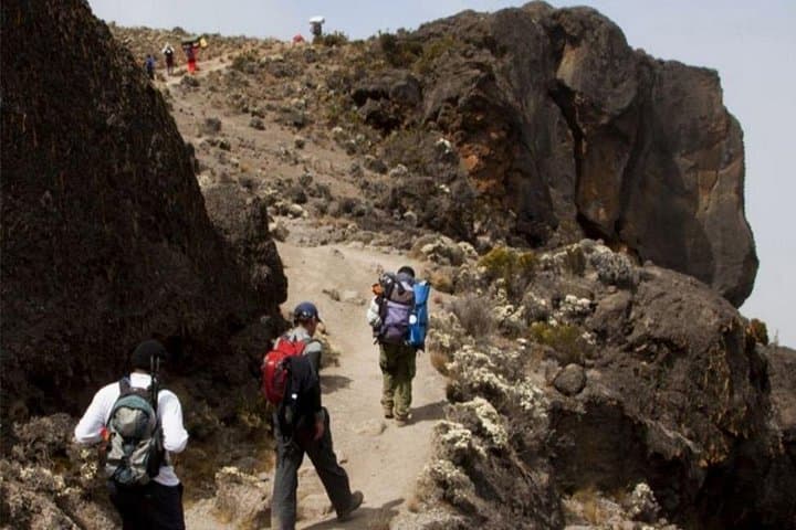
The climb is both physically exacting and non-technical: expect daily hiking of 4–7 hours, with summit day requiring 7–8 hours up and several hours descending. Camps are basic tent platforms—Forest Camp, Shira 1 & 2, Moir Hut, Barranco, Karanga, Barafu, and Mweka—and meals are supplied as the itinerary lists. Porters and guides manage logistics; tipping standards are customary and part of local economic impact.
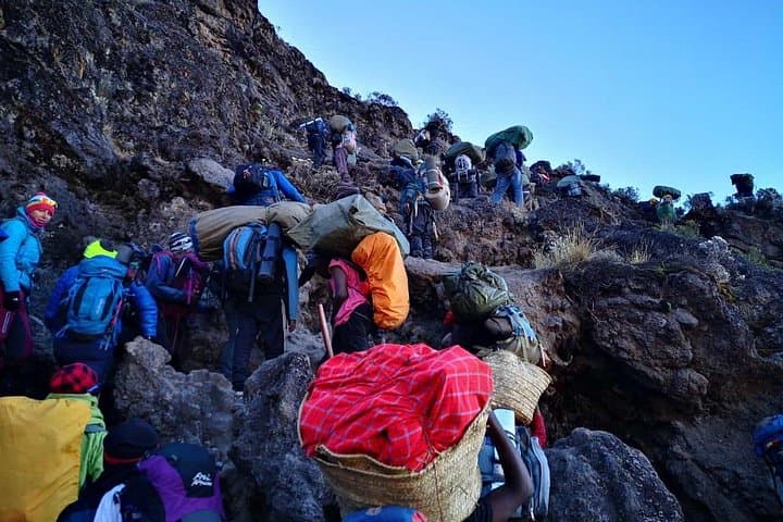
Practical guidance: hydrate early and often, keep calories coming with salty snacks, and use the march-and-rest rhythm on steep scree sections. Staggered pacing works best on the steep Barranco Wall and the final scree to Stella Point. Gaiters and poles reduce dust and knee strain on long descents. Weather is changeable—daytime can be warm on the lower moorlands and brutally cold above 15,000 ft—so layers that wick, insulate, and block wind are essential.
For photographers, sunrise from Stella Point or views across the Shira Plateau are unforgettable. For culture seekers, a pre- or post-trek visit to Moshi’s markets and a conversation with Chagga guides adds important context to the climb.
This is a climb that rewards preparation and patience: not a technical ascent, but a high-altitude endurance challenge where strategy—acclimatization, rest, and hydration—decides success.
No—Kilimanjaro is a non-technical trek; the challenge is altitude and endurance rather than rock or ice climbing.
Dry months (June–October and late December–February) offer the clearest weather and higher summit success rates.
The extra day breaks up the ascent to Barafu allowing the body to adjust, which reduces acute altitude symptoms and improves summit odds.
Yes—this private trip includes local guides, porters, camp staff, and camping equipment as listed in inclusions.
Tipping is customary; plan a per-person budget for guides, assistant guides, and porters—your operator can give current recommended amounts.
Guides will prioritize safety; if you cannot continue, they will arrange descent and support—summit success is not guaranteed.
Destiny Explorers operates guided outdoor trips and adventures with an emphasis on safety, stewardship, and memorable experiences.
A pre-dawn hush hangs over Barafu Camp. Headlamps cut swaths of light through a horizon that refuses to brighten; the mountain waits like a patient judge. By midnight groups rise from their sleeping bags and begin a slow, breath-steadying shuffle across scree toward Stella Point. The air is thin; every step is deliberate. When the sky finally splits open with sunrise at 18,600 ft, it feels earned.
A pre-dawn hush hangs over Barafu Camp. Headlamps cut swaths of light through a horizon that refuses to brighten; the mountain waits like a patient judge. By midnight groups rise from their sleeping bags and begin a slow, breath-steadying shuffle across scree toward Stella Point. The air is thin; every step is deliberate. When the sky finally splits open with sunrise at 18,600 ft, it feels earned.
The Lemosho route approaches Kilimanjaro from the west and is prized for its long, gradual acclimatization profile and the variety of habitats it passes through—from rain forest at 7,800 ft to the arctic of Uhuru Peak at 19,345 ft. This eight-day itinerary deliberately breaks the approach to Barafu into an extra short day before summit push, giving climbers a rest window that can be the difference between reaching the crater rim and turning back.
Geologically, Kilimanjaro is a dormant stratovolcano composed of three cones: Shira, Mawenzi and Kibo. The Lemosho traverse crosses ancient lava flows and the high Shira Plateau—one of the highest plateaus on earth—before skirting the “Shark’s Tooth” of Lava Tower at about 16,000 ft. The route’s gradual profile helps bodies adapt to lower oxygen; it also reveals the Chagga people's agricultural terraces on the mountain’s southern flanks and the long human history of trade and high-altitude pastoralism.
The climb is both physically exacting and non-technical: expect daily hiking of 4–7 hours, with summit day requiring 7–8 hours up and several hours descending. Camps are basic tent platforms—Forest Camp, Shira 1 & 2, Moir Hut, Barranco, Karanga, Barafu, and Mweka—and meals are supplied as the itinerary lists. Porters and guides manage logistics; tipping standards are customary and part of local economic impact.
Practical guidance: hydrate early and often, keep calories coming with salty snacks, and use the march-and-rest rhythm on steep scree sections. Staggered pacing works best on the steep Barranco Wall and the final scree to Stella Point. Gaiters and poles reduce dust and knee strain on long descents. Weather is changeable—daytime can be warm on the lower moorlands and brutally cold above 15,000 ft—so layers that wick, insulate, and block wind are essential.
For photographers, sunrise from Stella Point or views across the Shira Plateau are unforgettable. For culture seekers, a pre- or post-trek visit to Moshi’s markets and a conversation with Chagga guides adds important context to the climb.
This is a climb that rewards preparation and patience: not a technical ascent, but a high-altitude endurance challenge where strategy—acclimatization, rest, and hydration—decides success.