THE ADVENTURE COLLECTIVE® · Independent discovery and booking for outdoor travel

A private eight-day trek from Pokhara to Khopra Ridge that trades crowded trails for rhododendron forests, Gurung villages, and panoramic views of Annapurna and Dhaulagiri. Expect steep stone steps, simple guesthouse nights, and high ridgeline vistas at 3,660 m.
A private eight-day trek from Pokhara to Khopra Ridge that trades crowded trails for rhododendron forests, Gurung villages, and panoramic views of Annapurna and Dhaulagiri. Expect steep stone steps, simple guesthouse nights, and high ridgeline vistas at 3,660 m.
You step out at dawn in Pokhara’s Lakeside and the city’s lake breathes a cool mist as a private jeep curls onto the mountain road. The drive to Nayapul is a warm-up; the real trail begins as terraces and stone walls fold into the first villages and the Annapurna massif raises its white crowns. Each day the ridge draws you higher: rhododendron and oak give way to juniper and alpine meadows, and Khopra Ridge opens like a natural viewing platform to Annapurna, Dhaulagiri and Machapuchare.
Verified experiences and guided adventures in the surrounding area.
Operated by Shriyan World Wide Tours Private Limited · Pokhara, Gandaki Province
You step out at dawn in Pokhara’s Lakeside and the city’s lake breathes a cool mist as a private jeep curls onto the mountain road. The drive to Nayapul is a warm-up; the real trail begins as terraces and stone walls fold into the first villages and the Annapurna massif raises its white crowns. Each day the ridge draws you higher: rhododendron and oak give way to juniper and alpine meadows, and Khopra Ridge opens like a natural viewing platform to Annapurna, Dhaulagiri and Machapuchare.
This route threads Gurung villages—Ghandruk, Swanta, Ulleri—where living culture meets staple terraces carved into steep hills. Geologically you’re walking the frontal ranges of the High Himalaya, land shaped by tectonic uplift and glacial carving; talus slopes and moraine traces are visible in the higher passes. Khayer Lake near Khopra is a seasonal, sacred tarn watched by prayer flags and local lore.
Practically: plan for altitude (highest sleeping point ~3,660 m), sustained ascents and steep stone stairways. Guesthouses provide basic meals and bunk-style lodgings; carry warm layers and a reliable sleeping liner. Trails can be steep and muddy after rain; trekking poles and solid boots meaningfully reduce impact on knees. Permits (TIMS and ACAP) are required and usually handled before or at the start. Water sources exist but treat or refill with vetted supplies. Best windows are spring and autumn for clear views and rhododendron bloom. Move at a steady pace, respect local customs, and leave no trace—this is a fragile highland community and it repays restraint with some of the clearest mountain panoramas in the Annapurna region.
Yes—an Annapurna Conservation Area Permit (ACAP) and a TIMS card are required; many operators arrange these before departure or at Pokhara checkpoints.
Expect 4–7 hours of walking on most days with several sustained climbs and stone stair sections; moderate fitness and previous day-hiking experience help.
Guesthouses (teahouses) offer basic twin rooms, shared bathrooms, simple hot meals, and often a wood- or gas-heated dining room.
Autumn (Sep–Nov) and spring (Mar–May) provide the clearest weather and best mountain views; avoid monsoon months for reduced visibility and mud.
Shriyan World Wide Tours Private Limited operates guided outdoor trips and adventures with an emphasis on safety, stewardship, and memorable experiences.
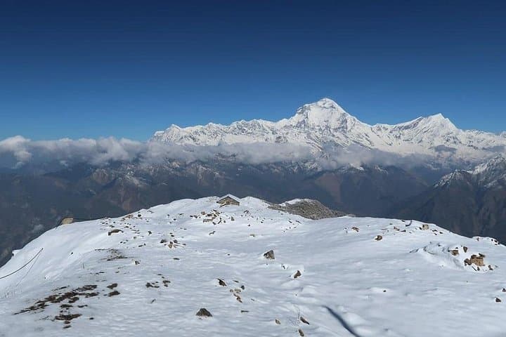
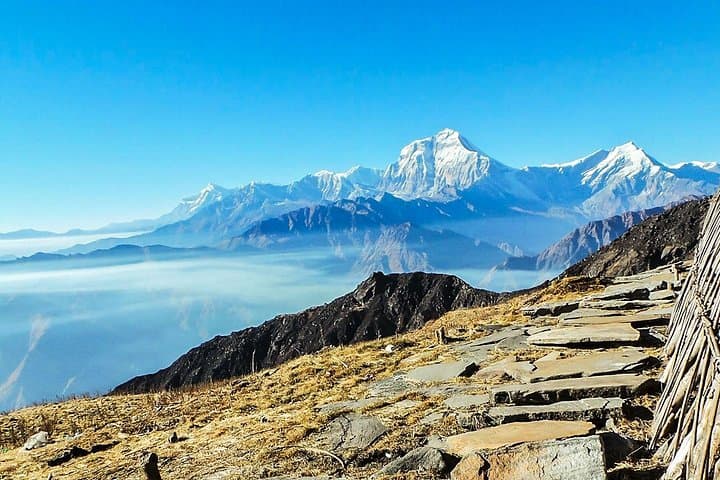
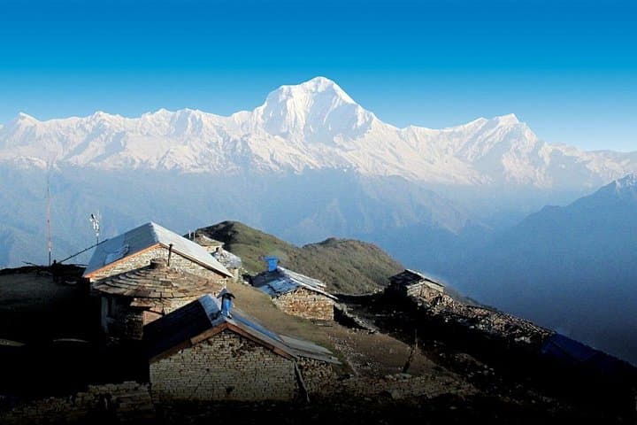
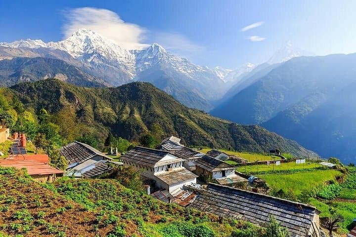
You step out at dawn in Pokhara’s Lakeside and the city’s lake breathes a cool mist as a private jeep curls onto the mountain road. The drive to Nayapul is a warm-up; the real trail begins as terraces and stone walls fold into the first villages and the Annapurna massif raises its white crowns. Each day the ridge draws you higher: rhododendron and oak give way to juniper and alpine meadows, and Khopra Ridge opens like a natural viewing platform to Annapurna, Dhaulagiri and Machapuchare.
You step out at dawn in Pokhara’s Lakeside and the city’s lake breathes a cool mist as a private jeep curls onto the mountain road. The drive to Nayapul is a warm-up; the real trail begins as terraces and stone walls fold into the first villages and the Annapurna massif raises its white crowns. Each day the ridge draws you higher: rhododendron and oak give way to juniper and alpine meadows, and Khopra Ridge opens like a natural viewing platform to Annapurna, Dhaulagiri and Machapuchare.
This route threads Gurung villages—Ghandruk, Swanta, Ulleri—where living culture meets staple terraces carved into steep hills. Geologically you’re walking the frontal ranges of the High Himalaya, land shaped by tectonic uplift and glacial carving; talus slopes and moraine traces are visible in the higher passes. Khayer Lake near Khopra is a seasonal, sacred tarn watched by prayer flags and local lore.
Practically: plan for altitude (highest sleeping point ~3,660 m), sustained ascents and steep stone stairways. Guesthouses provide basic meals and bunk-style lodgings; carry warm layers and a reliable sleeping liner. Trails can be steep and muddy after rain; trekking poles and solid boots meaningfully reduce impact on knees. Permits (TIMS and ACAP) are required and usually handled before or at the start. Water sources exist but treat or refill with vetted supplies. Best windows are spring and autumn for clear views and rhododendron bloom. Move at a steady pace, respect local customs, and leave no trace—this is a fragile highland community and it repays restraint with some of the clearest mountain panoramas in the Annapurna region.