THE ADVENTURE COLLECTIVE® · Independent discovery and booking for outdoor travel

Camp overnight on Acatenango and watch the active Fuego volcano light the sky at night, then push for the summit at sunrise. This two-day trek combines volcanic scenery, a high-altitude camp at ~3,600m, and guided logistics from Antigua.
Camp overnight on Acatenango and watch the active Fuego volcano light the sky at night, then push for the summit at sunrise. This two-day trek combines volcanic scenery, a high-altitude camp at ~3,600m, and guided logistics from Antigua.
Headlamps cut white arcs through the pre-dawn as a string of hikers pushes up volcanic scree toward the camp at 3,600m. Cold air bites; every breath is visible. From camp, the active neighbor Fuego punctuates the skyline with glowing bursts that remind you why people make this climb: a raw, close view of a living volcano.
Verified experiences and guided adventures in the surrounding area.
Operated by OX Expeditions, S.A. · Antigua Guatemala, Sacatepéquez
Headlamps cut white arcs through the pre-dawn as a string of hikers pushes up volcanic scree toward the camp at 3,600m. Cold air bites; every breath is visible. From camp, the active neighbor Fuego punctuates the skyline with glowing bursts that remind you why people make this climb: a raw, close view of a living volcano.
Acatenango is part of the Central American Volcanic Arc — a layered stratovolcano that records millions of years of eruptions, lava flows and ash. The mountain’s slopes have been farmed for centuries by communities tied to Antigua, whose colonial stone streets lie down-valley. Geology here is immediate: pumice patches, loose scoria, and firmer volcanic soils that give way to panoramic ridgelines.
The standard overnight itinerary gains roughly 1,200–1,400 m over about 7 km to basecamp, with an additional 2–3 km and ~300–400 m to the true summit (3,976 m) if conditions allow. Terrain alternates packed dirt, loose volcanic scree and short steep sections; expect cold nights near freezing and strong winds. Guides typically run a pre-trip meeting, provide basic warm rental layers and camp facilities, and time the summit push for sunrise to watch Fuego’s eruptions against a brightening sky.
Practical advice: acclimatize in Antigua, carry layered insulation, a reliable headlamp and at least 2–3 liters of water, and use sturdy boots with good traction. Respect guide instructions around Fuego’s activity, pack out all waste, and be prepared for rapid weather shifts — the mountain can change mood as quickly as its lava glows.
Expect roughly 7 km to basecamp with about 1,200–1,400 m of gain; the summit adds another 2–3 km and ~300–400 m to reach 3,976 m.
Yes — Fuego is active and frequently erupts. Tours position camps at safe distances and guides monitor conditions; always follow their instructions.
Overnight is in mountain camp cabins or tents depending on operator; expect basic but sheltered accommodations and communal meals provided by the guide team.
No technical climbing skills are required, but you should have recent high-elevation trekking experience and strong fitness for steep, loose terrain.
OX Expeditions, S.A. operates guided outdoor trips and adventures with an emphasis on safety, stewardship, and memorable experiences.
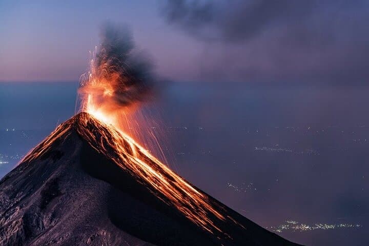
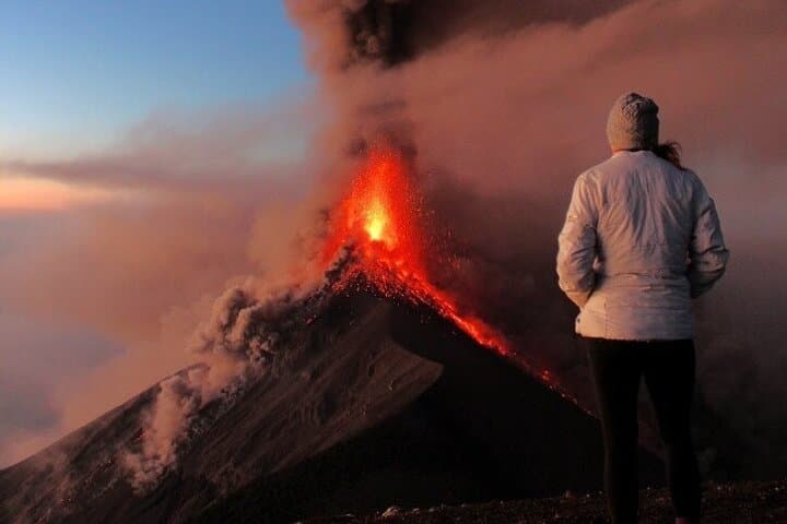

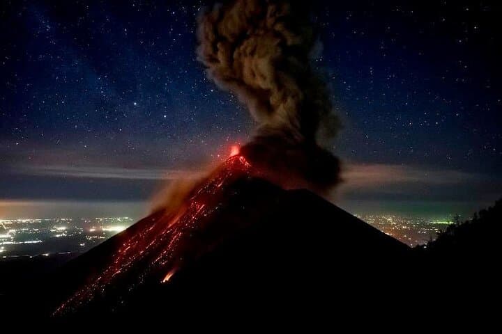
Headlamps cut white arcs through the pre-dawn as a string of hikers pushes up volcanic scree toward the camp at 3,600m. Cold air bites; every breath is visible. From camp, the active neighbor Fuego punctuates the skyline with glowing bursts that remind you why people make this climb: a raw, close view of a living volcano.
Headlamps cut white arcs through the pre-dawn as a string of hikers pushes up volcanic scree toward the camp at 3,600m. Cold air bites; every breath is visible. From camp, the active neighbor Fuego punctuates the skyline with glowing bursts that remind you why people make this climb: a raw, close view of a living volcano.
Acatenango is part of the Central American Volcanic Arc — a layered stratovolcano that records millions of years of eruptions, lava flows and ash. The mountain’s slopes have been farmed for centuries by communities tied to Antigua, whose colonial stone streets lie down-valley. Geology here is immediate: pumice patches, loose scoria, and firmer volcanic soils that give way to panoramic ridgelines.
The standard overnight itinerary gains roughly 1,200–1,400 m over about 7 km to basecamp, with an additional 2–3 km and ~300–400 m to the true summit (3,976 m) if conditions allow. Terrain alternates packed dirt, loose volcanic scree and short steep sections; expect cold nights near freezing and strong winds. Guides typically run a pre-trip meeting, provide basic warm rental layers and camp facilities, and time the summit push for sunrise to watch Fuego’s eruptions against a brightening sky.
Practical advice: acclimatize in Antigua, carry layered insulation, a reliable headlamp and at least 2–3 liters of water, and use sturdy boots with good traction. Respect guide instructions around Fuego’s activity, pack out all waste, and be prepared for rapid weather shifts — the mountain can change mood as quickly as its lava glows.