THE ADVENTURE COLLECTIVE® · Independent discovery and booking for outdoor travel

Traverse 75 km of coastal ridgelines on the Alta Via dei Monti Lattari—five days of high viewpoints, limestone ridges and village hospitality between Cava dei Tirreni and Massa Lubrense. This guided trek pairs demanding terrain with unmatched Amalfi Coast panoramas.
Traverse 75 km of coastal ridgelines on the Alta Via dei Monti Lattari—five days of high viewpoints, limestone ridges and village hospitality between Cava dei Tirreni and Massa Lubrense. This guided trek pairs demanding terrain with unmatched Amalfi Coast panoramas.
You step from the train at Cava dei Tirreni and the ridge rises like a rough spine above the Tyrrhenian—rock, scrub and old chestnut woods cutting the sky line. Over five days you walk 75 km along the Alta Via dei Monti Lattari, trading seaside towns for high viewpoints where the Amalfi and Sorrento coasts unfurl below like a living map.
Verified experiences and guided adventures in the surrounding area.
Operated by Enzo Masullo · Massa Lubrense, Campania
You step from the train at Cava dei Tirreni and the ridge rises like a rough spine above the Tyrrhenian—rock, scrub and old chestnut woods cutting the sky line. Over five days you walk 75 km along the Alta Via dei Monti Lattari, trading seaside towns for high viewpoints where the Amalfi and Sorrento coasts unfurl below like a living map.
The route threads mountain passes used for centuries by shepherds and muleteers; terraced citrus groves and abandoned stone huts speak to a landscape shaped by agriculture and human hands. The geology is primarily limestone and marl, eroded into sharp ridges and sudden cliffs; underfoot expect rocky singletrack, mule paths and the occasional paved mule road.
Culturally the path links small villages—Tramonti, Agerola, Massa Lubrense—where local cuisine is simple and wild: lemons, capers, goat cheese and bruschetta. Wildlife is active at dawn; falcons quarter the air and wild boar root the undergrowth.
Practical: the trip is strenuous—five days averaging 15 km/day with climbs up to 1,400 m on some sections—so hike-fit legs, steady pace and early starts matter. Pack layered clothing for coastal sun and exposed ridge wind, carry 2–3 liters of water and use trekking poles on descents. Meet at Cava train station; the route finishes near Massa Lubrense with public-transport options back to Sorrento.
Expect exposed sections, rapidly changing weather above the treeline, and rewarding panoramas at each summit. A guide keeps navigation simple; still, know how to read a map and move confidently on rocky terrain.
This is challenging: expect daily distances around 12–18 km with sustained climbs up to ~1,400 m; regular uphill hiking and multi-day experience recommended.
The guide meets at Cava dei Tirreni train station for the start; the route finishes near Massa Lubrense with transport options back toward Sorrento.
Accommodation and meals vary by operator—confirm whether overnight stays are booked by the guide or if you’ll arrange B&Bs and dinners independently.
Parts of the Alta Via are waymarked, but some ridge sections are indistinct; a guide or solid map-reading skills are recommended.
Enzo Masullo operates guided outdoor trips and adventures with an emphasis on safety, stewardship, and memorable experiences.
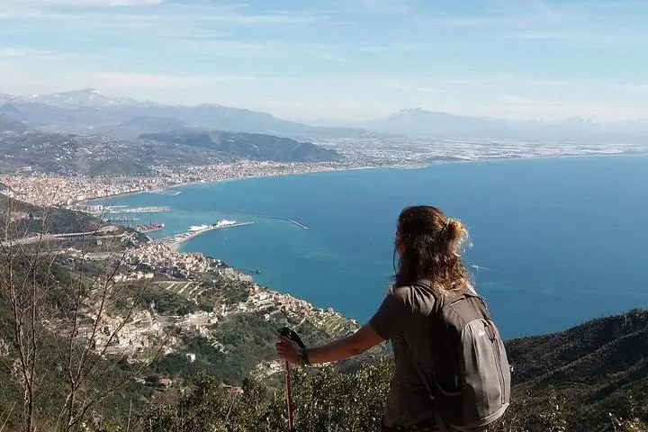
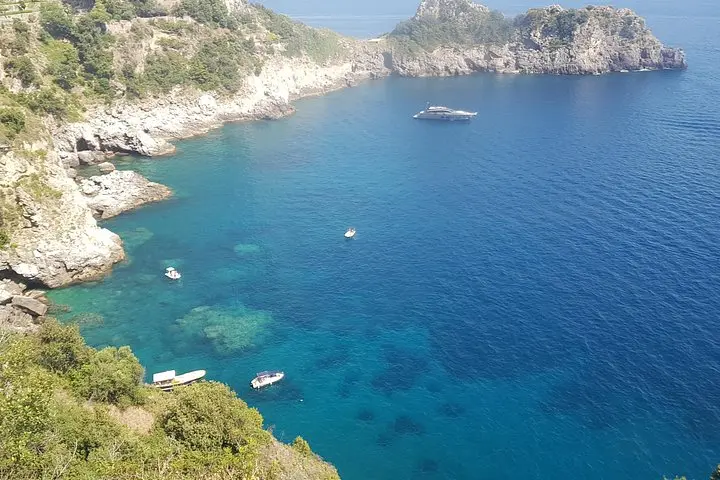
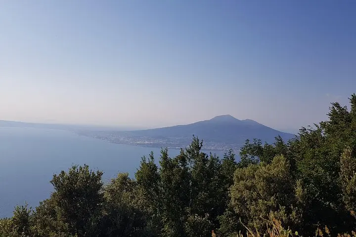
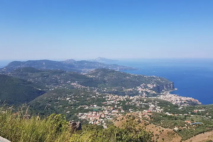
You step from the train at Cava dei Tirreni and the ridge rises like a rough spine above the Tyrrhenian—rock, scrub and old chestnut woods cutting the sky line. Over five days you walk 75 km along the Alta Via dei Monti Lattari, trading seaside towns for high viewpoints where the Amalfi and Sorrento coasts unfurl below like a living map.
You step from the train at Cava dei Tirreni and the ridge rises like a rough spine above the Tyrrhenian—rock, scrub and old chestnut woods cutting the sky line. Over five days you walk 75 km along the Alta Via dei Monti Lattari, trading seaside towns for high viewpoints where the Amalfi and Sorrento coasts unfurl below like a living map.
The route threads mountain passes used for centuries by shepherds and muleteers; terraced citrus groves and abandoned stone huts speak to a landscape shaped by agriculture and human hands. The geology is primarily limestone and marl, eroded into sharp ridges and sudden cliffs; underfoot expect rocky singletrack, mule paths and the occasional paved mule road.
Culturally the path links small villages—Tramonti, Agerola, Massa Lubrense—where local cuisine is simple and wild: lemons, capers, goat cheese and bruschetta. Wildlife is active at dawn; falcons quarter the air and wild boar root the undergrowth.
Practical: the trip is strenuous—five days averaging 15 km/day with climbs up to 1,400 m on some sections—so hike-fit legs, steady pace and early starts matter. Pack layered clothing for coastal sun and exposed ridge wind, carry 2–3 liters of water and use trekking poles on descents. Meet at Cava train station; the route finishes near Massa Lubrense with public-transport options back to Sorrento.
Expect exposed sections, rapidly changing weather above the treeline, and rewarding panoramas at each summit. A guide keeps navigation simple; still, know how to read a map and move confidently on rocky terrain.