THE ADVENTURE COLLECTIVE® · Independent discovery and booking for outdoor travel

Spend a half-day exploring Anaga Rural Park’s rare laurel forests and coastal viewpoints on a guided small-group hike. This moderate 5.5 km route includes ancient water channels, 220 m of ascent, and plenty of photo stops.
Spend a half-day exploring Anaga Rural Park’s rare laurel forests and coastal viewpoints on a guided small-group hike. This moderate 5.5 km route includes ancient water channels, 220 m of ascent, and plenty of photo stops.
You step off the minivan at 420 meters and the island’s damp air closes around you — a cool, green hush that makes the cliffs and ocean feel farther away. The trail immediately threads into laurel forest: thick trunks draped with moss, narrow paths that slope and twist, and the muted gurgle of centuries-old water channels guiding your steps.
Verified experiences and guided adventures in the surrounding area.
Operated by Sherpa · Taganana, Tenerife
You step off the minivan at 420 meters and the island’s damp air closes around you — a cool, green hush that makes the cliffs and ocean feel farther away. The trail immediately threads into laurel forest: thick trunks draped with moss, narrow paths that slope and twist, and the muted gurgle of centuries-old water channels guiding your steps.
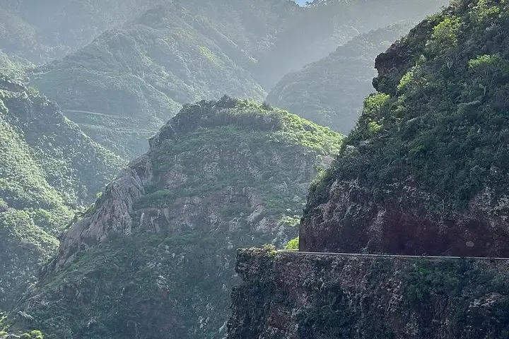
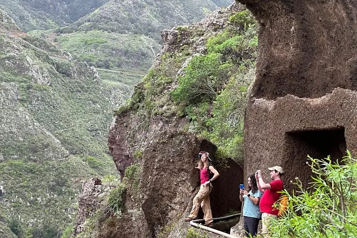
Anaga Rural Park is a remnant of Tertiary-era forests and a UNESCO Biosphere Reserve. Geologically it’s rugged schist and basalt carved by ancient volcanoes and ocean erosion; culturally it’s dotted with cliffside hamlets and troglodyte homes where traditional Canarian life still shows. Guides here point out acequias — hand-cut irrigation channels — that sustained settlements for generations and now add rhythm to a hike that gains about 220 meters over roughly 5.5 km.
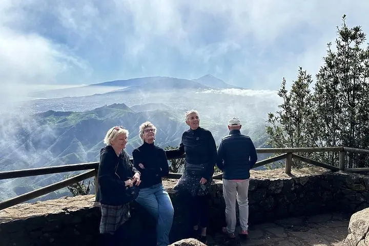
Expect a moderately paced 3-hour walk inside a longer half-day tour (transport and viewpoint stops make the full experience 4–6 hours). Terrain alternates compact dirt, rocky steps, and narrow ledges beside the man-made canal. Photo stops at Mirador de Zapata and coastal overlooks are frequent; the hike rewards steady breathing and slow attention to the understory plants and bird calls.
Practical guidance: wear grippy hiking shoes, pack 1.5–2 liters of water, and bring a lightweight waterproof layer — cloud and drizzle are common. Start mid-morning for softer light and calmer wind, and keep to the marked track to protect fragile laurel soil. The route is accessible to most hikers with moderate fitness and pays back effort with dense forest, engineered waterways, and sweeping coastal views.
The guided hike portion is about 3 hours covering roughly 5.5 km with 220 m of ascent; the full tour (including pickup and viewpoint stops) runs 4–6 hours.
Families with older children and active older adults can manage it if they have moderate fitness; steep or narrow sections may be challenging for very young children or mobility-limited travelers.
Bring snacks or a light lunch if you expect to be hungry between the guided stops — the tour may include a break but not a full meal service by default.
Trails are generally well-marked but include roots, stone steps, and wet leaves; follow your guide and stay on the path to avoid damaging vegetation.
Sherpa operates guided outdoor trips and adventures with an emphasis on safety, stewardship, and memorable experiences.
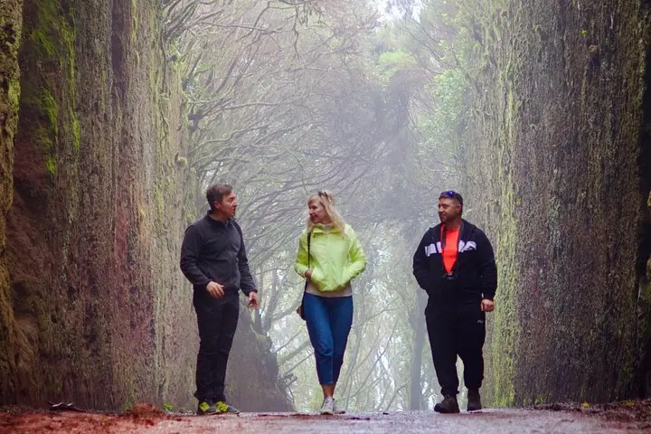
You step off the minivan at 420 meters and the island’s damp air closes around you — a cool, green hush that makes the cliffs and ocean feel farther away. The trail immediately threads into laurel forest: thick trunks draped with moss, narrow paths that slope and twist, and the muted gurgle of centuries-old water channels guiding your steps.
You step off the minivan at 420 meters and the island’s damp air closes around you — a cool, green hush that makes the cliffs and ocean feel farther away. The trail immediately threads into laurel forest: thick trunks draped with moss, narrow paths that slope and twist, and the muted gurgle of centuries-old water channels guiding your steps.
Anaga Rural Park is a remnant of Tertiary-era forests and a UNESCO Biosphere Reserve. Geologically it’s rugged schist and basalt carved by ancient volcanoes and ocean erosion; culturally it’s dotted with cliffside hamlets and troglodyte homes where traditional Canarian life still shows. Guides here point out acequias — hand-cut irrigation channels — that sustained settlements for generations and now add rhythm to a hike that gains about 220 meters over roughly 5.5 km.
Expect a moderately paced 3-hour walk inside a longer half-day tour (transport and viewpoint stops make the full experience 4–6 hours). Terrain alternates compact dirt, rocky steps, and narrow ledges beside the man-made canal. Photo stops at Mirador de Zapata and coastal overlooks are frequent; the hike rewards steady breathing and slow attention to the understory plants and bird calls.
Practical guidance: wear grippy hiking shoes, pack 1.5–2 liters of water, and bring a lightweight waterproof layer — cloud and drizzle are common. Start mid-morning for softer light and calmer wind, and keep to the marked track to protect fragile laurel soil. The route is accessible to most hikers with moderate fitness and pays back effort with dense forest, engineered waterways, and sweeping coastal views.