THE ADVENTURE COLLECTIVE® · Independent discovery and booking for outdoor travel

Crossing Thorong La is a high-altitude rite of passage: a 15-day circuit that climbs from subtropical valleys to a 5,416m pass, moving through river gorges, alpine meadows, and Tibetan-influenced plateaus. This guide covers what to expect on the route, logistics and how to prepare for the pass day.
Crossing Thorong La is a high-altitude rite of passage: a 15-day circuit that climbs from subtropical valleys to a 5,416m pass, moving through river gorges, alpine meadows, and Tibetan-influenced plateaus. This guide covers what to expect on the route, logistics and how to prepare for the pass day.
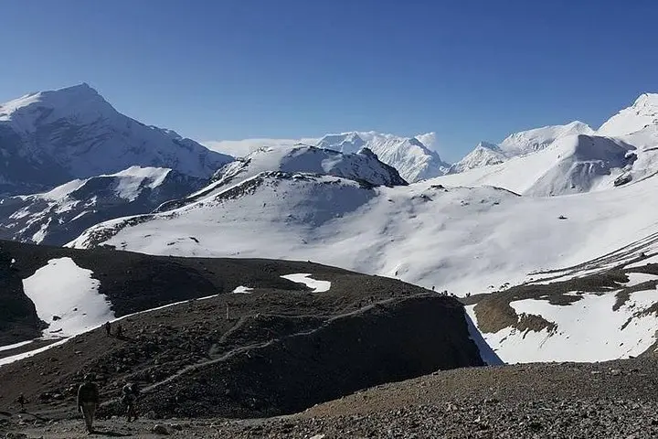
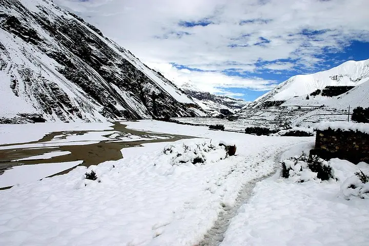
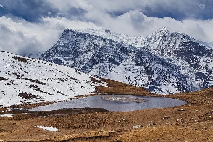
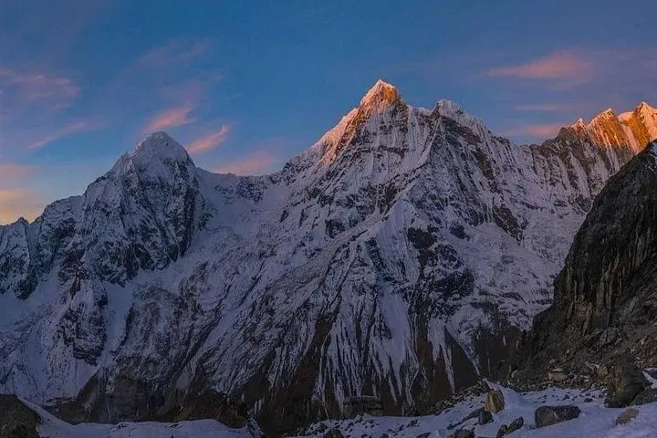
You step out of the bus into a thin, cool air and the valley seems to inhale with you — rice terraces and rivers give way to choked rhododendron slopes, then to wind-scoured moraine and stone villages. Over 15 days the route climbs from roughly 760m in Besisahar through alpine meadows to Thorong La at 5,416m, where a final, exposed ridge opens into a wide, Tibetan-leaning plateau.
Verified experiences and guided adventures in the surrounding area.
Operated by Happyland Treks · Manang, Gandaki Province
You step out of the bus into a thin, cool air and the valley seems to inhale with you — rice terraces and rivers give way to choked rhododendron slopes, then to wind-scoured moraine and stone villages. Over 15 days the route climbs from roughly 760m in Besisahar through alpine meadows to Thorong La at 5,416m, where a final, exposed ridge opens into a wide, Tibetan-leaning plateau.
The circuit threads older trade routes that linked Kathmandu with Mustang and Tibet. Geologically the trail traces uplifted Himalayan strata and glacial carve: expect river-cut gorges in the lower section, glacial till and scree near the pass, and stark dry valleys on the Muktinath side. Culturally the hike moves from Hindu and Gurung villages to Thakali and Tibetan-influenced communities — tea houses, mani walls and prayer flags mark that transition.
Practically, the itinerary builds acclimatization into Manang with a rest day and shorter stages before the big push: the pass day involves roughly 1,200m of ascent from Thorang Phedi and a long 8–9 hour day with technical footing on snow or loose rock depending on season. Trails are well-established but can be rocky, icy or muddy; tea house accommodation is standard and porter service is commonly available (this operator notes one porter per two trekkers).
Bring layered insulation, a sturdy pair of trekking boots, and a plan for altitude: hydrate, pace uphill, and recognize symptoms of AMS. Permits (ACAP and TIMS) are required and are normally handled by operators. Spring and autumn give the most stable weather and the clearest mountain views; winter brings deep cold and summer monsoon can make lower trails slippery. With preparation this circuit is a rugged, deeply rewarding high-altitude journey.
You need the Annapurna Conservation Area Permit (ACAP) and a TIMS card; operators usually arrange these for you.
Autumn (Sept–Nov) and spring (Mar–May) offer the most stable weather and clear views; monsoon months are wet at lower elevations and winter is very cold with heavier snow on the pass.
The Thorang La day typically involves about 1,200m of climb from Thorang Phedi with long hours (8–9 hours) and possible snow — it’s the most strenuous and exposure-prone day on the route.
Yes — porter service is widely available and many operators include or offer it (this tour notes one porter per two trekkers); hiring a porter reduces load and helps with altitude pacing.
Happyland Treks operates guided outdoor trips and adventures with an emphasis on safety, stewardship, and memorable experiences.
You step out of the bus into a thin, cool air and the valley seems to inhale with you — rice terraces and rivers give way to choked rhododendron slopes, then to wind-scoured moraine and stone villages. Over 15 days the route climbs from roughly 760m in Besisahar through alpine meadows to Thorong La at 5,416m, where a final, exposed ridge opens into a wide, Tibetan-leaning plateau.
You step out of the bus into a thin, cool air and the valley seems to inhale with you — rice terraces and rivers give way to choked rhododendron slopes, then to wind-scoured moraine and stone villages. Over 15 days the route climbs from roughly 760m in Besisahar through alpine meadows to Thorong La at 5,416m, where a final, exposed ridge opens into a wide, Tibetan-leaning plateau.
The circuit threads older trade routes that linked Kathmandu with Mustang and Tibet. Geologically the trail traces uplifted Himalayan strata and glacial carve: expect river-cut gorges in the lower section, glacial till and scree near the pass, and stark dry valleys on the Muktinath side. Culturally the hike moves from Hindu and Gurung villages to Thakali and Tibetan-influenced communities — tea houses, mani walls and prayer flags mark that transition.
Practically, the itinerary builds acclimatization into Manang with a rest day and shorter stages before the big push: the pass day involves roughly 1,200m of ascent from Thorang Phedi and a long 8–9 hour day with technical footing on snow or loose rock depending on season. Trails are well-established but can be rocky, icy or muddy; tea house accommodation is standard and porter service is commonly available (this operator notes one porter per two trekkers).
Bring layered insulation, a sturdy pair of trekking boots, and a plan for altitude: hydrate, pace uphill, and recognize symptoms of AMS. Permits (ACAP and TIMS) are required and are normally handled by operators. Spring and autumn give the most stable weather and the clearest mountain views; winter brings deep cold and summer monsoon can make lower trails slippery. With preparation this circuit is a rugged, deeply rewarding high-altitude journey.