THE ADVENTURE COLLECTIVE® · Independent discovery and booking for outdoor travel

Traverse river gorges, high alpine pastures and ancient villages on this 18‑day circuit that climbs to Thorong La (5,416 m) and detours to Tilicho Lake. Expect varied terrain, teahouse nights and essential acclimatization in Manang.
Traverse river gorges, high alpine pastures and ancient villages on this 18‑day circuit that climbs to Thorong La (5,416 m) and detours to Tilicho Lake. Expect varied terrain, teahouse nights and essential acclimatization in Manang.
A cold dawn on the trail, headlamp halos cutting through pine-scented air, sets the tone for the Annapurna Circuit. Hikers step from subtropical river valleys onto narrow ridgelines, cross suspension bridges that sway above the rushing Kali Gandaki, and watch fields of prayer flags appear like punctuation on the high passes.
Verified experiences and guided adventures in the surrounding area.
Operated by Accessible Adventure Pvt. Ltd · Manang, Gandaki Province
A cold dawn on the trail, headlamp halos cutting through pine-scented air, sets the tone for the Annapurna Circuit. Hikers step from subtropical river valleys onto narrow ridgelines, cross suspension bridges that sway above the rushing Kali Gandaki, and watch fields of prayer flags appear like punctuation on the high passes.
The route threads centuries of human movement: Brahmin and Chhetri farmsteads give way to Gurung and Manangi communities that have long traded, farmed and supplied recruits to the Gurkha regiments. Geologically the trek travels from river-cut gorges—Kali Gandaki claims one of the world's deepest—into rain-shadowed, arid highlands shaped by glacial moraine and wind-polished scree. Culture and altitude collide at sites like Muktinath, a spiritual stop, and Tilicho Lake, a sapphire basin sitting near 4,900–5,000 m—one of the highest lakes hikers can visit on a trek.
Expect a mixture of terrain: forested switchbacks, rhododendron slopes, stone-paved village lanes and exposed high camps. Thorong La (5,416 m) is the technical and psychological apex; pre-dawn starts, steady pacing and clear weather windows are critical. The standard itinerary spans roughly 18 days with scheduled acclimatization (usually in Manang). Teahouse lodging and regulated permits (ACAP, TIMS) are standard; porters and guides are commonly hired to manage loads and altitude risk.
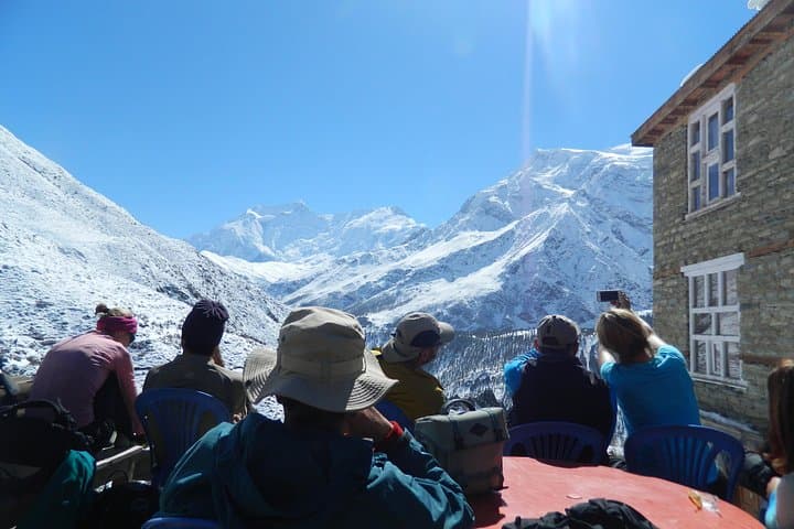
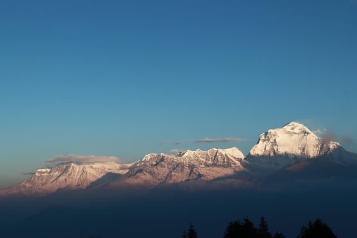
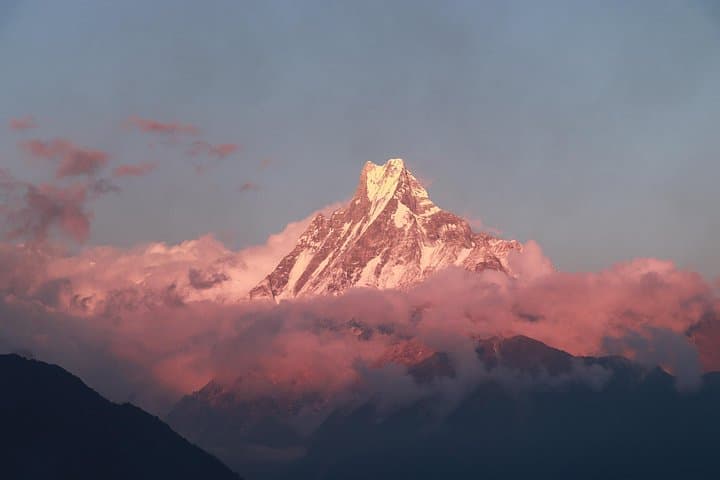
Plan for significant daily elevation changes—several days include 700–1,200 m gains—layered clothing, reliable boots, trek poles and a conservative ascent profile. Hydrate, sleep lower than you climb during acclimatization days, and follow your guide's weather-based decisions: the mountains demand respect but repay careful planning with open, panoramic views of the Annapurna massif.
Yes—ACAP (Annapurna Conservation Area Permit) and TIMS (Trekkers’ Information Management System) are required and typically checked at trailheads.
Thorong La reaches 5,416 m and is the trek’s hardest day; it requires early starts, steady pacing and good acclimatization rather than technical mountaineering skills.
Yes—this itinerary uses teahouse accommodations with basic rooms and shared bathrooms; bring a warm sleeping liner for cold nights.
Autumn (Sept–Nov) and spring (Mar–May) offer the most stable weather and best visibility; monsoon and deep winter present higher risks.
Accessible Adventure Pvt. Ltd operates guided outdoor trips and adventures with an emphasis on safety, stewardship, and memorable experiences.
A cold dawn on the trail, headlamp halos cutting through pine-scented air, sets the tone for the Annapurna Circuit. Hikers step from subtropical river valleys onto narrow ridgelines, cross suspension bridges that sway above the rushing Kali Gandaki, and watch fields of prayer flags appear like punctuation on the high passes.
A cold dawn on the trail, headlamp halos cutting through pine-scented air, sets the tone for the Annapurna Circuit. Hikers step from subtropical river valleys onto narrow ridgelines, cross suspension bridges that sway above the rushing Kali Gandaki, and watch fields of prayer flags appear like punctuation on the high passes.
The route threads centuries of human movement: Brahmin and Chhetri farmsteads give way to Gurung and Manangi communities that have long traded, farmed and supplied recruits to the Gurkha regiments. Geologically the trek travels from river-cut gorges—Kali Gandaki claims one of the world's deepest—into rain-shadowed, arid highlands shaped by glacial moraine and wind-polished scree. Culture and altitude collide at sites like Muktinath, a spiritual stop, and Tilicho Lake, a sapphire basin sitting near 4,900–5,000 m—one of the highest lakes hikers can visit on a trek.
Expect a mixture of terrain: forested switchbacks, rhododendron slopes, stone-paved village lanes and exposed high camps. Thorong La (5,416 m) is the technical and psychological apex; pre-dawn starts, steady pacing and clear weather windows are critical. The standard itinerary spans roughly 18 days with scheduled acclimatization (usually in Manang). Teahouse lodging and regulated permits (ACAP, TIMS) are standard; porters and guides are commonly hired to manage loads and altitude risk.
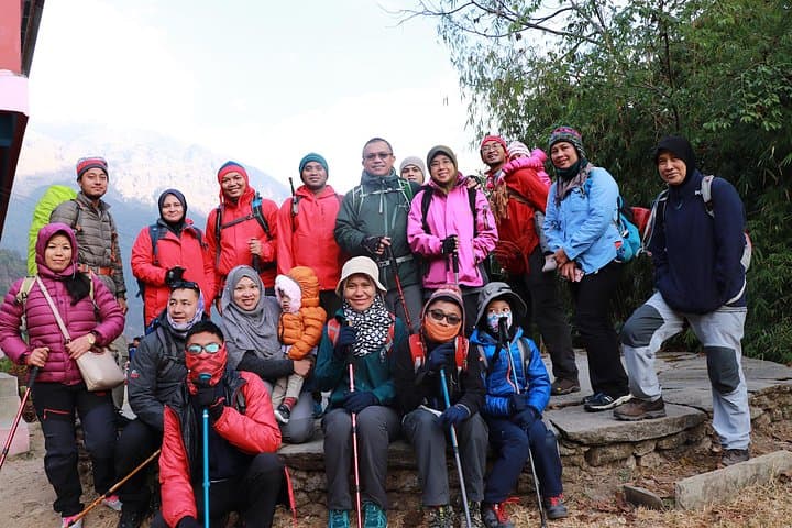
Plan for significant daily elevation changes—several days include 700–1,200 m gains—layered clothing, reliable boots, trek poles and a conservative ascent profile. Hydrate, sleep lower than you climb during acclimatization days, and follow your guide's weather-based decisions: the mountains demand respect but repay careful planning with open, panoramic views of the Annapurna massif.