THE ADVENTURE COLLECTIVE® · Independent discovery and booking for outdoor travel

A 16-day loop around the Annapurna massif that includes Tilicho Lake and the Thorong La pass—expect high alpine terrain, Buddhist villages, and dramatic views. This guide covers what you’ll see, the permits you’ll need, and how to prepare for the altitude and changing weather.
A 16-day loop around the Annapurna massif that includes Tilicho Lake and the Thorong La pass—expect high alpine terrain, Buddhist villages, and dramatic views. This guide covers what you’ll see, the permits you’ll need, and how to prepare for the altitude and changing weather.
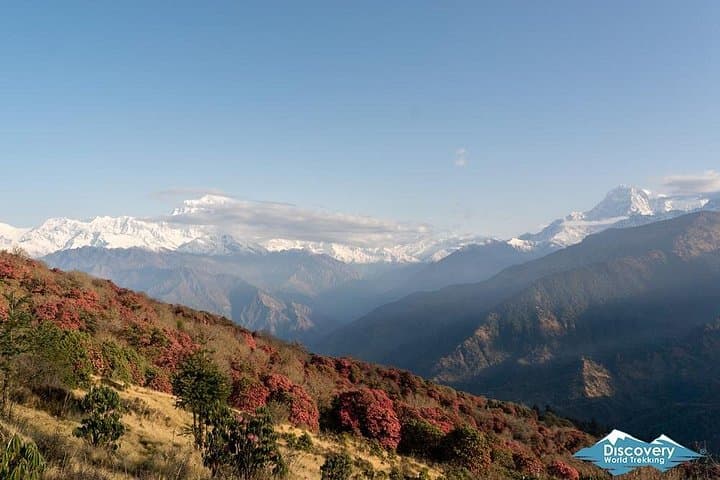
The day begins before dawn on a winding mountain road: a slow, rickety bus slides out of Kathmandu and climbs through terraced villages until the Himalaya appears—raw, vertical, unblinking. On trail, suspension bridges sway underfoot, the pine-scented air thins, and each ridge reveals a new face of Annapurna, from glittering cornices to bare rock walls.
Verified experiences and guided adventures in the surrounding area.
Operated by Discovery World Trekking · Manang, Gandaki Province
The day begins before dawn on a winding mountain road: a slow, rickety bus slides out of Kathmandu and climbs through terraced villages until the Himalaya appears—raw, vertical, unblinking. On trail, suspension bridges sway underfoot, the pine-scented air thins, and each ridge reveals a new face of Annapurna, from glittering cornices to bare rock walls.
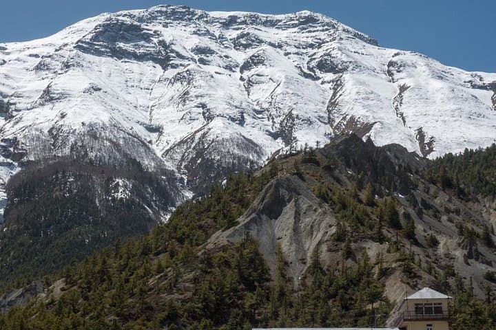
This 16-day loop circles the Annapurna massif and detours to Tilicho Lake, the world’s highest large lake. Geologically the route follows uplifted thrusts of the Greater Himalaya and cuts through the deep Kali Gandaki gorge; you’ll pass Paungda Danda’s 1,500m rock face and moraine-scarred slopes above Tilicho. Culturally the valley is a meeting point for Hindu pilgrimage at Muktinath and Tibetan Buddhist settlements in Manang and Khangsar—monasteries, mani walls and prayer flags are part of the trail’s fabric.
Practical realities: expect sustained alpine walking, a highest altitude of 5,416m at Thorong La, and a day-to-day rhythm of 4–8 hours trekking. Plan an acclimatization day in Manang, carry cash for remote lodges, and budget time for slow ascents—the Thorong La push typically starts around 03:00 to beat the wind. Permits required include an Annapurna Conservation Area Permit (ACAP) and a TIMS card. Footwear must be broken-in, layers essential for big diurnal swings, and treat altitude seriously—hydration, a conservative pace, and knowledge of AMS symptoms are non-negotiable.
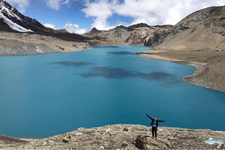
The route rewards patience: Tilicho’s glassy bowl at 4,920m, the hot springs at Tatopani, and sunrise from Poon Hill are earned views—spectacular, tactile, and uncompromising.
Yes—Annapurna Conservation Area Permit (ACAP) and a TIMS card are required; your operator typically arranges these.
Spring (Apr–May) and fall (Sept–Nov) offer the most stable weather and clear mountain views; monsoon and deep winter are less suitable.
Yes—local agencies provide guides and porters; hiring a guide is strongly recommended for navigation, acclimatization advice and logistics.
Early signs include headache, nausea, dizziness and poor sleep—descend immediately if symptoms worsen or breathing becomes difficult.
Discovery World Trekking operates guided outdoor trips and adventures with an emphasis on safety, stewardship, and memorable experiences.
The day begins before dawn on a winding mountain road: a slow, rickety bus slides out of Kathmandu and climbs through terraced villages until the Himalaya appears—raw, vertical, unblinking. On trail, suspension bridges sway underfoot, the pine-scented air thins, and each ridge reveals a new face of Annapurna, from glittering cornices to bare rock walls.
The day begins before dawn on a winding mountain road: a slow, rickety bus slides out of Kathmandu and climbs through terraced villages until the Himalaya appears—raw, vertical, unblinking. On trail, suspension bridges sway underfoot, the pine-scented air thins, and each ridge reveals a new face of Annapurna, from glittering cornices to bare rock walls.
This 16-day loop circles the Annapurna massif and detours to Tilicho Lake, the world’s highest large lake. Geologically the route follows uplifted thrusts of the Greater Himalaya and cuts through the deep Kali Gandaki gorge; you’ll pass Paungda Danda’s 1,500m rock face and moraine-scarred slopes above Tilicho. Culturally the valley is a meeting point for Hindu pilgrimage at Muktinath and Tibetan Buddhist settlements in Manang and Khangsar—monasteries, mani walls and prayer flags are part of the trail’s fabric.
Practical realities: expect sustained alpine walking, a highest altitude of 5,416m at Thorong La, and a day-to-day rhythm of 4–8 hours trekking. Plan an acclimatization day in Manang, carry cash for remote lodges, and budget time for slow ascents—the Thorong La push typically starts around 03:00 to beat the wind. Permits required include an Annapurna Conservation Area Permit (ACAP) and a TIMS card. Footwear must be broken-in, layers essential for big diurnal swings, and treat altitude seriously—hydration, a conservative pace, and knowledge of AMS symptoms are non-negotiable.
The route rewards patience: Tilicho’s glassy bowl at 4,920m, the hot springs at Tatopani, and sunrise from Poon Hill are earned views—spectacular, tactile, and uncompromising.