THE ADVENTURE COLLECTIVE® · Independent discovery and booking for outdoor travel

Leave Marrakech behind for a day in the High Atlas: gentle village hikes, mountain air, and a home-cooked Berber lunch framed by Mount Toubkal. Expect stone paths, terraced fields, and an authentic cultural exchange guided by local hosts.
Leave Marrakech behind for a day in the High Atlas: gentle village hikes, mountain air, and a home-cooked Berber lunch framed by Mount Toubkal. Expect stone paths, terraced fields, and an authentic cultural exchange guided by local hosts.
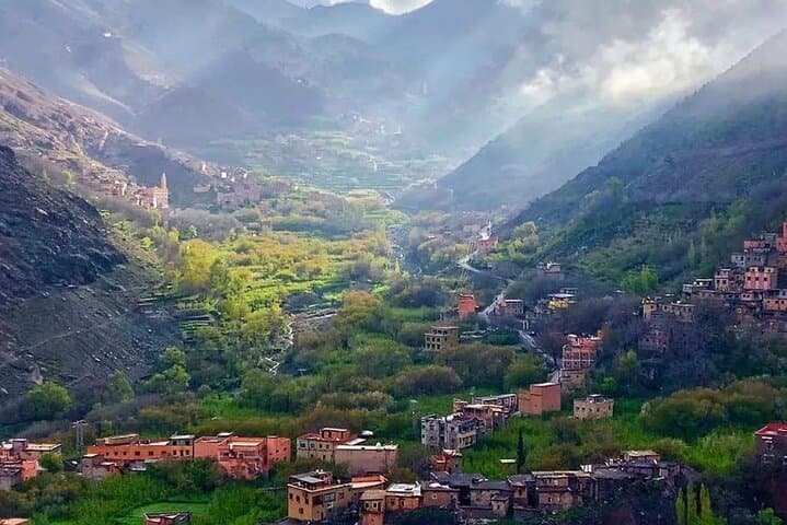
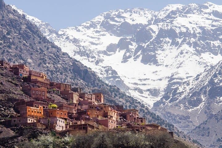
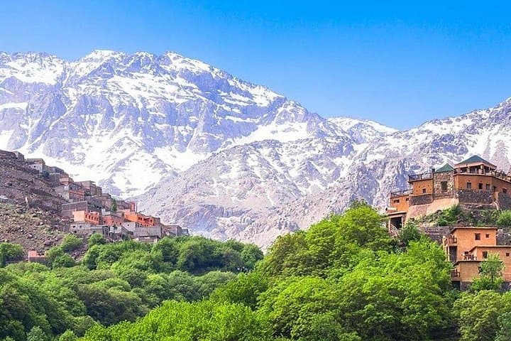
A low-slung minivan leaves Marrakech before the road tightens and the city’s heat gives way to olive groves and stone-built villages. By the time travelers reach Imlil, the air feels cleaner and Mount Toubkal looms, a snow-capped neighbor that seems to watch over the valley.
Verified experiences and guided adventures in the surrounding area.
Operated by View of Marrakech · Imlil, Marrakech-Safi
A low-slung minivan leaves Marrakech before the road tightens and the city’s heat gives way to olive groves and stone-built villages. By the time travelers reach Imlil, the air feels cleaner and Mount Toubkal looms, a snow-capped neighbor that seems to watch over the valley.
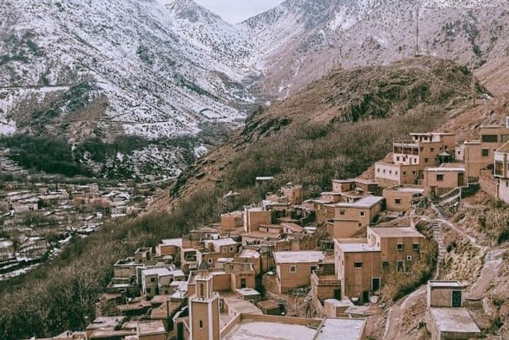
The High Atlas is folded rock—gneiss and mica-schist—carved by streams into stepped terraces where Amazigh (Berber) families have farmed for centuries. Imlil itself sits at roughly 1,700–1,800 meters and serves as a living cultural waypoint: mule tracks, flat-roofed houses, and kitchens where argan and preserved lemons flavor the day. Local guides translate both language and custom, inviting visitors into homes for mint tea and a lunch cooked on a wood-fired stove.
On the trail expect 4–8 km of walking on uneven stone paths and dirt tracks, with 200–600 m of cumulative elevation gain depending on route—gentle by mountain standards but demanding on loose sections. Waterfalls and terraced fields mark the way; streams sometimes dare you to pick your footing. Photography and short cultural stops are the rhythm, not a forced pace.
Practical notes: wear broken-in hiking shoes, carry 1–2 liters of water, and layer for sun-to-snow swings. Aim for spring or autumn for stable weather and wildflowers; winter brings snow and requires sturdy boots. Respect private homes when visiting for lunch, tip guides locally, and stay on established paths to protect fragile terraces. This day trip is a compact, authentic window into Atlas mountain life—part nature, part cultural exchange, wholly grounded in local pace and hospitality.
The drive takes roughly 1–1.5 hours each way depending on traffic and the exact pickup point in Marrakech.
The route is family-friendly in short segments, but participants should be comfortable on uneven ground; tell the operator if mobility is limited.
Yes—on clear days you’ll have sustained views of Mount Toubkal (4,167 m) from multiple vantage points in the valley.
A traditional lunch and mint tea are included; inform the operator of dietary restrictions when booking to allow local hosts to prepare accordingly.
View of Marrakech operates guided outdoor trips and adventures with an emphasis on safety, stewardship, and memorable experiences.
A low-slung minivan leaves Marrakech before the road tightens and the city’s heat gives way to olive groves and stone-built villages. By the time travelers reach Imlil, the air feels cleaner and Mount Toubkal looms, a snow-capped neighbor that seems to watch over the valley.
A low-slung minivan leaves Marrakech before the road tightens and the city’s heat gives way to olive groves and stone-built villages. By the time travelers reach Imlil, the air feels cleaner and Mount Toubkal looms, a snow-capped neighbor that seems to watch over the valley.
The High Atlas is folded rock—gneiss and mica-schist—carved by streams into stepped terraces where Amazigh (Berber) families have farmed for centuries. Imlil itself sits at roughly 1,700–1,800 meters and serves as a living cultural waypoint: mule tracks, flat-roofed houses, and kitchens where argan and preserved lemons flavor the day. Local guides translate both language and custom, inviting visitors into homes for mint tea and a lunch cooked on a wood-fired stove.
On the trail expect 4–8 km of walking on uneven stone paths and dirt tracks, with 200–600 m of cumulative elevation gain depending on route—gentle by mountain standards but demanding on loose sections. Waterfalls and terraced fields mark the way; streams sometimes dare you to pick your footing. Photography and short cultural stops are the rhythm, not a forced pace.
Practical notes: wear broken-in hiking shoes, carry 1–2 liters of water, and layer for sun-to-snow swings. Aim for spring or autumn for stable weather and wildflowers; winter brings snow and requires sturdy boots. Respect private homes when visiting for lunch, tip guides locally, and stay on established paths to protect fragile terraces. This day trip is a compact, authentic window into Atlas mountain life—part nature, part cultural exchange, wholly grounded in local pace and hospitality.