THE ADVENTURE COLLECTIVE® · Independent discovery and booking for outdoor travel

Board a short ferry from Auckland to Rangitoto and trade the city skyline for volcanic rock, native bush and a one‑hour summit walk. This accessible day trip pairs dramatic geology with panoramic Hauraki Gulf views—just remember there are no shops on the island.
Board a short ferry from Auckland to Rangitoto and trade the city skyline for volcanic rock, native bush and a one‑hour summit walk. This accessible day trip pairs dramatic geology with panoramic Hauraki Gulf views—just remember there are no shops on the island.
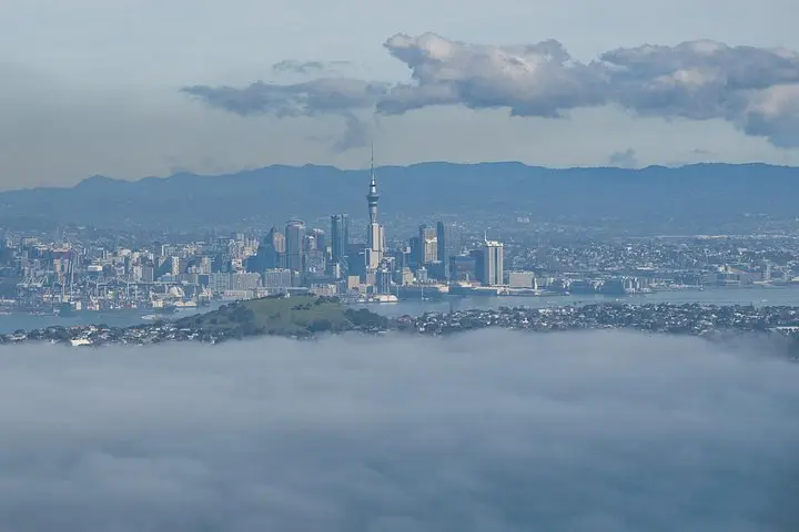
You leave Auckland's downtown ferry terminal with the city shrinking behind you and Rangitoto's clean cone rising on the horizon, a 260‑metre volcanic silhouette against the Hauraki Gulf. The ferry cuts through salt spray and working boats; gulls wheel overhead as the island's twin textures—black lava and green native bush—come into focus.
Verified experiences and guided adventures in the surrounding area.
Operated by Fullers360 · Auckland, Auckland Region
You leave Auckland's downtown ferry terminal with the city shrinking behind you and Rangitoto's clean cone rising on the horizon, a 260‑metre volcanic silhouette against the Hauraki Gulf. The ferry cuts through salt spray and working boats; gulls wheel overhead as the island's twin textures—black lava and green native bush—come into focus.
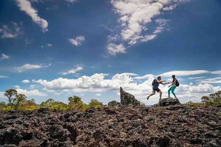
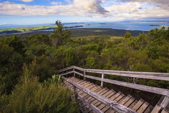
Rangitoto is one of Auckland's youngest volcanoes, erupting roughly 600 years ago, its fresh lava flows creating the island's sharp ridgelines and underground lava tubes. Māori and local iwi maintain deep cultural ties to the island; traces of occupation and traditional place names thread through the landscape. Geologically, the island is a scoria cone grown from multiple flows, the summit lookout offering panoramic views across the Gulf to Auckland, Waiheke and the outer islands.
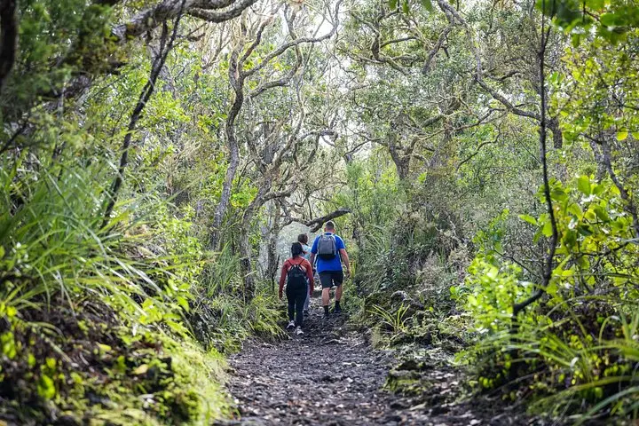
On arrival, walkers can choose a direct boardwalked route to the summit (about an hour at an easy pace) or linger along sheltered bays and explore short lava caves near the northern shore. Expect uneven volcanic rock, short stair sections, and open ridgelines that expose you to sun and wind. There are no shops on Rangitoto—pack water, snacks and sun protection—and keep an eye on the ferry timetable so you don't miss the return crossing.
Practical: wear sturdy footwear with decent grip, carry at least 1–2 litres of water, and allocate 3–4 hours for the round trip including exploration. Check weather and ferry schedules before boarding; on windy days the crossing is choppy and the summit quicker but colder. Stay on marked tracks to protect fragile vegetation and preserve the island for future visitors.
The crossing takes about 25–30 minutes each way depending on the vessel and sea conditions.
No—the main summit trail is graded and takes roughly an hour at a steady pace; some short stair sections and uneven volcanic rock are present.
There are no shops on the island; basic toilet facilities exist near the main landing but bring food and water with you.
Yes—small lava tube caves are accessible near some shorelines; exercise caution, use a torch, and avoid entering unstable or fenced areas.
Fullers360 operates guided outdoor trips and adventures with an emphasis on safety, stewardship, and memorable experiences.
You leave Auckland's downtown ferry terminal with the city shrinking behind you and Rangitoto's clean cone rising on the horizon, a 260‑metre volcanic silhouette against the Hauraki Gulf. The ferry cuts through salt spray and working boats; gulls wheel overhead as the island's twin textures—black lava and green native bush—come into focus.
You leave Auckland's downtown ferry terminal with the city shrinking behind you and Rangitoto's clean cone rising on the horizon, a 260‑metre volcanic silhouette against the Hauraki Gulf. The ferry cuts through salt spray and working boats; gulls wheel overhead as the island's twin textures—black lava and green native bush—come into focus.
Rangitoto is one of Auckland's youngest volcanoes, erupting roughly 600 years ago, its fresh lava flows creating the island's sharp ridgelines and underground lava tubes. Māori and local iwi maintain deep cultural ties to the island; traces of occupation and traditional place names thread through the landscape. Geologically, the island is a scoria cone grown from multiple flows, the summit lookout offering panoramic views across the Gulf to Auckland, Waiheke and the outer islands.
On arrival, walkers can choose a direct boardwalked route to the summit (about an hour at an easy pace) or linger along sheltered bays and explore short lava caves near the northern shore. Expect uneven volcanic rock, short stair sections, and open ridgelines that expose you to sun and wind. There are no shops on Rangitoto—pack water, snacks and sun protection—and keep an eye on the ferry timetable so you don't miss the return crossing.
Practical: wear sturdy footwear with decent grip, carry at least 1–2 litres of water, and allocate 3–4 hours for the round trip including exploration. Check weather and ferry schedules before boarding; on windy days the crossing is choppy and the summit quicker but colder. Stay on marked tracks to protect fragile vegetation and preserve the island for future visitors.