THE ADVENTURE COLLECTIVE® · Independent discovery and booking for outdoor travel

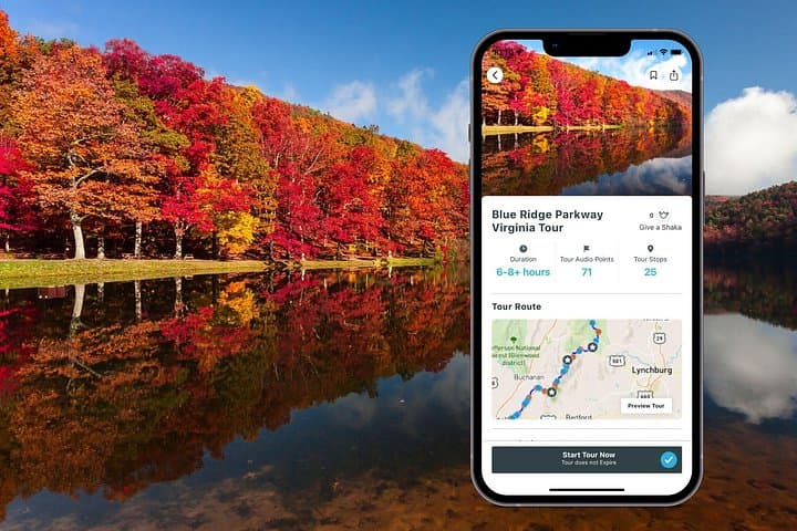
Drive a flexible day-long route through Virginia’s northern Blue Ridge. This GPS-activated audio tour guides you to overlooks, visitor centers, short hikes, and lakes—letting you choose how long to linger at each stop.
Drive a flexible day-long route through Virginia’s northern Blue Ridge. This GPS-activated audio tour guides you to overlooks, visitor centers, short hikes, and lakes—letting you choose how long to linger at each stop.
You pull off the two-lane highway into a parking pullout and the mountains open like a folded map: ridgelines sweep west, a single pine stakes its claim against the skyline, and the road hums under your tires. This self-guided audio tour escorts drivers along the northernmost Virginia stretch of the Blue Ridge Parkway, letting you stop at overlooks, visitor centers, and short hikes on your own schedule.
Verified experiences and guided adventures in the surrounding area.
Operated by Shaka Guide Apps · Roanoke, Virginia
You pull off the two-lane highway into a parking pullout and the mountains open like a folded map: ridgelines sweep west, a single pine stakes its claim against the skyline, and the road hums under your tires. This self-guided audio tour escorts drivers along the northernmost Virginia stretch of the Blue Ridge Parkway, letting you stop at overlooks, visitor centers, and short hikes on your own schedule.
Geology here is readable—ancient metamorphic rocks tilted and scoured by millennia form the undulating crest of the Blue Ridge; valleys like the Great Valley trace old migration routes and colonial corridors. Culturally, the parkway is stitched to Appalachian life: farmsteads, Scotch-Irish place names, and restored settler demonstrations at living-history sites that explain how people adapted to these slopes.
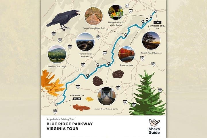
Expect a mix of easy, interpretive stops (visitor centers with exhibits and ranger desks), short but steep footpaths (Apple Orchard Falls and Humpback Rocks), and panoramic overlooks such as Thunder Ridge and Afton Overlook for sunset photography. Peaks of Otter offers a paved, accessible loop and a lodge with food; Sherando Lake is the go-to if you want water-based downtime.
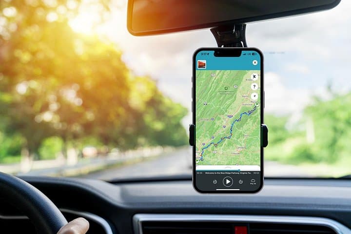
Practical guidance: download the Shaka Guide tour in advance and load it offline; the app triggers narration via GPS so keep a phone mount handy and battery charged. Plan 8–9 hours to follow the suggested route, allow extra time for hikes, and bring layers—the ridge-to-valley elevation change creates quick temperature swings. Respect seasonal closures, carry water for hikes, and leave no trace at overlooks and fragile rock outcrops.
The suggested route is roughly 8–9 hours; you can complete highlights in one long day but plan extra time if you want to hike or linger at overlooks.
No—redeem and download the tour on Wi‑Fi before you go; the app and offline GPS narration work without cellular data.
Most visitor centers operate seasonally or with reduced hours in winter; check National Park Service hours and local closures before traveling.
Parts of the Parkway have tight curves and narrow pullouts—oversized vehicles should consult Parkway regulations and may need to plan alternate routes or shorter segments.
Shaka Guide Apps operates guided outdoor trips and adventures with an emphasis on safety, stewardship, and memorable experiences.

You pull off the two-lane highway into a parking pullout and the mountains open like a folded map: ridgelines sweep west, a single pine stakes its claim against the skyline, and the road hums under your tires. This self-guided audio tour escorts drivers along the northernmost Virginia stretch of the Blue Ridge Parkway, letting you stop at overlooks, visitor centers, and short hikes on your own schedule.
You pull off the two-lane highway into a parking pullout and the mountains open like a folded map: ridgelines sweep west, a single pine stakes its claim against the skyline, and the road hums under your tires. This self-guided audio tour escorts drivers along the northernmost Virginia stretch of the Blue Ridge Parkway, letting you stop at overlooks, visitor centers, and short hikes on your own schedule.
Geology here is readable—ancient metamorphic rocks tilted and scoured by millennia form the undulating crest of the Blue Ridge; valleys like the Great Valley trace old migration routes and colonial corridors. Culturally, the parkway is stitched to Appalachian life: farmsteads, Scotch-Irish place names, and restored settler demonstrations at living-history sites that explain how people adapted to these slopes.
Expect a mix of easy, interpretive stops (visitor centers with exhibits and ranger desks), short but steep footpaths (Apple Orchard Falls and Humpback Rocks), and panoramic overlooks such as Thunder Ridge and Afton Overlook for sunset photography. Peaks of Otter offers a paved, accessible loop and a lodge with food; Sherando Lake is the go-to if you want water-based downtime.
Practical guidance: download the Shaka Guide tour in advance and load it offline; the app triggers narration via GPS so keep a phone mount handy and battery charged. Plan 8–9 hours to follow the suggested route, allow extra time for hikes, and bring layers—the ridge-to-valley elevation change creates quick temperature swings. Respect seasonal closures, carry water for hikes, and leave no trace at overlooks and fragile rock outcrops.