THE ADVENTURE COLLECTIVE® · Independent discovery and booking for outdoor travel

Follow a painted red line through 2.5 miles of American history with a self-guided audio tour that puts colonial Boston in context. Go at your own pace, skip crowded stops, and use offline maps to keep the route rolling.
Follow a painted red line through 2.5 miles of American history with a self-guided audio tour that puts colonial Boston in context. Go at your own pace, skip crowded stops, and use offline maps to keep the route rolling.
Morning light slices between brick facades and colonial steeples as you step onto the red-brick line that stitches Boston’s oldest public spaces together. Footsteps mix with the faint hiss of commuter buses; seagulls argue over crumbs near the harbor; the trail’s painted markers lead you from the open lawn of Boston Common to the granite rise of Bunker Hill.
Verified experiences and guided adventures in the surrounding area.
Operated by Shaka Guide Apps · Boston, MA
Morning light slices between brick facades and colonial steeples as you step onto the red-brick line that stitches Boston’s oldest public spaces together. Footsteps mix with the faint hiss of commuter buses; seagulls argue over crumbs near the harbor; the trail’s painted markers lead you from the open lawn of Boston Common to the granite rise of Bunker Hill.
The Freedom Trail traces roughly 2.5 miles of Revolutionary-era sites: meeting houses, burial grounds, the Old State House and Paul Revere’s modest workshop. The city’s bedrock—glacially scoured granite—forms the wharves and the low hills you’ll pass, while layers of immigration and industry have left Italian bakeries, maritime monuments, and Federal-era architecture along the route.
Culturally, the trail moves through the civic heart: promenades where orators once rallied, marketplaces now filled with food stalls, and narrow North End lanes where old-world families run corner shops. Expect uneven cobbles, subway crossings, and pockets of shade beneath elms and plane trees.
Practical guidance: download the audio and offline map before you arrive, plan 2–4 hours for a focused walk or split the route over two shorter days, and check individual site hours if you want to enter museums. Comfortable, supportive shoes and a light rain layer make the difference on unpredictable New England days. Bring a refillable bottle—water fountains are available near major parks—and allow time to sit on a bench at Paul Revere Mall to let the city’s past settle in around you.
The official Freedom Trail covers about 2.5 miles; walking the core sites without extended museum visits typically takes 2–4 hours.
No—this is self-guided audio signage; you control the pace and can pause or resume across multiple days.
Many outdoor sites and portions of the route are wheelchair accessible, though some historic buildings have limited accessibility; check specific sites for details.
Yes—download the Shaka Guide tour and offline map over Wi‑Fi before you go and GPS-triggered narration will work without data.
Shaka Guide Apps operates guided outdoor trips and adventures with an emphasis on safety, stewardship, and memorable experiences.

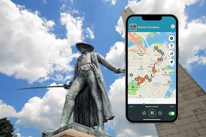
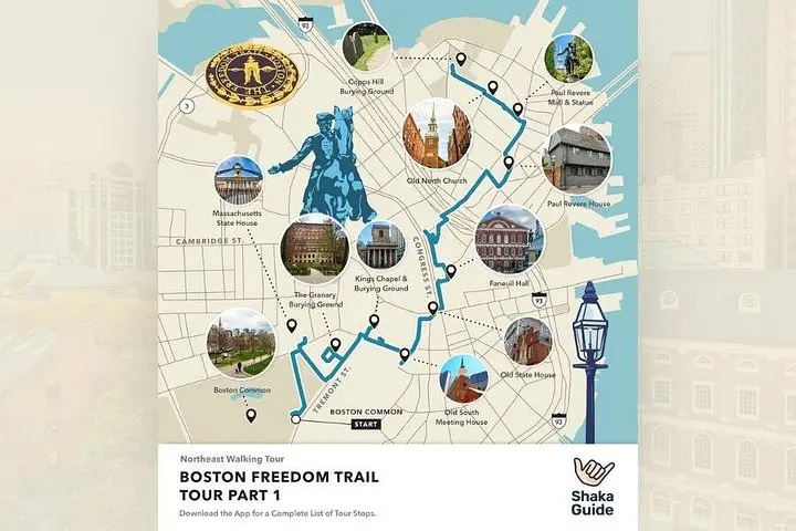
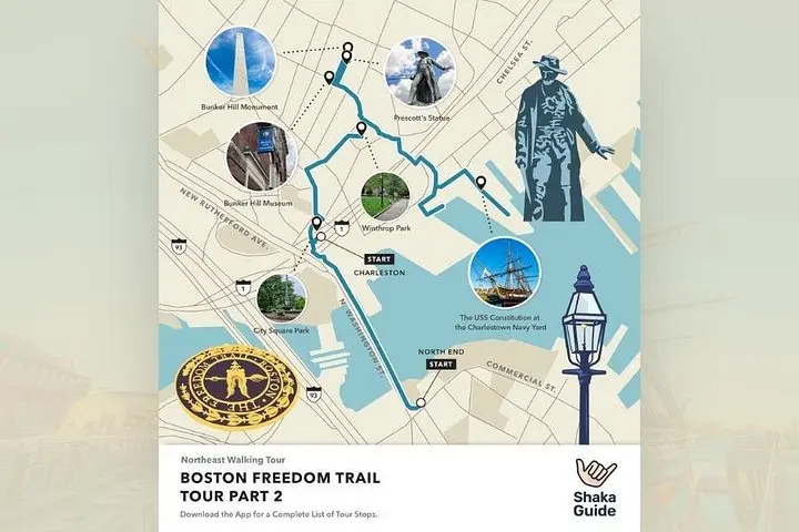
Morning light slices between brick facades and colonial steeples as you step onto the red-brick line that stitches Boston’s oldest public spaces together. Footsteps mix with the faint hiss of commuter buses; seagulls argue over crumbs near the harbor; the trail’s painted markers lead you from the open lawn of Boston Common to the granite rise of Bunker Hill.
Morning light slices between brick facades and colonial steeples as you step onto the red-brick line that stitches Boston’s oldest public spaces together. Footsteps mix with the faint hiss of commuter buses; seagulls argue over crumbs near the harbor; the trail’s painted markers lead you from the open lawn of Boston Common to the granite rise of Bunker Hill.
The Freedom Trail traces roughly 2.5 miles of Revolutionary-era sites: meeting houses, burial grounds, the Old State House and Paul Revere’s modest workshop. The city’s bedrock—glacially scoured granite—forms the wharves and the low hills you’ll pass, while layers of immigration and industry have left Italian bakeries, maritime monuments, and Federal-era architecture along the route.
Culturally, the trail moves through the civic heart: promenades where orators once rallied, marketplaces now filled with food stalls, and narrow North End lanes where old-world families run corner shops. Expect uneven cobbles, subway crossings, and pockets of shade beneath elms and plane trees.
Practical guidance: download the audio and offline map before you arrive, plan 2–4 hours for a focused walk or split the route over two shorter days, and check individual site hours if you want to enter museums. Comfortable, supportive shoes and a light rain layer make the difference on unpredictable New England days. Bring a refillable bottle—water fountains are available near major parks—and allow time to sit on a bench at Paul Revere Mall to let the city’s past settle in around you.