THE ADVENTURE COLLECTIVE® · Independent discovery and booking for outdoor travel

This four-day guided loop from Salta stitches together the sculpted canyons of Quebrada de las Conchas, Cafayate’s vineyards, the blinding expanse of Salinas Grandes and the striated summit of Hornocal. Expect long travel days, high-altitude viewpoints and vivid geological scenery.
This four-day guided loop from Salta stitches together the sculpted canyons of Quebrada de las Conchas, Cafayate’s vineyards, the blinding expanse of Salinas Grandes and the striated summit of Hornocal. Expect long travel days, high-altitude viewpoints and vivid geological scenery.
You step out of a small bus as the morning light chisels the red folds of Quebrada de las Conchas. Wind scours the canyon walls and the road—Provincial Route 68—unspools toward vineyards and serrated hoodoos. Over four days from Salta, this guided circuit threads high-altitude salt flats, colonial cobblestones and a palette of mountains whose stripes look almost improvised.
Verified experiences and guided adventures in the surrounding area.
Operated by AGENCIA DE TURISMO TIAMAR EVT · Salta, Salta Province
You step out of a small bus as the morning light chisels the red folds of Quebrada de las Conchas. Wind scours the canyon walls and the road—Provincial Route 68—unspools toward vineyards and serrated hoodoos. Over four days from Salta, this guided circuit threads high-altitude salt flats, colonial cobblestones and a palette of mountains whose stripes look almost improvised.
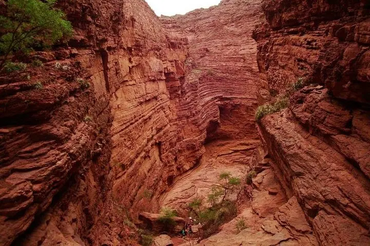
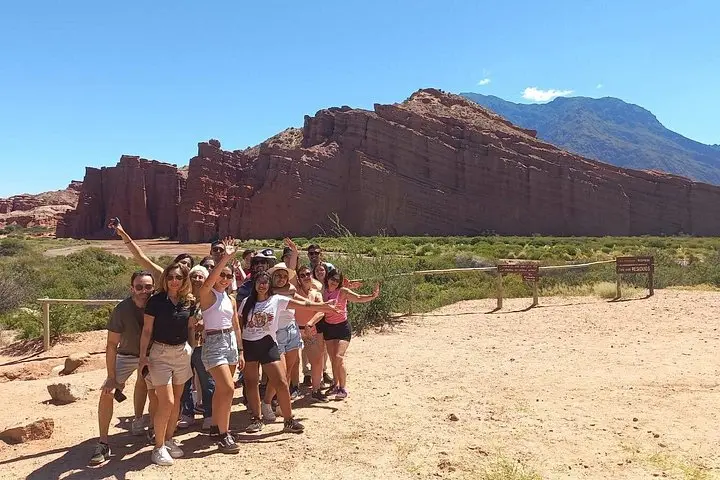
The route is as much geological classroom as scenic highway. Quebrada de las Conchas is roughly 90 km of sculpted sedimentary rock—sands and clays lifted and tilted by Andean uplift—where narrow gorges and isolated spires invite short walks and sharp photos. Cafayate sits lower at about 1,660 m, its terraces and Calchaquí vineyards benefitting from sun-drenched days and drastic diurnal temperature swings. Cachi rises higher and quieter; its colonial church and town plaza are reminders of Spanish settlement layered atop indigenous Calchaquí history.
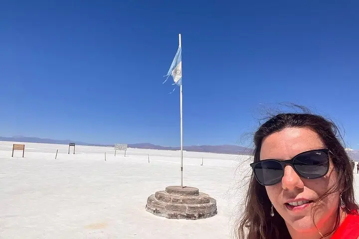
Day three confronts the salar: Salinas Grandes, a blinding white sheet cut with shallow pools and community-run viewpoints. The tour continues over Cuesta de Lipán, climbing to 4,720 m at the pass—bring time to acclimatize; altitude is an active player here. Hornocal, the Cerro de 14 Colores, reads like a geological ledger—limestone and shale in angled strata that flash ochre, rose and green when the sun sashays across them.
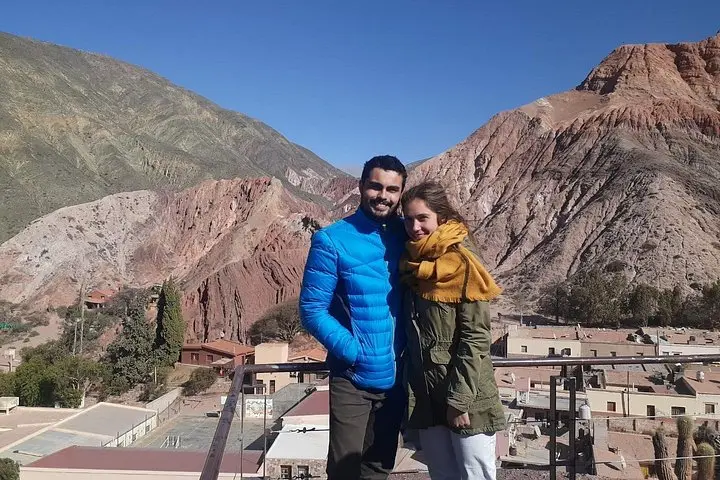
Culture moves in slow, human rhythms: local artisans in Purmamarca sell hand-dyed ponchos, cooperatives manage small entrance fees at the salt flats, and wineries near Cafayate still press Torrontés with old-world sensibility. Guides usually include these local interactions and a brief history of pre-Colombian and colonial layers that shaped the valley towns.
Practicalities matter: expect long travel days—12 to 14 hours on several days—mostly paved roads with occasional gravel stretches; walking time is light to moderate (short hikes and viewpoint strolls). Altitude gain from Salta (≈1,200 m) to Cuesta de Lipán (4,720 m) is the biggest physical factor. Hydration, sun protection and layered clothing are essential. Comfortable walking shoes, snacks, and a small daypack will keep you moving between van stops and short explorations.
For photographers, brutal contrasts reward careful exposures: early morning on the salt, mid-afternoon ridgelines at Hornocal, and golden-hour light on Quebrada de las Conchas. Expect variable temperatures—hot lowlands, sharp chill above 3,500 m—so plan clothing and pacing.
This is a route for travelers who want wild landscapes without roughing it—air-conditioned transport and experienced guides do the logistics, but the terrain and altitude insist you come prepared. The payoff is immediate: geological theater, quiet mountain towns and salt that seems to glare back at you with the sun.
Most days combine 3–6 hours of driving with multiple stops; full days typically total 12–14 hours from pickup to return.
Yes—Cuesta de Lipán reaches about 4,720 m. Take time to acclimatize, hydrate, and inform the guide of any symptoms.
Lunch is usually free time in towns (Cafayate, Cachi, Purmamarca) so plan for local restaurant meals; guides sometimes suggest where to eat.
Carry small bills for community contributions at Salinas Grandes, souvenirs and remote purchases where cards may not work.
Basic facilities exist at towns and major viewpoint stops; bring hand sanitizer and toilet paper for remote stops.
Not recommended for travelers with spinal problems or severe mobility limits; infants can travel but check with operator about child seats.
AGENCIA DE TURISMO TIAMAR EVT operates guided outdoor trips and adventures with an emphasis on safety, stewardship, and memorable experiences.
You step out of a small bus as the morning light chisels the red folds of Quebrada de las Conchas. Wind scours the canyon walls and the road—Provincial Route 68—unspools toward vineyards and serrated hoodoos. Over four days from Salta, this guided circuit threads high-altitude salt flats, colonial cobblestones and a palette of mountains whose stripes look almost improvised.
You step out of a small bus as the morning light chisels the red folds of Quebrada de las Conchas. Wind scours the canyon walls and the road—Provincial Route 68—unspools toward vineyards and serrated hoodoos. Over four days from Salta, this guided circuit threads high-altitude salt flats, colonial cobblestones and a palette of mountains whose stripes look almost improvised.
The route is as much geological classroom as scenic highway. Quebrada de las Conchas is roughly 90 km of sculpted sedimentary rock—sands and clays lifted and tilted by Andean uplift—where narrow gorges and isolated spires invite short walks and sharp photos. Cafayate sits lower at about 1,660 m, its terraces and Calchaquí vineyards benefitting from sun-drenched days and drastic diurnal temperature swings. Cachi rises higher and quieter; its colonial church and town plaza are reminders of Spanish settlement layered atop indigenous Calchaquí history.
Day three confronts the salar: Salinas Grandes, a blinding white sheet cut with shallow pools and community-run viewpoints. The tour continues over Cuesta de Lipán, climbing to 4,720 m at the pass—bring time to acclimatize; altitude is an active player here. Hornocal, the Cerro de 14 Colores, reads like a geological ledger—limestone and shale in angled strata that flash ochre, rose and green when the sun sashays across them.
Culture moves in slow, human rhythms: local artisans in Purmamarca sell hand-dyed ponchos, cooperatives manage small entrance fees at the salt flats, and wineries near Cafayate still press Torrontés with old-world sensibility. Guides usually include these local interactions and a brief history of pre-Colombian and colonial layers that shaped the valley towns.
Practicalities matter: expect long travel days—12 to 14 hours on several days—mostly paved roads with occasional gravel stretches; walking time is light to moderate (short hikes and viewpoint strolls). Altitude gain from Salta (≈1,200 m) to Cuesta de Lipán (4,720 m) is the biggest physical factor. Hydration, sun protection and layered clothing are essential. Comfortable walking shoes, snacks, and a small daypack will keep you moving between van stops and short explorations.
For photographers, brutal contrasts reward careful exposures: early morning on the salt, mid-afternoon ridgelines at Hornocal, and golden-hour light on Quebrada de las Conchas. Expect variable temperatures—hot lowlands, sharp chill above 3,500 m—so plan clothing and pacing.
This is a route for travelers who want wild landscapes without roughing it—air-conditioned transport and experienced guides do the logistics, but the terrain and altitude insist you come prepared. The payoff is immediate: geological theater, quiet mountain towns and salt that seems to glare back at you with the sun.