THE ADVENTURE COLLECTIVE® · Independent discovery and booking for outdoor travel

Turn Canal Street into a live puzzle: this app-led scavenger hunt on foot prompts photo challenges, local trivia, and short puzzles as you explore New Orleans’ cultural corridor. Perfect for groups, teams, or solo city explorers seeking a structured urban adventure.
Turn Canal Street into a live puzzle: this app-led scavenger hunt on foot prompts photo challenges, local trivia, and short puzzles as you explore New Orleans’ cultural corridor. Perfect for groups, teams, or solo city explorers seeking a structured urban adventure.
The map loads and the streetcar bell cuts through humid morning air as you step onto Canal Street. Traffic hums, brass notes drift from a nearby corner, and the pavement beckons with plaques, statues, and architectural details that hide the clues you need. This app-led scavenger hunt turns Canal Street into a series of short missions: read a marker, snap a photo, solve a riddle, score points.
Verified experiences and guided adventures in the surrounding area.
Operated by Let's Roam · New Orleans, Louisiana
The map loads and the streetcar bell cuts through humid morning air as you step onto Canal Street. Traffic hums, brass notes drift from a nearby corner, and the pavement beckons with plaques, statues, and architectural details that hide the clues you need. This app-led scavenger hunt turns Canal Street into a series of short missions: read a marker, snap a photo, solve a riddle, score points.
Canal Street itself has long been a city divider — historically the boundary between the French Quarter and the commercial district — its broad avenue born from 19th-century planning and kept level by river-engineered levees. Beneath the asphalt, soft delta soils and levee work tell the geologic story of the Mississippi, whose current shaped the city’s layout and commerce. Culturally, the route is a crossroads of Creole, African American, and commercial histories; expect murals, memorials, and the occasional brass band busking for passersby.
Practicalities matter: download the hunt app beforehand, redeem your digital ticket, and charge your phone. The typical run takes 1.5–2 hours on foot along mostly flat, paved streets with frequent stops. Public transit and streetcars put you close to start points; stroller- and wheelchair-accessible sections are available but check specifics in-app. Bring water, comfortable shoes, and a small battery pack; plan around festivals and parade routes that can swell crowds. Play competitively or casually — the format fits bachelorettes, small teams, or anyone who wants a lively, self-guided way to read the city one clue at a time.
No—this is a self-guided, app-led experience you can begin at any time during the day within local hours.
Portions of Canal Street are wheelchair and stroller accessible, but accessibility may vary by exact route—check in-app details before you go.
The format supports small teams; ticketing is typically one booking per group—confirm participant limits at checkout.
Most challenges are GPS-based; intermittent signal may affect location prompts—download any offline content and keep a local map handy if possible.
Let's Roam operates guided outdoor trips and adventures with an emphasis on safety, stewardship, and memorable experiences.
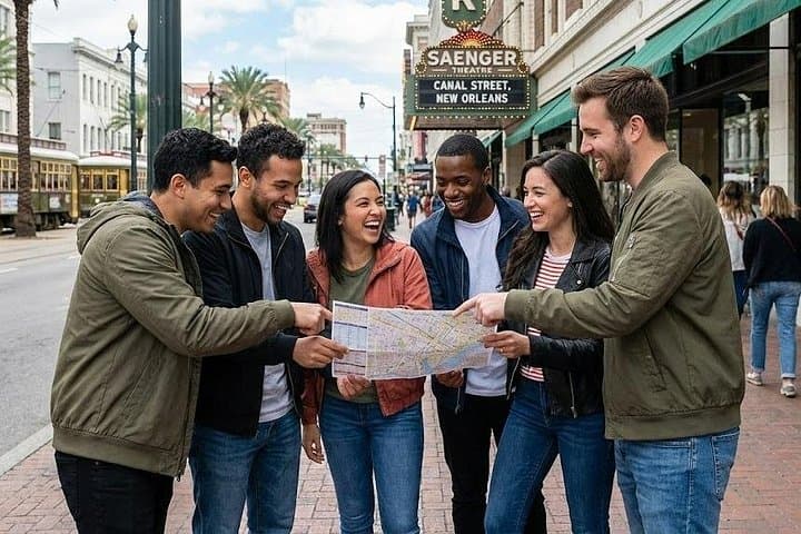


The map loads and the streetcar bell cuts through humid morning air as you step onto Canal Street. Traffic hums, brass notes drift from a nearby corner, and the pavement beckons with plaques, statues, and architectural details that hide the clues you need. This app-led scavenger hunt turns Canal Street into a series of short missions: read a marker, snap a photo, solve a riddle, score points.
The map loads and the streetcar bell cuts through humid morning air as you step onto Canal Street. Traffic hums, brass notes drift from a nearby corner, and the pavement beckons with plaques, statues, and architectural details that hide the clues you need. This app-led scavenger hunt turns Canal Street into a series of short missions: read a marker, snap a photo, solve a riddle, score points.
Canal Street itself has long been a city divider — historically the boundary between the French Quarter and the commercial district — its broad avenue born from 19th-century planning and kept level by river-engineered levees. Beneath the asphalt, soft delta soils and levee work tell the geologic story of the Mississippi, whose current shaped the city’s layout and commerce. Culturally, the route is a crossroads of Creole, African American, and commercial histories; expect murals, memorials, and the occasional brass band busking for passersby.
Practicalities matter: download the hunt app beforehand, redeem your digital ticket, and charge your phone. The typical run takes 1.5–2 hours on foot along mostly flat, paved streets with frequent stops. Public transit and streetcars put you close to start points; stroller- and wheelchair-accessible sections are available but check specifics in-app. Bring water, comfortable shoes, and a small battery pack; plan around festivals and parade routes that can swell crowds. Play competitively or casually — the format fits bachelorettes, small teams, or anyone who wants a lively, self-guided way to read the city one clue at a time.