THE ADVENTURE COLLECTIVE® · Independent discovery and booking for outdoor travel

Rise above Canyonlands and watch mesas, braided rivers and hidden arches reveal themselves from a high-wing airplane. This hour-long flight out of the field north of Moab condenses geology, history and photographic chance into a single, memorable loop.
Rise above Canyonlands and watch mesas, braided rivers and hidden arches reveal themselves from a high-wing airplane. This hour-long flight out of the field north of Moab condenses geology, history and photographic chance into a single, memorable loop.
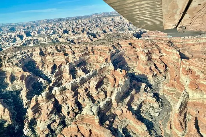
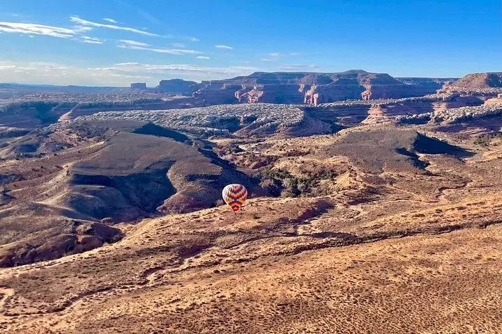
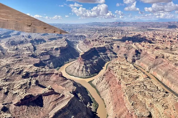
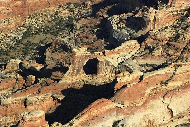
You taxi past scrub and a low concrete hangar, and within minutes the red rock below opens like a map—ridges, braided rivers and isolated mesas arranged with a blunt, patient geometry. From your window seat the Colorado and Green Rivers cut bright ribbons; cliffs that rise 1,000 feet look like folded pages. The pilot’s voice comes through a headset and points out a cluster of spires, then a pale arc of stone hiding in a back canyon.
Verified experiences and guided adventures in the surrounding area.
Operated by Redtail Air · Moab, Utah
You taxi past scrub and a low concrete hangar, and within minutes the red rock below opens like a map—ridges, braided rivers and isolated mesas arranged with a blunt, patient geometry. From your window seat the Colorado and Green Rivers cut bright ribbons; cliffs that rise 1,000 feet look like folded pages. The pilot’s voice comes through a headset and points out a cluster of spires, then a pale arc of stone hiding in a back canyon.
This hour-long flight is not sightseeing in the casual sense. It’s a concentrated geography lesson: how uplift, water and time have etched Canyonlands into islands of stone and carved the Needles into stacks and fins striped with pink and white layers. Upheaval Dome—an odd circular scar whose origin has long been debated by geologists—makes sense from above. The Confluence, where the Colorado and Green Rivers meet, reads like a fold in earth’s skin, a meeting of currents that has directed human travel and habitation for millennia.
The cultural story is compact but present. For tens of generations Ancestral Puebloans navigated these canyons, leaving granaries, pictographs and faint garden spots on ledges. Modern gateway town Moab grew as a trading post, now serving photographers, climbers and river runners who come to test the scale of this landscape. The airplane tour is a shortcut to an understanding that would otherwise take days on foot and river.
Practicalities matter: flights launch from the field about 20 miles north of Moab, are scheduled as a 60-minute loop and include live pilot commentary through provided headsets. High-wing aircraft give unobstructed views and each guest receives a window seat. The operator requires a minimum of two passengers per flight and reserves the right to alter times for weather or weight restrictions—be ready for manual confirmation.
For photographers, compositional wins come fast: the best light is low and warm, the river confluence looks like flowing metal, and the Needles throw dramatic shadows. Dress in layers—the cabin can be chilly—and keep lenses free of fingerprints; headsets make communication easy but don’t muffle the sense of scale below.
Safety is straightforward: follow pre-flight briefings, weigh and balance rules may apply, and accessibility-friendly boarding is available. If you want the most stable air and the longest shadows, book first light. If you prefer warmer cabin temps and calmer wind patterns, late morning in spring or fall is often ideal.
In sixty minutes you’ll leave Moab with the desert at eye level and return with a clearer map of how stone, water and human history fit together—an aerial primer that makes the landscape below feel immediate and navigable.
Flights depart from Canyonlands Field, roughly 20 miles north of Moab; check your booking for exact meeting instructions.
The flight duration is approximately 60 minutes and includes pilot commentary via headsets provided on board.
A minimum of two passengers is required per booking and operators may request passenger weights for aircraft balance.
Infants and small children are allowed; confirm any age-related policies with the operator at booking.
Yes—boarding accommodations are listed as wheelchair accessible; notify the operator of special needs ahead of time.
Full refunds are available if you cancel at least 24 hours before departure; flights may be canceled for weather with refunds per the operator’s policy.
Redtail Air operates guided outdoor trips and adventures with an emphasis on safety, stewardship, and memorable experiences.
You taxi past scrub and a low concrete hangar, and within minutes the red rock below opens like a map—ridges, braided rivers and isolated mesas arranged with a blunt, patient geometry. From your window seat the Colorado and Green Rivers cut bright ribbons; cliffs that rise 1,000 feet look like folded pages. The pilot’s voice comes through a headset and points out a cluster of spires, then a pale arc of stone hiding in a back canyon.
You taxi past scrub and a low concrete hangar, and within minutes the red rock below opens like a map—ridges, braided rivers and isolated mesas arranged with a blunt, patient geometry. From your window seat the Colorado and Green Rivers cut bright ribbons; cliffs that rise 1,000 feet look like folded pages. The pilot’s voice comes through a headset and points out a cluster of spires, then a pale arc of stone hiding in a back canyon.
This hour-long flight is not sightseeing in the casual sense. It’s a concentrated geography lesson: how uplift, water and time have etched Canyonlands into islands of stone and carved the Needles into stacks and fins striped with pink and white layers. Upheaval Dome—an odd circular scar whose origin has long been debated by geologists—makes sense from above. The Confluence, where the Colorado and Green Rivers meet, reads like a fold in earth’s skin, a meeting of currents that has directed human travel and habitation for millennia.
The cultural story is compact but present. For tens of generations Ancestral Puebloans navigated these canyons, leaving granaries, pictographs and faint garden spots on ledges. Modern gateway town Moab grew as a trading post, now serving photographers, climbers and river runners who come to test the scale of this landscape. The airplane tour is a shortcut to an understanding that would otherwise take days on foot and river.
Practicalities matter: flights launch from the field about 20 miles north of Moab, are scheduled as a 60-minute loop and include live pilot commentary through provided headsets. High-wing aircraft give unobstructed views and each guest receives a window seat. The operator requires a minimum of two passengers per flight and reserves the right to alter times for weather or weight restrictions—be ready for manual confirmation.
For photographers, compositional wins come fast: the best light is low and warm, the river confluence looks like flowing metal, and the Needles throw dramatic shadows. Dress in layers—the cabin can be chilly—and keep lenses free of fingerprints; headsets make communication easy but don’t muffle the sense of scale below.
Safety is straightforward: follow pre-flight briefings, weigh and balance rules may apply, and accessibility-friendly boarding is available. If you want the most stable air and the longest shadows, book first light. If you prefer warmer cabin temps and calmer wind patterns, late morning in spring or fall is often ideal.
In sixty minutes you’ll leave Moab with the desert at eye level and return with a clearer map of how stone, water and human history fit together—an aerial primer that makes the landscape below feel immediate and navigable.