THE ADVENTURE COLLECTIVE® · Independent discovery and booking for outdoor travel

Follow carved limestone ledges, ancient cave paintings and a set of wooden hanging bridges across the Turia canyon on a 6-hour loop from Valencia. Expect steep climbs, panoramic reservoir views and a photo-ready crossing 160 meters above the river.
Follow carved limestone ledges, ancient cave paintings and a set of wooden hanging bridges across the Turia canyon on a 6-hour loop from Valencia. Expect steep climbs, panoramic reservoir views and a photo-ready crossing 160 meters above the river.
A dry wind scours the canyon and the Turia slips like a ribbon far below as you step off the village lane into stone and shadow. The trail at Chulilla starts low—along the canyon floor where the river has cut 160 meters of vertical face—and then climbs, trading cool gorges for sunlit ridgelines and a high, lung-opening view of the Loriguilla Reservoir.
Verified experiences and guided adventures in the surrounding area.
Operated by Valencia Mountain Enthusiasts · Chulilla, Valencia
A dry wind scours the canyon and the Turia slips like a ribbon far below as you step off the village lane into stone and shadow. The trail at Chulilla starts low—along the canyon floor where the river has cut 160 meters of vertical face—and then climbs, trading cool gorges for sunlit ridgelines and a high, lung-opening view of the Loriguilla Reservoir.
This route follows parts of the Ruta de los Calderones, a path carved in limestone where prehistoric people painted simple motifs on sheltered walls and later farmers traced terraces into the slopes. Geologically, the canyon is a classic river incision in Miocene limestone; expect sheer walls, exposed strata, and narrow ledges above fast water. Local culture still centers on the village of Chulilla—white houses, a ruined castle watching from the heights, and small bars where tortillas and local wine refuel hikers.
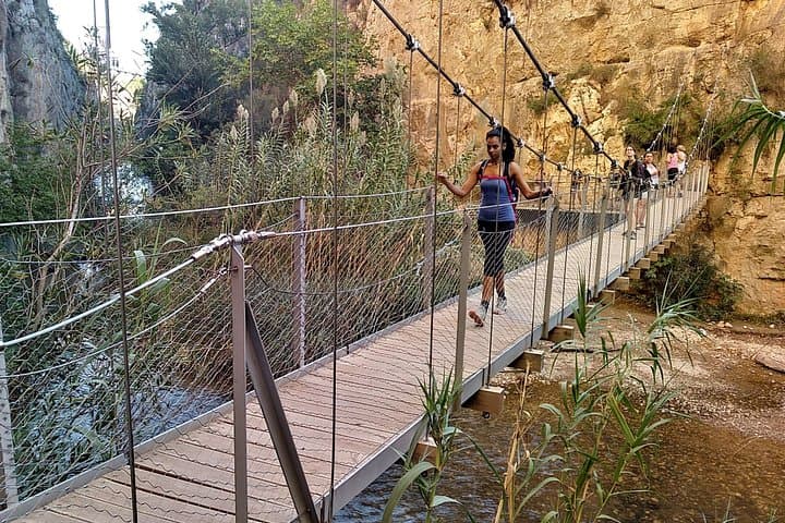
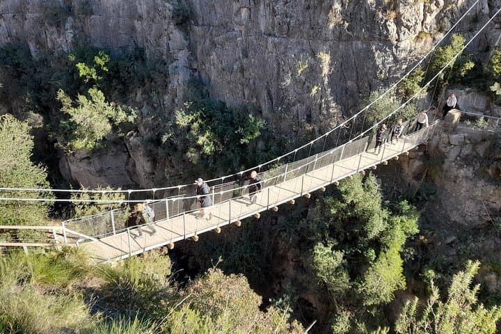
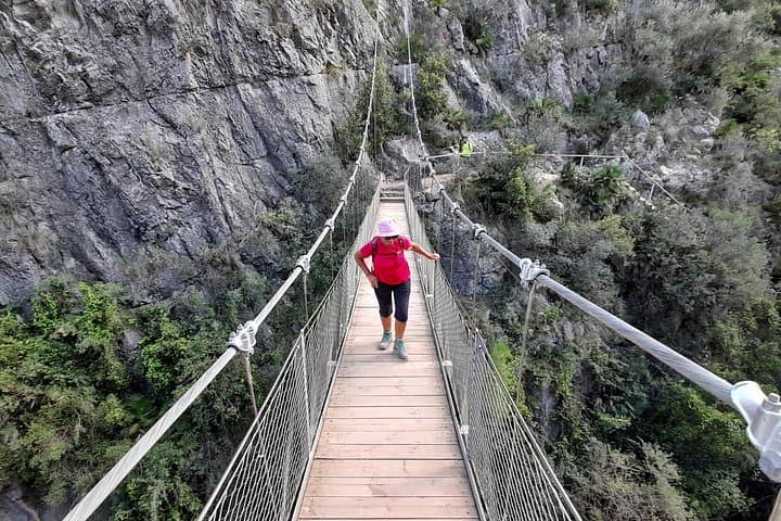
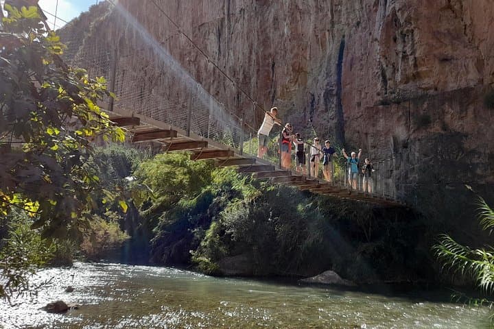
When you reach the hanging bridges, the planks sway a little underfoot and the canyon’s scale becomes explicit: river, rock, sky. That crossing is the emotional high point; the rest of the loop eases back through olive groves and pine-scented tracks.
Practical guidance: start early to avoid midday heat, bring 1.5–2 liters of water in summer, and wear grippy boots for rocky and potentially slippery switchbacks. The route suits hikers with moderate fitness and a head for exposure; consider trekking poles for the steeper ascents. Respect marked paths and local closures, especially near nesting seasons, and plan transportation—many tours pick up in Valencia for a 45-minute drive to the trailhead.
The organized loop runs about 5–6 hours with moderate climbs; it suits hikers with a reasonable level of fitness and no technical climbing skills.
The bridges are secure but exposed; children should be supervised, and caregivers should assess comfort with heights before crossing.
The route is well-marked and popular, so independent hikers can do it, but a guided tour adds local history, cave-painting context and transport logistics from Valencia.
There are no reliable water points or facilities on the trail—use village facilities before you start and carry sufficient water for the day.
Valencia Mountain Enthusiasts operates guided outdoor trips and adventures with an emphasis on safety, stewardship, and memorable experiences.
A dry wind scours the canyon and the Turia slips like a ribbon far below as you step off the village lane into stone and shadow. The trail at Chulilla starts low—along the canyon floor where the river has cut 160 meters of vertical face—and then climbs, trading cool gorges for sunlit ridgelines and a high, lung-opening view of the Loriguilla Reservoir.
A dry wind scours the canyon and the Turia slips like a ribbon far below as you step off the village lane into stone and shadow. The trail at Chulilla starts low—along the canyon floor where the river has cut 160 meters of vertical face—and then climbs, trading cool gorges for sunlit ridgelines and a high, lung-opening view of the Loriguilla Reservoir.
This route follows parts of the Ruta de los Calderones, a path carved in limestone where prehistoric people painted simple motifs on sheltered walls and later farmers traced terraces into the slopes. Geologically, the canyon is a classic river incision in Miocene limestone; expect sheer walls, exposed strata, and narrow ledges above fast water. Local culture still centers on the village of Chulilla—white houses, a ruined castle watching from the heights, and small bars where tortillas and local wine refuel hikers.
When you reach the hanging bridges, the planks sway a little underfoot and the canyon’s scale becomes explicit: river, rock, sky. That crossing is the emotional high point; the rest of the loop eases back through olive groves and pine-scented tracks.
Practical guidance: start early to avoid midday heat, bring 1.5–2 liters of water in summer, and wear grippy boots for rocky and potentially slippery switchbacks. The route suits hikers with moderate fitness and a head for exposure; consider trekking poles for the steeper ascents. Respect marked paths and local closures, especially near nesting seasons, and plan transportation—many tours pick up in Valencia for a 45-minute drive to the trailhead.