THE ADVENTURE COLLECTIVE® · Independent discovery and booking for outdoor travel

Take the western Lemosho route onto Kilimanjaro for an eight-day climb that favors acclimatization and scenery. From rainforest to alpine desert, this guided itinerary balances hard miles with strategic rest to give you the best shot at Uhuru Peak.
Take the western Lemosho route onto Kilimanjaro for an eight-day climb that favors acclimatization and scenery. From rainforest to alpine desert, this guided itinerary balances hard miles with strategic rest to give you the best shot at Uhuru Peak.
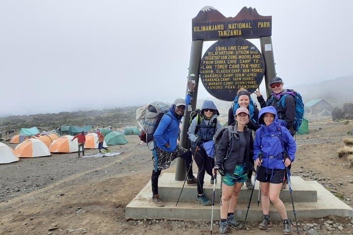
A cool predawn hush hangs over Londorossi Gate as your headlamp cones cut through mountain mist. Porters sling bundles, guides issue last-minute route checks, and the rainforest breathes around you — damp, green, alive with the rustle of colobus monkeys and distant bird calls. The first day’s 5 km through forest to Forest Camp (2,830 m) is a gentle immersion; by the second day you rise into Heather moorland and an expansive Shira Plateau, a high plain that opens Kibo’s bulk on the horizon.
Verified experiences and guided adventures in the surrounding area.
Operated by Guide Private · Moshi, Kilimanjaro Region
A cool predawn hush hangs over Londorossi Gate as your headlamp cones cut through mountain mist. Porters sling bundles, guides issue last-minute route checks, and the rainforest breathes around you — damp, green, alive with the rustle of colobus monkeys and distant bird calls. The first day’s 5 km through forest to Forest Camp (2,830 m) is a gentle immersion; by the second day you rise into Heather moorland and an expansive Shira Plateau, a high plain that opens Kibo’s bulk on the horizon.
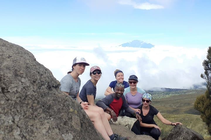
The Lemosho route is the western, slow-built way up Kilimanjaro: longer approaches, strategic acclimatization, and a higher summit success rate. Geologically, Kilimanjaro is three volcanic cones — Kibo, Mawenzi and Shira — with Kibo’s summit, Uhuru Peak (5,896 m), capped in remnant ice and jagged volcanic scree. Your nights move from rainforest to moorland, then alpine desert; landscapes shift from tree ferns and Erica to lava scars and the stark, wind-burned ridgelines above Barafu Hut (4,620 m).
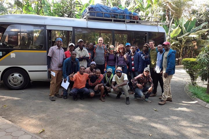
Culturally you begin and end near Moshi and Arusha, towns shaped by Chagga agricultural terraces and the coffee trade. Local guides and porters are not just logistics — they are translators of place, telling stories about the mountain’s role in community life and performing critical work that makes summit attempts possible.
Expect structured days: 4–6 hours of hiking on acclimatization days (Shira Plateau, Lava Tower at 4,605 m) and a summit push that starts around midnight from Barafu, climbs to Stella Point (5,756 m) and on to Uhuru, then descends to Mweka Hut (3,100 m). Terrain ranges from packed forest trails to eroded scree and steep rock steps on the Barranco Wall. Weather swings quickly: cold, wind and snow near the top; humid and warm lower down.
Practical edge: hydrate proactively, eat small frequent meals, and use the ‘climb high, sleep low’ principle built into the itinerary. Your guides will carry group kit, but bring layered technical clothing, a down sleeping bag rated to -10°C or lower, and boots with good ankle support. Take altitude seriously — communicate symptoms early and accept slower paces.
Logistics and planning: the trip includes meals and camps, and operators usually handle park permits and camping equipment. Budget extra for tipping porters, park fees, and a day or two in Moshi pre- or post-climb. With patient pacing, the Lemosho route is the most scenic, best-acclimatized path to stand above the clouds on Africa’s roof.
No — the Lemosho route is non-technical; you’ll reach Uhuru Peak by hiking and scrambling, not ropework or glacier travel.
Dry seasons from late June–October and January–March offer more stable weather and clearer summit views, though climbs happen year-round.
Altitude is the main objective risk; the itinerary’s acclimatization days reduce risk, but monitor symptoms and be prepared to descend if necessary.
Most operators include porters, collective camping gear and group tents; confirm sleeping bag and personal gear requirements before booking.
Budget a group tip around 10–20% of the trip price distributed among guides, cooks and porters — bring cash in local currency.
Yes — Kilimanjaro National Park entry and rescue/park fees are required and typically handled by the operator as part of the booking.
Guide Private operates guided outdoor trips and adventures with an emphasis on safety, stewardship, and memorable experiences.
A cool predawn hush hangs over Londorossi Gate as your headlamp cones cut through mountain mist. Porters sling bundles, guides issue last-minute route checks, and the rainforest breathes around you — damp, green, alive with the rustle of colobus monkeys and distant bird calls. The first day’s 5 km through forest to Forest Camp (2,830 m) is a gentle immersion; by the second day you rise into Heather moorland and an expansive Shira Plateau, a high plain that opens Kibo’s bulk on the horizon.
A cool predawn hush hangs over Londorossi Gate as your headlamp cones cut through mountain mist. Porters sling bundles, guides issue last-minute route checks, and the rainforest breathes around you — damp, green, alive with the rustle of colobus monkeys and distant bird calls. The first day’s 5 km through forest to Forest Camp (2,830 m) is a gentle immersion; by the second day you rise into Heather moorland and an expansive Shira Plateau, a high plain that opens Kibo’s bulk on the horizon.
The Lemosho route is the western, slow-built way up Kilimanjaro: longer approaches, strategic acclimatization, and a higher summit success rate. Geologically, Kilimanjaro is three volcanic cones — Kibo, Mawenzi and Shira — with Kibo’s summit, Uhuru Peak (5,896 m), capped in remnant ice and jagged volcanic scree. Your nights move from rainforest to moorland, then alpine desert; landscapes shift from tree ferns and Erica to lava scars and the stark, wind-burned ridgelines above Barafu Hut (4,620 m).
Culturally you begin and end near Moshi and Arusha, towns shaped by Chagga agricultural terraces and the coffee trade. Local guides and porters are not just logistics — they are translators of place, telling stories about the mountain’s role in community life and performing critical work that makes summit attempts possible.
Expect structured days: 4–6 hours of hiking on acclimatization days (Shira Plateau, Lava Tower at 4,605 m) and a summit push that starts around midnight from Barafu, climbs to Stella Point (5,756 m) and on to Uhuru, then descends to Mweka Hut (3,100 m). Terrain ranges from packed forest trails to eroded scree and steep rock steps on the Barranco Wall. Weather swings quickly: cold, wind and snow near the top; humid and warm lower down.
Practical edge: hydrate proactively, eat small frequent meals, and use the ‘climb high, sleep low’ principle built into the itinerary. Your guides will carry group kit, but bring layered technical clothing, a down sleeping bag rated to -10°C or lower, and boots with good ankle support. Take altitude seriously — communicate symptoms early and accept slower paces.
Logistics and planning: the trip includes meals and camps, and operators usually handle park permits and camping equipment. Budget extra for tipping porters, park fees, and a day or two in Moshi pre- or post-climb. With patient pacing, the Lemosho route is the most scenic, best-acclimatized path to stand above the clouds on Africa’s roof.