THE ADVENTURE COLLECTIVE® · Independent discovery and booking for outdoor travel

Daylight breaks over Sapa as hikers set off for Fansipan, the Indochina peninsula’s highest summit. This one-day summit trek delivers raw mountain terrain, swift weather shifts, and wide-ranging views — plus practical support from local guides.
Daylight breaks over Sapa as hikers set off for Fansipan, the Indochina peninsula’s highest summit. This one-day summit trek delivers raw mountain terrain, swift weather shifts, and wide-ranging views — plus practical support from local guides.
A cold dawn in Sapa, rice terraces blurred by cloud, becomes the launching point for a steady climb toward Fansipan’s jagged silhouette. Guides collect hikers from Ta Van and Lao Chai, and after a drive up the Hoang Lien Son foothills the trail begins to pull you into higher air — each switchback peeling open wider views of terraced slopes and distant ridgelines.
Verified experiences and guided adventures in the surrounding area.
Operated by comlam travel north Viet Nam adventures · Sapa, Lào Cai
A cold dawn in Sapa, rice terraces blurred by cloud, becomes the launching point for a steady climb toward Fansipan’s jagged silhouette. Guides collect hikers from Ta Van and Lao Chai, and after a drive up the Hoang Lien Son foothills the trail begins to pull you into higher air — each switchback peeling open wider views of terraced slopes and distant ridgelines.
Fansipan, at 3,143 m, is the highest point on the Indochinese Peninsula. The mountain sits on the Hoang Lien range, a mass of uplifted metamorphic rock and granite that pushes north toward the Chinese border; weather here changes fast, and condensation often writes cloud seas across the valleys. Sapa’s Dao and Hmong communities have long shaped the lowland culture — villages you pass are working landscapes as much as cultural stops.
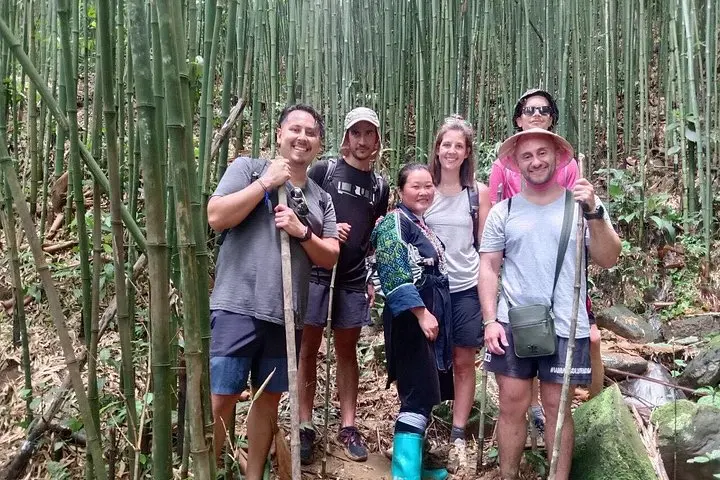
Expect steep, sometimes muddy trails and loose rock in sections; the ascent tests legs more than technical skill. Many groups accept the cable car for the final ascent if weather or fitness dictates, but a full day on foot rewards with a summit view that spans Sapa town and, on clear days, across into Yunnan.
Practical notes: start early, layer for wind and cold at the summit, and carry snacks and 1–2 liters of water. Guides provide pickup, basic meals, and support; the tour returns the same day. Be realistic about altitude and descent time — moving downhill can be as demanding as the climb. A small medal at the end is a nice local touch, but the real reward is the slow opening of highland sky and the ache that proves you earned it.
A typical guided day trek ranges 8–10 hours round-trip depending on pace and weather; the operator sometimes uses cable car options for parts of the route.
Fansipan’s summit is 3,143 m; most healthy hikers manage without formal acclimatization, but take it slow, hydrate, and monitor for headache or nausea.
Local guides lead the route for safety and logistics; basic breakfast and lunch are usually provided along with hotel pick-up in Sapa.
The operator monitors conditions; in poor weather options can include retracing lower sections or taking the cable car where available, and cancellations are subject to the tour’s policy.
comlam travel north Viet Nam adventures operates guided outdoor trips and adventures with an emphasis on safety, stewardship, and memorable experiences.

A cold dawn in Sapa, rice terraces blurred by cloud, becomes the launching point for a steady climb toward Fansipan’s jagged silhouette. Guides collect hikers from Ta Van and Lao Chai, and after a drive up the Hoang Lien Son foothills the trail begins to pull you into higher air — each switchback peeling open wider views of terraced slopes and distant ridgelines.
A cold dawn in Sapa, rice terraces blurred by cloud, becomes the launching point for a steady climb toward Fansipan’s jagged silhouette. Guides collect hikers from Ta Van and Lao Chai, and after a drive up the Hoang Lien Son foothills the trail begins to pull you into higher air — each switchback peeling open wider views of terraced slopes and distant ridgelines.
Fansipan, at 3,143 m, is the highest point on the Indochinese Peninsula. The mountain sits on the Hoang Lien range, a mass of uplifted metamorphic rock and granite that pushes north toward the Chinese border; weather here changes fast, and condensation often writes cloud seas across the valleys. Sapa’s Dao and Hmong communities have long shaped the lowland culture — villages you pass are working landscapes as much as cultural stops.
Expect steep, sometimes muddy trails and loose rock in sections; the ascent tests legs more than technical skill. Many groups accept the cable car for the final ascent if weather or fitness dictates, but a full day on foot rewards with a summit view that spans Sapa town and, on clear days, across into Yunnan.
Practical notes: start early, layer for wind and cold at the summit, and carry snacks and 1–2 liters of water. Guides provide pickup, basic meals, and support; the tour returns the same day. Be realistic about altitude and descent time — moving downhill can be as demanding as the climb. A small medal at the end is a nice local touch, but the real reward is the slow opening of highland sky and the ache that proves you earned it.