THE ADVENTURE COLLECTIVE® · Independent discovery and booking for outdoor travel

Drive the Avenue of the Volcanoes to stand beneath Cotopaxi’s icy flanks, then descend to Baños’ steaming hot springs and thunderous waterfalls. This private 2-day itinerary pairs high-altitude hikes and dramatic viewpoints with practical advice for acclimatization and timing.
Drive the Avenue of the Volcanoes to stand beneath Cotopaxi’s icy flanks, then descend to Baños’ steaming hot springs and thunderous waterfalls. This private 2-day itinerary pairs high-altitude hikes and dramatic viewpoints with practical advice for acclimatization and timing.
You break out of Quito’s morning fog onto the Avenue of the Volcanoes and the air thins, sharp and metallic. Peaks loom—Cotopaxi’s conical summit capped with ice at 5,897 m—and the road carves through páramo grasslands toward Limpiopungo Lake where Andean gulls slice the surface and wind seems to push you forward.
Verified experiences and guided adventures in the surrounding area.
Operated by Ecuador Local Guide · Cotopaxi National Park, Cotopaxi Province
You break out of Quito’s morning fog onto the Avenue of the Volcanoes and the air thins, sharp and metallic. Peaks loom—Cotopaxi’s conical summit capped with ice at 5,897 m—and the road carves through páramo grasslands toward Limpiopungo Lake where Andean gulls slice the surface and wind seems to push you forward.
Cotopaxi has shaped local life for millennia: its eruptions recorded in indigenous oral history and colonial chronicles alike. The park’s volcanic soils feed highland peatlands and puna ecosystems; at 3,800 m Limpiopungo is a compact wildlife corridor. Geologically recent, Cotopaxi’s glacier-and-ash profile contrasts with Tungurahua near Baños, a more frequently restless neighbor whose smoke plumes define the valley skyline.
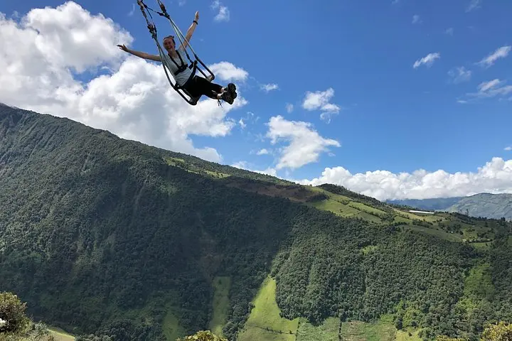
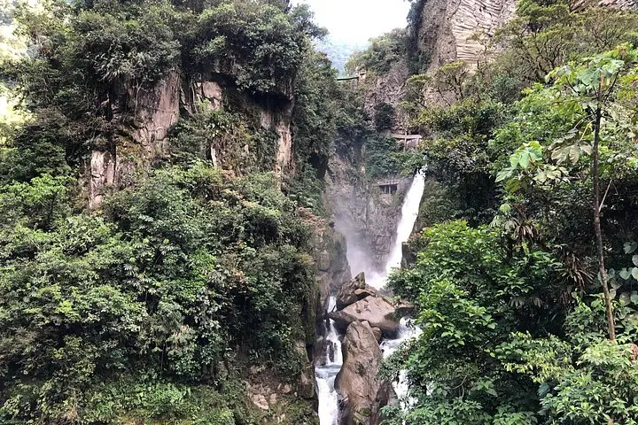
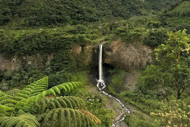
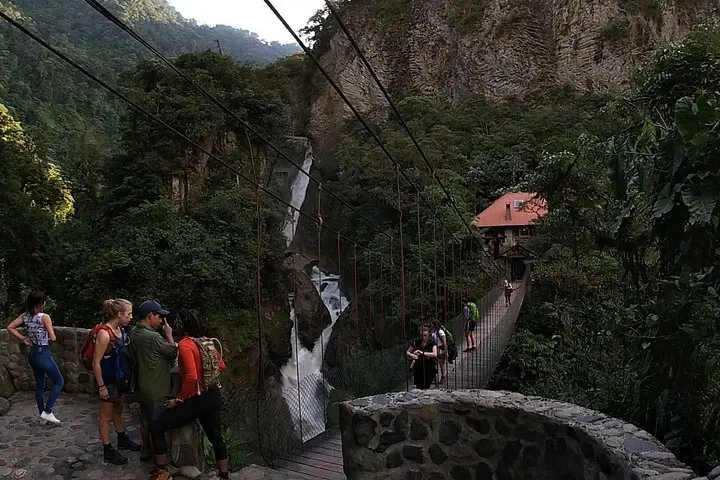
Baños delivers a shift in pace—warm springs steam against cloud-shaded cliffs, waterfalls pound the gorge, and the Ruta de las Cascadas threads suspension bridges and zip lines across plunging drops. The Swing at the End of the World offers a vertiginous stare at Tungurahua; Pailón del Diablo rewards wet, jungle-close views from a suspension bridge.
Practical side: this private, multi-day loop includes private transport and one night in Baños, but altitude is the real variable. Expect driving windows of 1–2 hours between stops, hikes between 45–120 minutes, and trail surfaces from gravel parking lots to muddy jungle steps. Bring layered insulation, quality boots, and water; plan for rapid weather changes and short daylight windows in high terrain. A local guide keeps logistics smooth and points out birdlife, historical context, and safe vantage points—so you can focus on the landscape’s push and pull rather than the map.
Yes—Cotopaxi approaches 4,600–4,800 m; symptoms can appear quickly. Move slowly, hydrate, avoid heavy meals before hikes, and inform your guide of any issues.
No—the swing site is a short, accessible visit about 20 minutes from Baños town, though uneven ground may require careful footing.
Closed-toe shoes with grippy soles are recommended; trails can be wet, muddy, and include steep steps and suspension bridge approaches.
This private tour includes breakfast, private transport, guide, and one night accommodation; check the booking for specific entrance fees and additional meals.
Ecuador Local Guide operates guided outdoor trips and adventures with an emphasis on safety, stewardship, and memorable experiences.
You break out of Quito’s morning fog onto the Avenue of the Volcanoes and the air thins, sharp and metallic. Peaks loom—Cotopaxi’s conical summit capped with ice at 5,897 m—and the road carves through páramo grasslands toward Limpiopungo Lake where Andean gulls slice the surface and wind seems to push you forward.
You break out of Quito’s morning fog onto the Avenue of the Volcanoes and the air thins, sharp and metallic. Peaks loom—Cotopaxi’s conical summit capped with ice at 5,897 m—and the road carves through páramo grasslands toward Limpiopungo Lake where Andean gulls slice the surface and wind seems to push you forward.
Cotopaxi has shaped local life for millennia: its eruptions recorded in indigenous oral history and colonial chronicles alike. The park’s volcanic soils feed highland peatlands and puna ecosystems; at 3,800 m Limpiopungo is a compact wildlife corridor. Geologically recent, Cotopaxi’s glacier-and-ash profile contrasts with Tungurahua near Baños, a more frequently restless neighbor whose smoke plumes define the valley skyline.
Baños delivers a shift in pace—warm springs steam against cloud-shaded cliffs, waterfalls pound the gorge, and the Ruta de las Cascadas threads suspension bridges and zip lines across plunging drops. The Swing at the End of the World offers a vertiginous stare at Tungurahua; Pailón del Diablo rewards wet, jungle-close views from a suspension bridge.
Practical side: this private, multi-day loop includes private transport and one night in Baños, but altitude is the real variable. Expect driving windows of 1–2 hours between stops, hikes between 45–120 minutes, and trail surfaces from gravel parking lots to muddy jungle steps. Bring layered insulation, quality boots, and water; plan for rapid weather changes and short daylight windows in high terrain. A local guide keeps logistics smooth and points out birdlife, historical context, and safe vantage points—so you can focus on the landscape’s push and pull rather than the map.