THE ADVENTURE COLLECTIVE® · Independent discovery and booking for outdoor travel

Drive the Avenue of the Volcanoes to Cotopaxi National Park for a full-day of high-Andean scenery, Limpiopungo lagoon walks and a visit to the José Rivas refuge. Expect volcanic panoramas, variable weather, and cultural stops at a colonial hacienda or the Saquisilí market on Thursdays.
Drive the Avenue of the Volcanoes to Cotopaxi National Park for a full-day of high-Andean scenery, Limpiopungo lagoon walks and a visit to the José Rivas refuge. Expect volcanic panoramas, variable weather, and cultural stops at a colonial hacienda or the Saquisilí market on Thursdays.
A thin blue light edges the volcanic cone as the van leaves Quito, the road climbing the Avenida de los Volcanes until the air thins and the páramo opens. Low shrubs—chuquiragua among them—tilt under wind that seems to push travelers toward the raw silhouette of Cotopaxi. The day is paced by altitude: the lagoon, the parking lot at roughly 15,000 ft, and the refuge at about 16,000 ft shape each stop.
Verified experiences and guided adventures in the surrounding area.
Operated by Guide Ecuador Travel · Quito, Pichincha
A thin blue light edges the volcanic cone as the van leaves Quito, the road climbing the Avenida de los Volcanes until the air thins and the páramo opens. Low shrubs—chuquiragua among them—tilt under wind that seems to push travelers toward the raw silhouette of Cotopaxi. The day is paced by altitude: the lagoon, the parking lot at roughly 15,000 ft, and the refuge at about 16,000 ft shape each stop.
Cotopaxi is a stratovolcano carved by ice and time, fringing a national park of more than 33,000 hectares. Limpiopungo’s lagoon offers short walks across peat and volcanic scree to watch Andean waterfowl and, on lucky afternoons, condors circling the thermals. Cultural layers appear at Hacienda La Ciénega, where the 1736 French Geodesic Mission left its mark measuring “half the world.” On Thursdays, the Saquisilí market exchanges livestock, textiles and highland flavors instead of the hacienda visit.
Expect broad volcanic vistas, tussock grass and sudden weather shifts. Practicalities matter: start early to avoid afternoon clouds, carry layered insulation, and move deliberately at high elevation. The route mixes well-formed park trails, short boardwalks around the lagoon and harder, rocky sections near the refuge; guided transport reduces route-finding and maximizes time for observation.
This full-day itinerary fits a range of fitness levels but rewards respect for altitude—plan hydration, sun protection and slow, steady pacing to enjoy Cotopaxi’s stark, high-Andean character.
Most walking is easy to moderate: short lagoon trails and well-marked park paths, with rockier ground and steeper sections if you reach the José Rivas refuge.
Altitude affects people differently; the tour reaches parking near 15,000 ft and the refuge near 16,000 ft—take time to acclimatize, hydrate, and notify guides of any symptoms.
Yes — private transportation and park admission are included; the tour departs from Quito and typically returns the same day.
Hacienda La Ciénega offers historical context tied to the French Geodesic Mission and a typical lunch; on Thursdays the itinerary replaces the hacienda with the lively Saquisilí indigenous market experience.
Guide Ecuador Travel operates guided outdoor trips and adventures with an emphasis on safety, stewardship, and memorable experiences.
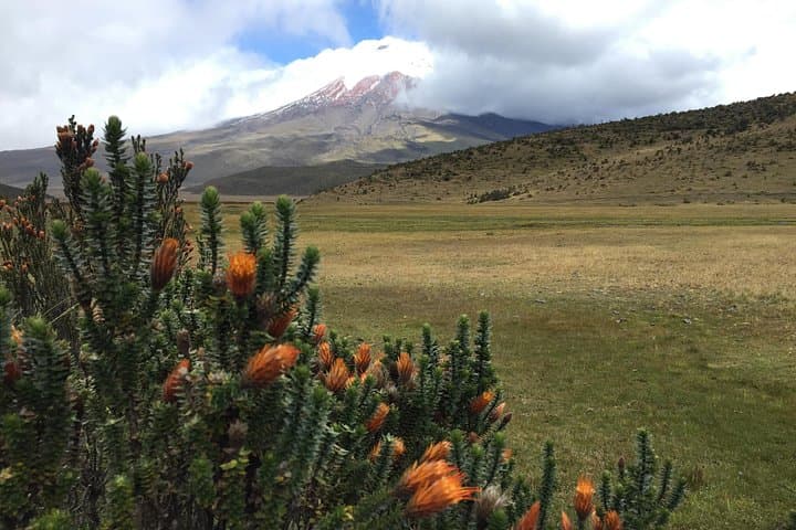
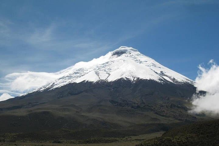
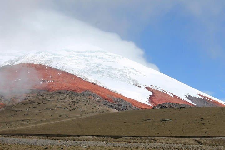
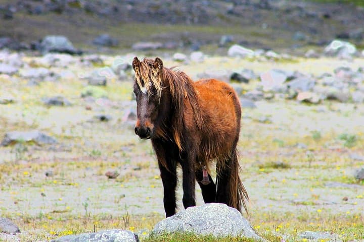
A thin blue light edges the volcanic cone as the van leaves Quito, the road climbing the Avenida de los Volcanes until the air thins and the páramo opens. Low shrubs—chuquiragua among them—tilt under wind that seems to push travelers toward the raw silhouette of Cotopaxi. The day is paced by altitude: the lagoon, the parking lot at roughly 15,000 ft, and the refuge at about 16,000 ft shape each stop.
A thin blue light edges the volcanic cone as the van leaves Quito, the road climbing the Avenida de los Volcanes until the air thins and the páramo opens. Low shrubs—chuquiragua among them—tilt under wind that seems to push travelers toward the raw silhouette of Cotopaxi. The day is paced by altitude: the lagoon, the parking lot at roughly 15,000 ft, and the refuge at about 16,000 ft shape each stop.
Cotopaxi is a stratovolcano carved by ice and time, fringing a national park of more than 33,000 hectares. Limpiopungo’s lagoon offers short walks across peat and volcanic scree to watch Andean waterfowl and, on lucky afternoons, condors circling the thermals. Cultural layers appear at Hacienda La Ciénega, where the 1736 French Geodesic Mission left its mark measuring “half the world.” On Thursdays, the Saquisilí market exchanges livestock, textiles and highland flavors instead of the hacienda visit.
Expect broad volcanic vistas, tussock grass and sudden weather shifts. Practicalities matter: start early to avoid afternoon clouds, carry layered insulation, and move deliberately at high elevation. The route mixes well-formed park trails, short boardwalks around the lagoon and harder, rocky sections near the refuge; guided transport reduces route-finding and maximizes time for observation.
This full-day itinerary fits a range of fitness levels but rewards respect for altitude—plan hydration, sun protection and slow, steady pacing to enjoy Cotopaxi’s stark, high-Andean character.