THE ADVENTURE COLLECTIVE® · Independent discovery and booking for outdoor travel

A full-day run from Quito to two of Ecuador’s most dramatic volcanic landscapes: the snowy cone of Cotopaxi and the emerald crater of Quilotoa. Expect long drives, short hikes, high-altitude views, and authentic market stops.
A full-day run from Quito to two of Ecuador’s most dramatic volcanic landscapes: the snowy cone of Cotopaxi and the emerald crater of Quilotoa. Expect long drives, short hikes, high-altitude views, and authentic market stops.
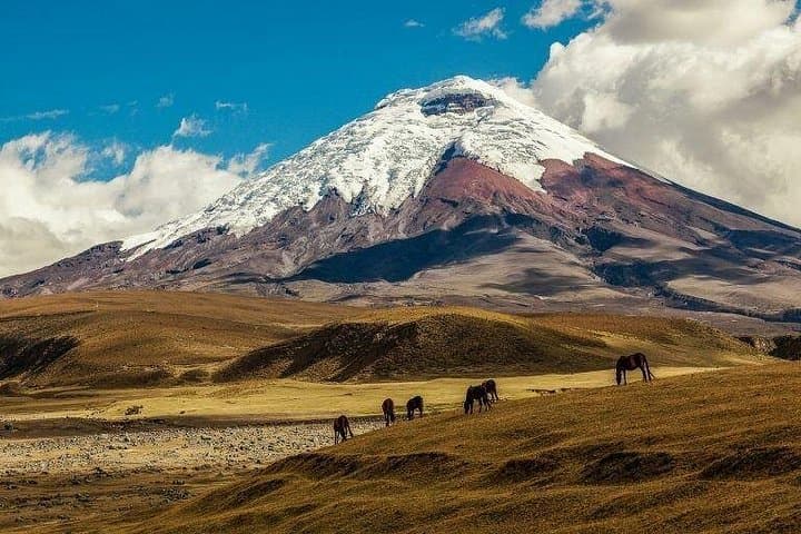
You step out before dawn in Quito, air sharp with altitude and the city lights still dimming behind you. The road unfurls through páramo—low shrubs, tussock grasses, and the occasional volcanic ridge—until Cotopaxi rises ahead, a conical presence at nearly 5,900 meters that seems to breathe steam into the cold sky. Limpiopungo Lagoon reflects its silhouette, daring you to compare scale: human and mountain.
Verified experiences and guided adventures in the surrounding area.
Operated by CarpeDM Adventures · Quito, Pichincha
You step out before dawn in Quito, air sharp with altitude and the city lights still dimming behind you. The road unfurls through páramo—low shrubs, tussock grasses, and the occasional volcanic ridge—until Cotopaxi rises ahead, a conical presence at nearly 5,900 meters that seems to breathe steam into the cold sky. Limpiopungo Lagoon reflects its silhouette, daring you to compare scale: human and mountain.
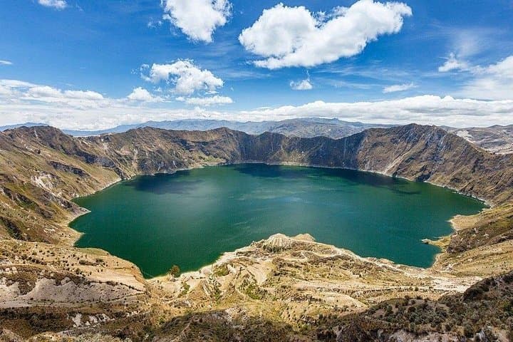
Cotopaxi and Quilotoa tell different geological chapters. Cotopaxi is an active stratovolcano, its snow-capped cone built by repeated eruptions; Quilotoa is a 3-kilometer caldera, hollowed out in an explosive event roughly eight centuries ago and now filled with an emerald crater lake. Culturally, this route threads highland markets—Saquisilí or Pujilí on market days—and small Andean communities where Quechua traditions remain visible in textiles and food.
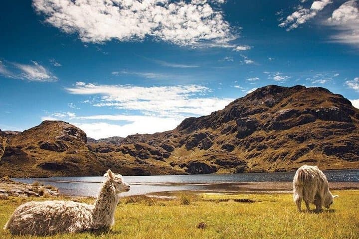
Expect a long but manageable day: 9–11 hours of travel with photo stops and short walks (some steep trails at Quilotoa’s rim). Altitude is the day’s true challenge—headaches or breathlessness are common, not a fitness failure. Practicalities: dress in layers, carry sun protection and water, and pace yourself on any uphill sections. Lunch is provided; toilets are basic at rural stops. Guides will handle permits and logistics, but leave no trace rules apply—pack out waste and respect grazing areas for local livestock.
This trip is best early in the morning for clear views and late-afternoon returns to Quito. Bring a charged camera, a windproof jacket, and realistic expectations: the Andes will reward patience with wide, cold-light vistas you won’t forget.
The tour lasts about 9–11 hours and typically departs Quito between 7:20–7:45 AM with return in the evening.
The itinerary notes it's not recommended for travelers with poor cardiovascular health due to high altitude; children may join but check with the operator first.
Yes—transportation, lunch, and fees are included; the guide is provided as well.
Yes—on certain days the itinerary includes market stops such as Saquisilí or Pujilí depending on the schedule.
CarpeDM Adventures operates guided outdoor trips and adventures with an emphasis on safety, stewardship, and memorable experiences.
You step out before dawn in Quito, air sharp with altitude and the city lights still dimming behind you. The road unfurls through páramo—low shrubs, tussock grasses, and the occasional volcanic ridge—until Cotopaxi rises ahead, a conical presence at nearly 5,900 meters that seems to breathe steam into the cold sky. Limpiopungo Lagoon reflects its silhouette, daring you to compare scale: human and mountain.
You step out before dawn in Quito, air sharp with altitude and the city lights still dimming behind you. The road unfurls through páramo—low shrubs, tussock grasses, and the occasional volcanic ridge—until Cotopaxi rises ahead, a conical presence at nearly 5,900 meters that seems to breathe steam into the cold sky. Limpiopungo Lagoon reflects its silhouette, daring you to compare scale: human and mountain.
Cotopaxi and Quilotoa tell different geological chapters. Cotopaxi is an active stratovolcano, its snow-capped cone built by repeated eruptions; Quilotoa is a 3-kilometer caldera, hollowed out in an explosive event roughly eight centuries ago and now filled with an emerald crater lake. Culturally, this route threads highland markets—Saquisilí or Pujilí on market days—and small Andean communities where Quechua traditions remain visible in textiles and food.
Expect a long but manageable day: 9–11 hours of travel with photo stops and short walks (some steep trails at Quilotoa’s rim). Altitude is the day’s true challenge—headaches or breathlessness are common, not a fitness failure. Practicalities: dress in layers, carry sun protection and water, and pace yourself on any uphill sections. Lunch is provided; toilets are basic at rural stops. Guides will handle permits and logistics, but leave no trace rules apply—pack out waste and respect grazing areas for local livestock.
This trip is best early in the morning for clear views and late-afternoon returns to Quito. Bring a charged camera, a windproof jacket, and realistic expectations: the Andes will reward patience with wide, cold-light vistas you won’t forget.