THE ADVENTURE COLLECTIVE® · Independent discovery and booking for outdoor travel

Traverse 60 km of Central America’s highest non‑volcanic range on a 3‑day trek from Nebaj to Todos Santos. Expect high plateaus, homestays with Maya families, and a pre‑sunrise summit at roughly 3,837 m.
Traverse 60 km of Central America’s highest non‑volcanic range on a 3‑day trek from Nebaj to Todos Santos. Expect high plateaus, homestays with Maya families, and a pre‑sunrise summit at roughly 3,837 m.
Dawn peels back the dark over the high plateau as you shoulder a pack and step onto a trail that climbs out of Nebaj. The wind in the Cuchumatanes dares you forward — sharp, cold, and honest — and the path alternates between shaded pine-rimmed gullies and exposed grassy plateaus that reveal long views back toward the Ixil valleys.
Verified experiences and guided adventures in the surrounding area.
Operated by Tours / Activities SA ((T&ASA)) · Nebaj, Quiché
Dawn peels back the dark over the high plateau as you shoulder a pack and step onto a trail that climbs out of Nebaj. The wind in the Cuchumatanes dares you forward — sharp, cold, and honest — and the path alternates between shaded pine-rimmed gullies and exposed grassy plateaus that reveal long views back toward the Ixil valleys.
This three‑day, roughly 60 km trek follows traditional Maya Ixil and Mam routes across the non‑volcanic Cuchumatanes, Central America’s highest mountain chain, topping near 3,837 m at the summit. The geology here is folded highland terrain and eroded plateaus, with soils that support pine, fir, juniper, oak and madrone. Local culture is visible at every stop: homestay evenings, temazcal steam baths, and villages still marked by memories of the thirty‑six year civil war that shaped modern life and local narratives.
Expect long walking days — 15 km the first day, a 25 km “big” day, and a final pre‑sunrise push to the summit. Terrain ranges from clear trail and pastoral tracks to rocky, wind‑scoured ridgelines and short sections of steep ascent. Nights are spent in simple homestays with shared meals; public transport links bookend the route.
Practical edge: acclimatize if you’re coming from low elevations, carry water purification, and plan for rapidly changing weather — sun, wind and afternoon showers are all possible in one day. Good boots, layered insulation, and an early start on summit day make the trip both safe and unforgettable. This is remote hiking — respect local customs, pack out waste, and leave time to move slowly through a landscape that keeps its own pace.
The elevation increases exposure to altitude effects; hikers should be fit and acclimatize. Pace yourself, drink water, and descend if severe symptoms occur.
Yes — nights are in local homestays with simple sleeping arrangements and shared meals, giving cultural immersion rather than hotel comfort.
Maya Ixil and Mam languages are common; Spanish is widely used with locals, but bringing a phrasebook or relying on guides helps.
Not consistently — bring a filter or purification tablets and refill at village sources after treating the water.
Tours / Activities SA ((T&ASA)) operates guided outdoor trips and adventures with an emphasis on safety, stewardship, and memorable experiences.
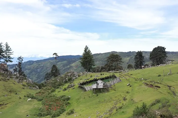
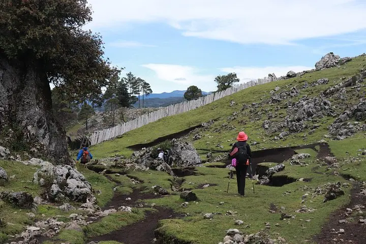
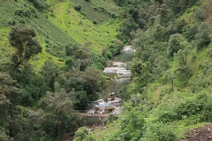
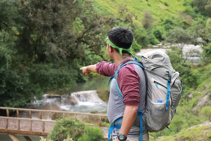
Dawn peels back the dark over the high plateau as you shoulder a pack and step onto a trail that climbs out of Nebaj. The wind in the Cuchumatanes dares you forward — sharp, cold, and honest — and the path alternates between shaded pine-rimmed gullies and exposed grassy plateaus that reveal long views back toward the Ixil valleys.
Dawn peels back the dark over the high plateau as you shoulder a pack and step onto a trail that climbs out of Nebaj. The wind in the Cuchumatanes dares you forward — sharp, cold, and honest — and the path alternates between shaded pine-rimmed gullies and exposed grassy plateaus that reveal long views back toward the Ixil valleys.
This three‑day, roughly 60 km trek follows traditional Maya Ixil and Mam routes across the non‑volcanic Cuchumatanes, Central America’s highest mountain chain, topping near 3,837 m at the summit. The geology here is folded highland terrain and eroded plateaus, with soils that support pine, fir, juniper, oak and madrone. Local culture is visible at every stop: homestay evenings, temazcal steam baths, and villages still marked by memories of the thirty‑six year civil war that shaped modern life and local narratives.
Expect long walking days — 15 km the first day, a 25 km “big” day, and a final pre‑sunrise push to the summit. Terrain ranges from clear trail and pastoral tracks to rocky, wind‑scoured ridgelines and short sections of steep ascent. Nights are spent in simple homestays with shared meals; public transport links bookend the route.
Practical edge: acclimatize if you’re coming from low elevations, carry water purification, and plan for rapidly changing weather — sun, wind and afternoon showers are all possible in one day. Good boots, layered insulation, and an early start on summit day make the trip both safe and unforgettable. This is remote hiking — respect local customs, pack out waste, and leave time to move slowly through a landscape that keeps its own pace.