THE ADVENTURE COLLECTIVE® · Independent discovery and booking for outdoor travel

Follow a local guide down into Dades Gorge and through the Valley of Roses on a 7–10 km hike that pairs short canyoning sections with cultural stops at kasbahs and ancient granaries. Ideal for travelers who want active exploration and panoramic valley views in a half-day outing.
Follow a local guide down into Dades Gorge and through the Valley of Roses on a 7–10 km hike that pairs short canyoning sections with cultural stops at kasbahs and ancient granaries. Ideal for travelers who want active exploration and panoramic valley views in a half-day outing.
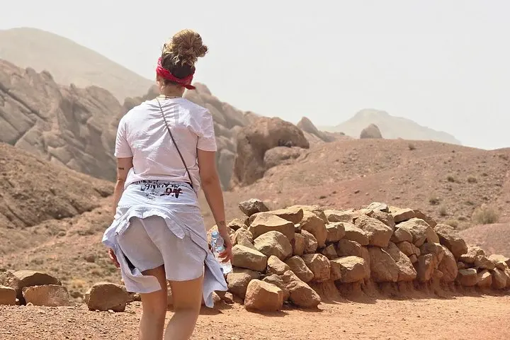
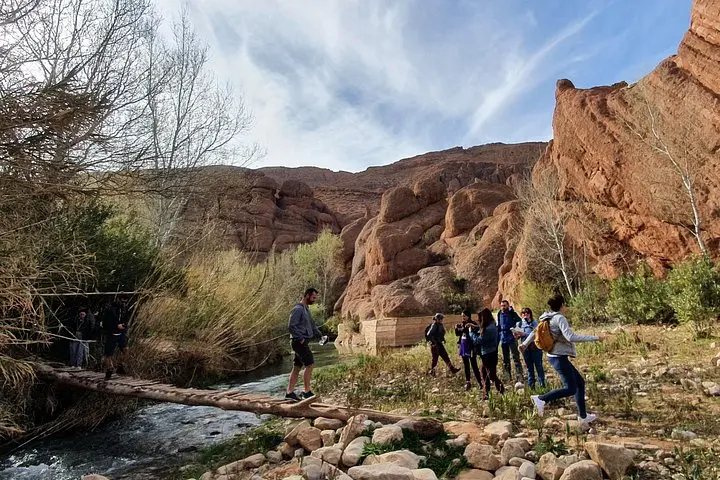
You step off the road at the Monkey Finger viewpoint and the air changes—dry, sun-warmed stone underfoot, a distant ribbon of river threading the canyon floor. Your guide gives a quick briefing, hands you a bottle of water, and leads a steep, dust-bright descent toward the Dades River. Fig trees and cultivated terraces line the valley; the sound shifts from highway hum to birdcalls and the faint murmur of irrigation channels.
Verified experiences and guided adventures in the surrounding area.
Operated by Morocco Exposure · Boumalne Dades, Drâa-Tafilalet
You step off the road at the Monkey Finger viewpoint and the air changes—dry, sun-warmed stone underfoot, a distant ribbon of river threading the canyon floor. Your guide gives a quick briefing, hands you a bottle of water, and leads a steep, dust-bright descent toward the Dades River. Fig trees and cultivated terraces line the valley; the sound shifts from highway hum to birdcalls and the faint murmur of irrigation channels.
Geology here is raw and readable: layered sandstone and weathered conglomerate carved into fingers, towers, and amphitheaters by wind and seasonal flash floods. The route follows farm tracks and a 30-minute stretch through the Valley of Roses, where local varieties perfume the air in spring and figs dangle like small suns. Cultural threads are visible at every turn—mud-brick kasbahs, granaries perched on ridgelines, and the irrigation techniques that have sustained Amazigh communities for generations.
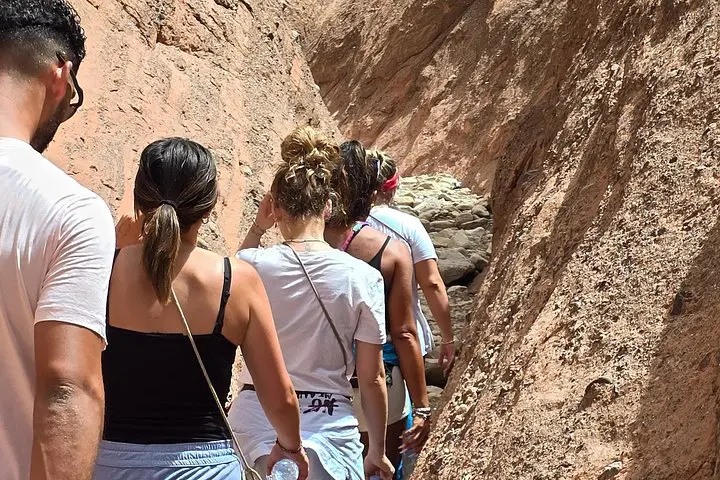
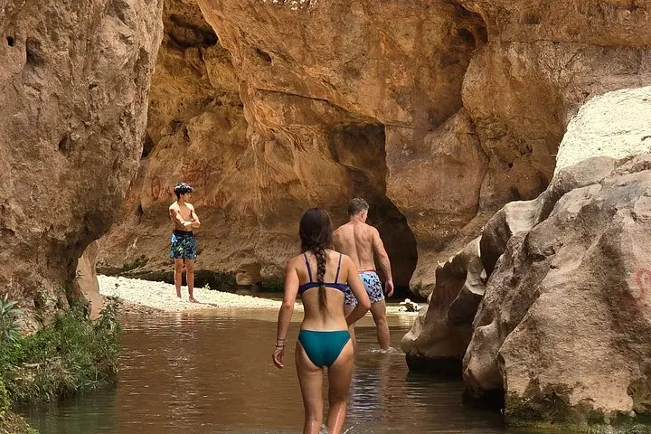
Expect 7–10 km of mixed terrain: firm trails, rocky scrambles through narrow canyon sections and several spots where your guide may offer a hand for stability. There’s a 1.5-hour canyoning portion amid sandstone walls—movement, not technical rope work—followed by a summit walk with 360-degree vistas of villages and terraced slopes. Stops include coffee, nuts and dates, and a short historical tour of nearby kasbahs.
Practical edge: start mid-morning to avoid the hottest hours, bring a full water bottle, sturdy trail shoes with grip, sun protection and a light layer for changing winds. Respect private farmland, follow your guide’s route through the canyon, and leave no trace—this fragile valley depends on careful visitation.
The guided route covers roughly 7–10 km and takes about 3 hours; terrain is mixed with some short canyon scrambles—rated moderate.
A professional mountains guide, a bottle of water, snacks (coffee/tea, nuts, dates) and a cultural tour of local kasbahs are included.
No ropes or technical equipment are required—guides provide assistance at three narrow sections; good footwear is important.
The meeting point is Auberge Kasbah Ait Merghad (Monkey Finger viewpoint); public transport options exist nearby but private transfers should be arranged if needed.
Morocco Exposure operates guided outdoor trips and adventures with an emphasis on safety, stewardship, and memorable experiences.
You step off the road at the Monkey Finger viewpoint and the air changes—dry, sun-warmed stone underfoot, a distant ribbon of river threading the canyon floor. Your guide gives a quick briefing, hands you a bottle of water, and leads a steep, dust-bright descent toward the Dades River. Fig trees and cultivated terraces line the valley; the sound shifts from highway hum to birdcalls and the faint murmur of irrigation channels.
You step off the road at the Monkey Finger viewpoint and the air changes—dry, sun-warmed stone underfoot, a distant ribbon of river threading the canyon floor. Your guide gives a quick briefing, hands you a bottle of water, and leads a steep, dust-bright descent toward the Dades River. Fig trees and cultivated terraces line the valley; the sound shifts from highway hum to birdcalls and the faint murmur of irrigation channels.
Geology here is raw and readable: layered sandstone and weathered conglomerate carved into fingers, towers, and amphitheaters by wind and seasonal flash floods. The route follows farm tracks and a 30-minute stretch through the Valley of Roses, where local varieties perfume the air in spring and figs dangle like small suns. Cultural threads are visible at every turn—mud-brick kasbahs, granaries perched on ridgelines, and the irrigation techniques that have sustained Amazigh communities for generations.
Expect 7–10 km of mixed terrain: firm trails, rocky scrambles through narrow canyon sections and several spots where your guide may offer a hand for stability. There’s a 1.5-hour canyoning portion amid sandstone walls—movement, not technical rope work—followed by a summit walk with 360-degree vistas of villages and terraced slopes. Stops include coffee, nuts and dates, and a short historical tour of nearby kasbahs.
Practical edge: start mid-morning to avoid the hottest hours, bring a full water bottle, sturdy trail shoes with grip, sun protection and a light layer for changing winds. Respect private farmland, follow your guide’s route through the canyon, and leave no trace—this fragile valley depends on careful visitation.