THE ADVENTURE COLLECTIVE® · Independent discovery and booking for outdoor travel

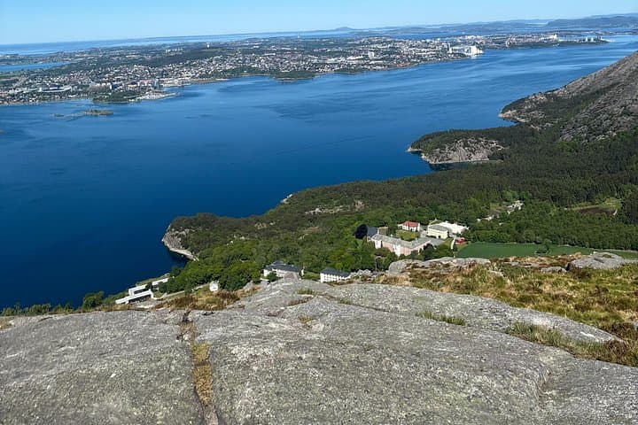
A short, steep climb rewards you with wide views over Gandsfjorden and the cities of Stavanger and Sandnes. This private hike to Dalsnuten blends accessible trails, local history, and dramatic coastal scenery in a 2–3 hour outing.
A short, steep climb rewards you with wide views over Gandsfjorden and the cities of Stavanger and Sandnes. This private hike to Dalsnuten blends accessible trails, local history, and dramatic coastal scenery in a 2–3 hour outing.
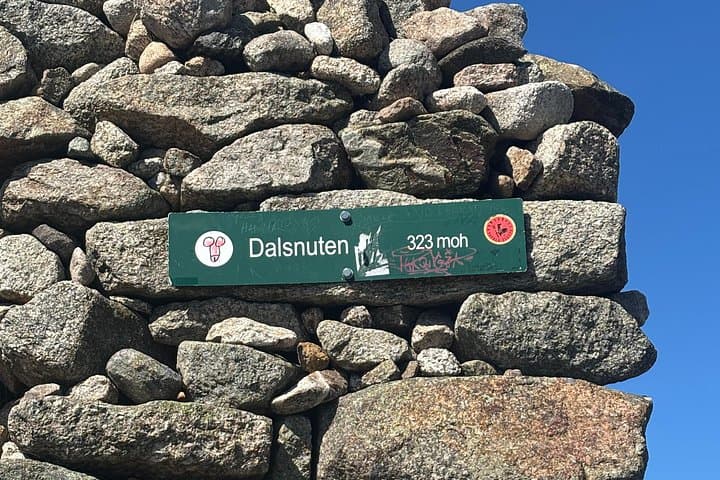
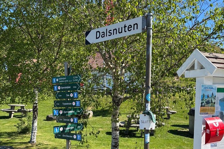
You step off a wide track into a small, cool wood and the city noise fades: only the soft scrape of boots, the cry of seabirds, and the distant glint of water below. The trail sweeps past Gramstadtjørn and threads between low stone walls—old farm boundaries that still hold the shape of pastures—before opening toward the final steep spine up to Dalsnuten's 323‑metre summit.
Verified experiences and guided adventures in the surrounding area.
Operated by My Adventures Travel · Sandnes, Rogaland
You step off a wide track into a small, cool wood and the city noise fades: only the soft scrape of boots, the cry of seabirds, and the distant glint of water below. The trail sweeps past Gramstadtjørn and threads between low stone walls—old farm boundaries that still hold the shape of pastures—before opening toward the final steep spine up to Dalsnuten's 323‑metre summit.
This route is both natural and cultural history. The stone fences are remnants of Revholen farm, occupied through the mid‑20th century, and the orchard near the trail blooms in early spring. Geologically the climb rides on hard Precambrian rock shaped by Pleistocene glaciers; the fjord you look down on, Gandsfjorden, was carved by ice and now catches the wind and light that sculpt local weather.
Locals have long used the ridge for grazing and quick escapes from the city—today Sandnes municipality maintains shelters and clear markers. Expect a mix of wide gravel track, forest tread, and a short steep scramble before the summit where the views open: the cityscapes of Stavanger and Sandnes, the fjord slicing inland, and islands scattered toward the North Sea.
Practical guide: allow about 2–3 hours roundtrip for a moderate‑paced group; distance is roughly 3–5 km with ~300 m ascent. Wear sturdy boots for rocky sections, carry windproof layers, and bring water—weather changes fast on exposed ridges. A private guide or small local group eases navigation, shares local stories at the top, and times the descent to avoid afternoon weather. Arrive early for calmer winds and clearer views—Dalsnuten rewards planning as much as effort.
Expect roughly 2–3 hours roundtrip, about 3–5 km and ~300 m of ascent; it’s moderate—short steep parts but no technical climbing.
Families with active children and older walkers who are used to uphill walking can manage the route, though the final slope requires steady footing and occasional rests.
The trail is marked and walkable independently, but a private guide adds local insight, route assurance in variable weather, and private transport options.
Coastal weather can switch quickly—layers, a windproof jacket, and waterproofs are recommended year‑round; check forecasts and start early to avoid afternoon wind.
My Adventures Travel operates guided outdoor trips and adventures with an emphasis on safety, stewardship, and memorable experiences.

You step off a wide track into a small, cool wood and the city noise fades: only the soft scrape of boots, the cry of seabirds, and the distant glint of water below. The trail sweeps past Gramstadtjørn and threads between low stone walls—old farm boundaries that still hold the shape of pastures—before opening toward the final steep spine up to Dalsnuten's 323‑metre summit.
You step off a wide track into a small, cool wood and the city noise fades: only the soft scrape of boots, the cry of seabirds, and the distant glint of water below. The trail sweeps past Gramstadtjørn and threads between low stone walls—old farm boundaries that still hold the shape of pastures—before opening toward the final steep spine up to Dalsnuten's 323‑metre summit.
This route is both natural and cultural history. The stone fences are remnants of Revholen farm, occupied through the mid‑20th century, and the orchard near the trail blooms in early spring. Geologically the climb rides on hard Precambrian rock shaped by Pleistocene glaciers; the fjord you look down on, Gandsfjorden, was carved by ice and now catches the wind and light that sculpt local weather.
Locals have long used the ridge for grazing and quick escapes from the city—today Sandnes municipality maintains shelters and clear markers. Expect a mix of wide gravel track, forest tread, and a short steep scramble before the summit where the views open: the cityscapes of Stavanger and Sandnes, the fjord slicing inland, and islands scattered toward the North Sea.
Practical guide: allow about 2–3 hours roundtrip for a moderate‑paced group; distance is roughly 3–5 km with ~300 m ascent. Wear sturdy boots for rocky sections, carry windproof layers, and bring water—weather changes fast on exposed ridges. A private guide or small local group eases navigation, shares local stories at the top, and times the descent to avoid afternoon weather. Arrive early for calmer winds and clearer views—Dalsnuten rewards planning as much as effort.