THE ADVENTURE COLLECTIVE® · Independent discovery and booking for outdoor travel

Climb from Met Station to 3,800 m on the fast, scenic Naro Moru route: a steep day hike with sweeping views of Batian and Nelion. Expect a long drive from Nairobi, sharp altitude gain, and rewarding alpine panoramas.
Climb from Met Station to 3,800 m on the fast, scenic Naro Moru route: a steep day hike with sweeping views of Batian and Nelion. Expect a long drive from Nairobi, sharp altitude gain, and rewarding alpine panoramas.
You leave Nairobi before dawn, the city lights shrinking behind your vehicle as the road climbs toward the equator line and the first shoulders of Mount Kenya appear on the horizon. A four-hour drive through highland farms drops you at the Naro Moru gate (≈2,400 m); the air already feels thinner and cooler, the mountain’s ridges cutting a clean silhouette against the sky.
Verified experiences and guided adventures in the surrounding area.
Operated by Excellent GameSpotting Adventures · Naro Moru, Nyeri County
You leave Nairobi before dawn, the city lights shrinking behind your vehicle as the road climbs toward the equator line and the first shoulders of Mount Kenya appear on the horizon. A four-hour drive through highland farms drops you at the Naro Moru gate (≈2,400 m); the air already feels thinner and cooler, the mountain’s ridges cutting a clean silhouette against the sky.
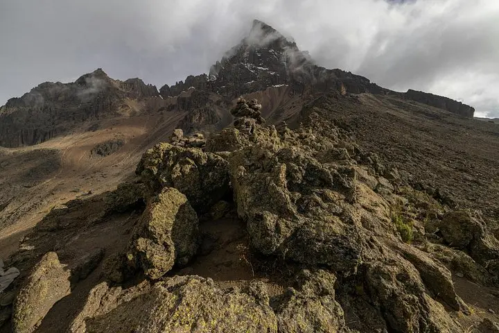
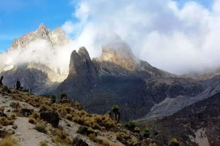
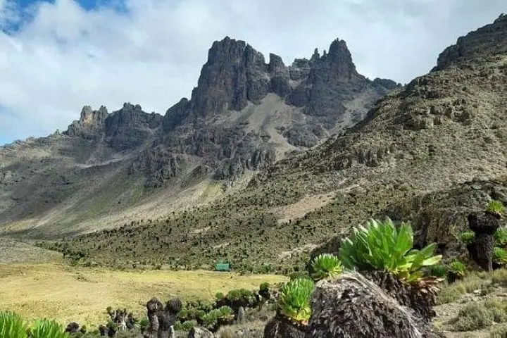
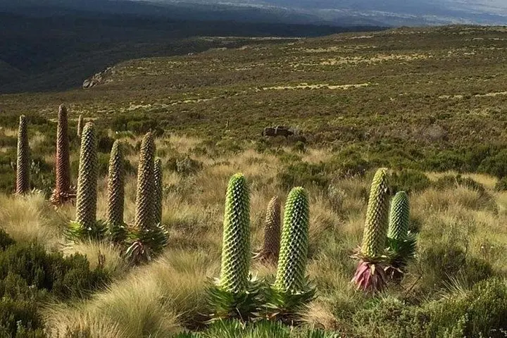
The Naro Moru (NaroMoru) route is the fastest, steepest approach on the western flank and gives some of the clearest frames of Batian (5,199 m) and Nelion (5,099 m). Geologically, Mount Kenya is a heavily eroded stratovolcano—granite and gneiss buttresses near the summit give way to mossy montane forest lower down. The mountain is culturally significant to the Kikuyu (called Kirinyaga — "that which ravages the land"), and the slopes have long been used for grazing and small-scale agriculture.
Expect a brisk three-hour ascent from the Met Station (≈3,095 m) to about 3,800 m, with steep switchbacks, river crossings that dare you to cross carefully, and open ridgelines that reveal the twin peaks overhead. Lunch usually happens back at the gate before the return drive to Nairobi.
Practical guidance: altitude gain is the main challenge—drink, pace, and recognize symptoms of acute mountain sickness. Wear sturdy boots and layered clothing; weather can shift from hot sun to cold wind in an hour. Carry 2–3 liters of water, a windproof layer, and snacks. Aim for an early start, keep to the marked trails, and leave no trace—Mount Kenya’s fragile ecosystems recover slowly but can be protected by simple choices on the trail.
The guided ascent from Met Station (≈3,095 m) to around 3,800 m typically takes about 2.5–3.5 hours one way depending on pace and conditions.
Some prior acclimatization helps—if you’re coming directly from Nairobi, move deliberately, hydrate, and be prepared to turn back if you develop altitude symptoms.
Moderate fitness: regular hikers who can manage sustained uphill walking for several hours will find this manageable; it’s not technical climbing.
Yes, park fees are generally included in the tour price and handled by the operator; still bring ID and any required documentation.
Excellent GameSpotting Adventures operates guided outdoor trips and adventures with an emphasis on safety, stewardship, and memorable experiences.
You leave Nairobi before dawn, the city lights shrinking behind your vehicle as the road climbs toward the equator line and the first shoulders of Mount Kenya appear on the horizon. A four-hour drive through highland farms drops you at the Naro Moru gate (≈2,400 m); the air already feels thinner and cooler, the mountain’s ridges cutting a clean silhouette against the sky.
You leave Nairobi before dawn, the city lights shrinking behind your vehicle as the road climbs toward the equator line and the first shoulders of Mount Kenya appear on the horizon. A four-hour drive through highland farms drops you at the Naro Moru gate (≈2,400 m); the air already feels thinner and cooler, the mountain’s ridges cutting a clean silhouette against the sky.
The Naro Moru (NaroMoru) route is the fastest, steepest approach on the western flank and gives some of the clearest frames of Batian (5,199 m) and Nelion (5,099 m). Geologically, Mount Kenya is a heavily eroded stratovolcano—granite and gneiss buttresses near the summit give way to mossy montane forest lower down. The mountain is culturally significant to the Kikuyu (called Kirinyaga — "that which ravages the land"), and the slopes have long been used for grazing and small-scale agriculture.
Expect a brisk three-hour ascent from the Met Station (≈3,095 m) to about 3,800 m, with steep switchbacks, river crossings that dare you to cross carefully, and open ridgelines that reveal the twin peaks overhead. Lunch usually happens back at the gate before the return drive to Nairobi.
Practical guidance: altitude gain is the main challenge—drink, pace, and recognize symptoms of acute mountain sickness. Wear sturdy boots and layered clothing; weather can shift from hot sun to cold wind in an hour. Carry 2–3 liters of water, a windproof layer, and snacks. Aim for an early start, keep to the marked trails, and leave no trace—Mount Kenya’s fragile ecosystems recover slowly but can be protected by simple choices on the trail.