THE ADVENTURE COLLECTIVE® · Independent discovery and booking for outdoor travel

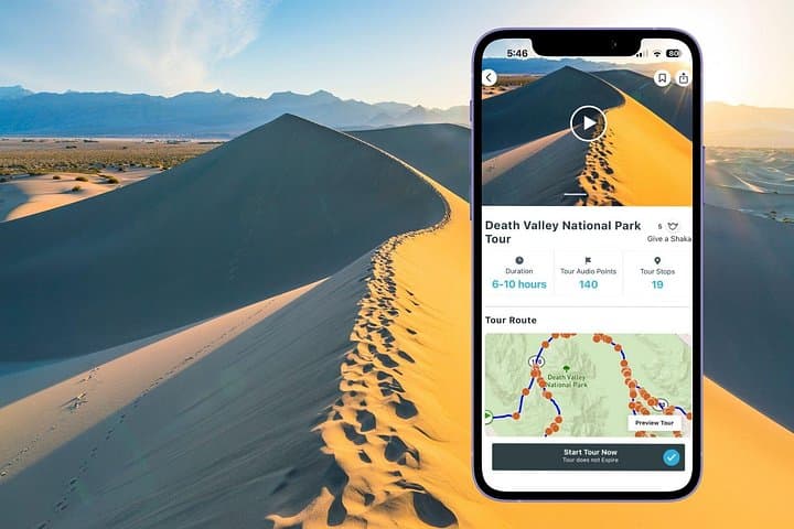
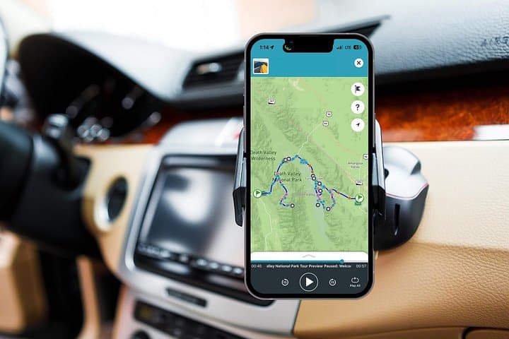
Drive Death Valley with GPS-triggered narration that explains geology, film history and mining relics as you go. This self-guided audio tour lets you stop at Badwater Basin, Mesquite Flat Dunes and Dante’s View on your own schedule.
Drive Death Valley with GPS-triggered narration that explains geology, film history and mining relics as you go. This self-guided audio tour lets you stop at Badwater Basin, Mesquite Flat Dunes and Dante’s View on your own schedule.
A windshield frames the valley: a flat, white plain that stretches farther than the eye expects while the Panamint Range cuts jagged teeth into the horizon. In a rental car with the Shaka Guide app cued, the road becomes a sequence of cinematic stops — salt flats that glare like sheet metal, dune ridges folding in the wind, and a viewpoint high enough to look down on the floor of North America.
Verified experiences and guided adventures in the surrounding area.
Operated by Shaka Guide Apps · Furnace Creek, California
A windshield frames the valley: a flat, white plain that stretches farther than the eye expects while the Panamint Range cuts jagged teeth into the horizon. In a rental car with the Shaka Guide app cued, the road becomes a sequence of cinematic stops — salt flats that glare like sheet metal, dune ridges folding in the wind, and a viewpoint high enough to look down on the floor of North America.
Geology here is blunt and ancient: basin-and-range faulting carved the bowl that traps salt and seasonal run-off, while evaporated lake beds left the white crust at Badwater Basin (-282 ft). Human history is layered on top — Timbisha Shoshone ancestral lands, a late-19th-century borax industry with 20-mule teams, and small mining camps that echoed during boom years. Artists Palette shows how minerals paint cliffs, and charcoal kilns mark the park’s high-country industrial past.
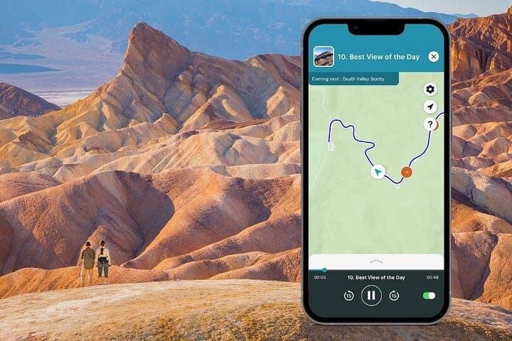
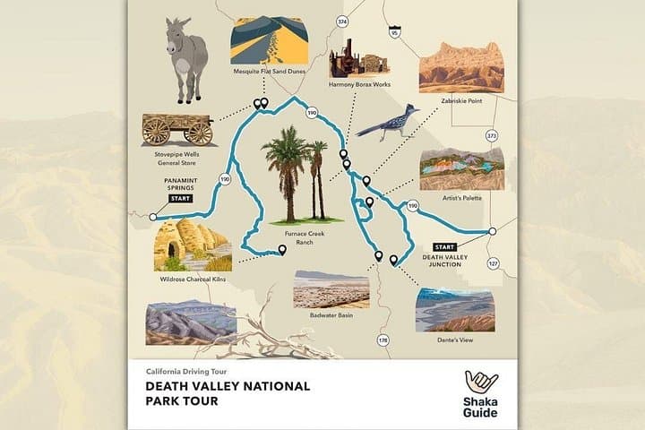
The audio tour routes these stories to specific stops — Dante’s View (over 5,000 ft), Mesquite Flat Sand Dunes, Zabriskie Point, the Furnace Creek museum and the Borax Historic District — letting drivers choose pace and side trips like Emigrant Canyon and Salt Creek boardwalk.
Practical: start early to avoid heat, fill gas before entering the park, and download the tour and offline maps over Wi‑Fi. Carry at least 1 liter of water per hour in summer, sturdy shoes for short walks, sun protection, and a spare tire — many dirt detours are rough. Cell service is patchy; follow the GPS prompts in the app, respect closed roads, and leave no trace. The result is a private, flexible way to see Death Valley’s extremes with context and safety built in.
No—most main roads are paved and accessible to standard cars, but some dirt detours (Emigrant Canyon, Mustard Canyon) require higher clearance; check conditions before driving.
No—the audio tour does not include park entrance fees; display a National Park pass or pay at the entrance station.
Yes—the Shaka Guide download includes offline audio and GPS maps; download the tour via Wi‑Fi before you arrive.
Several stops like Zabriskie Point and some Furnace Creek facilities are wheelchair accessible, but dunes and some trails are uneven; check specific stop accessibility in the app.
Shaka Guide Apps operates guided outdoor trips and adventures with an emphasis on safety, stewardship, and memorable experiences.
A windshield frames the valley: a flat, white plain that stretches farther than the eye expects while the Panamint Range cuts jagged teeth into the horizon. In a rental car with the Shaka Guide app cued, the road becomes a sequence of cinematic stops — salt flats that glare like sheet metal, dune ridges folding in the wind, and a viewpoint high enough to look down on the floor of North America.
A windshield frames the valley: a flat, white plain that stretches farther than the eye expects while the Panamint Range cuts jagged teeth into the horizon. In a rental car with the Shaka Guide app cued, the road becomes a sequence of cinematic stops — salt flats that glare like sheet metal, dune ridges folding in the wind, and a viewpoint high enough to look down on the floor of North America.
Geology here is blunt and ancient: basin-and-range faulting carved the bowl that traps salt and seasonal run-off, while evaporated lake beds left the white crust at Badwater Basin (-282 ft). Human history is layered on top — Timbisha Shoshone ancestral lands, a late-19th-century borax industry with 20-mule teams, and small mining camps that echoed during boom years. Artists Palette shows how minerals paint cliffs, and charcoal kilns mark the park’s high-country industrial past.
The audio tour routes these stories to specific stops — Dante’s View (over 5,000 ft), Mesquite Flat Sand Dunes, Zabriskie Point, the Furnace Creek museum and the Borax Historic District — letting drivers choose pace and side trips like Emigrant Canyon and Salt Creek boardwalk.
Practical: start early to avoid heat, fill gas before entering the park, and download the tour and offline maps over Wi‑Fi. Carry at least 1 liter of water per hour in summer, sturdy shoes for short walks, sun protection, and a spare tire — many dirt detours are rough. Cell service is patchy; follow the GPS prompts in the app, respect closed roads, and leave no trace. The result is a private, flexible way to see Death Valley’s extremes with context and safety built in.