THE ADVENTURE COLLECTIVE® · Independent discovery and booking for outdoor travel

Climb the upper slopes of the Alhambra fortress on a guided urban hike through Dehesa del Generalife—holly oaks, Nasrid cisterns and a skyline view of Granada. This 4-hour route mixes gentle ascent with history and city panoramas.
Climb the upper slopes of the Alhambra fortress on a guided urban hike through Dehesa del Generalife—holly oaks, Nasrid cisterns and a skyline view of Granada. This 4-hour route mixes gentle ascent with history and city panoramas.
The path begins above the palace walls where the city exhales—stone roofs and church towers fall away beneath scrubby hills and the silhouette of the Alhambra looms to the west. You set off along sun-warmed tracks, holm oaks casting patchwork shade, while the city’s orange-tiled grid slides into view below.
Verified experiences and guided adventures in the surrounding area.
Operated by DIM TRAP · Granada, Andalucía
The path begins above the palace walls where the city exhales—stone roofs and church towers fall away beneath scrubby hills and the silhouette of the Alhambra looms to the west. You set off along sun-warmed tracks, holm oaks casting patchwork shade, while the city’s orange-tiled grid slides into view below.
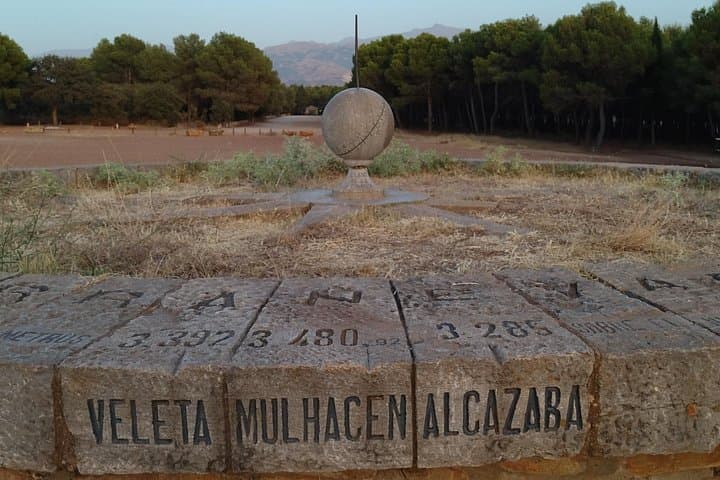
This route follows the Dehesa del Generalife, the upper slopes that historically framed the Nasrid fortress. Walkers pass features with names that map centuries: El Aljibe de la lluvia, the old rain cisterns; Reloj de Sol, a simple sundial; and the Silla del Moro viewpoint that keeps a patient watch over Granada. Geology here is a mix of weathered limestone and compacted red soils that support Mediterranean scrub—low pines, rosemary, and the scattered holm oak specimens that remain near the city.
Expect a roughly 4-hour outing covering about 6 km with approximately 150–250 m of cumulative elevation gain—enough to raise the pulse without technical scrambling. The guide threads history and natural history through the hike, pointing out spots where Nasrid engineers shaped water flow and where birds use exposed rocks as hunting perches.
Practical side: start in the cool hours for best light, bring layered clothing for wind on exposed ridges, and carry at least 1–1.5 L of water (bottled water and snacks are provided on organized departures). Stick to marked paths to protect the fragile Mediterranean vegetation and the archaeological traces tucked into the hills.
Commonly the departures start at Puerta de las Granadas near the Alhambra entrance; check your booking confirmation for exact pickup coordinates.
Older children used to walking 6–8 km and short climbs will manage it, but the route is not recommended for very young kids due to exposure and uneven ground.
Guides typically work in English and Spanish; confirm language options when booking if you need another language support.
Trekking sticks are included by the operator and can be useful on steeper or loose sections.
DIM TRAP operates guided outdoor trips and adventures with an emphasis on safety, stewardship, and memorable experiences.


The path begins above the palace walls where the city exhales—stone roofs and church towers fall away beneath scrubby hills and the silhouette of the Alhambra looms to the west. You set off along sun-warmed tracks, holm oaks casting patchwork shade, while the city’s orange-tiled grid slides into view below.
The path begins above the palace walls where the city exhales—stone roofs and church towers fall away beneath scrubby hills and the silhouette of the Alhambra looms to the west. You set off along sun-warmed tracks, holm oaks casting patchwork shade, while the city’s orange-tiled grid slides into view below.
This route follows the Dehesa del Generalife, the upper slopes that historically framed the Nasrid fortress. Walkers pass features with names that map centuries: El Aljibe de la lluvia, the old rain cisterns; Reloj de Sol, a simple sundial; and the Silla del Moro viewpoint that keeps a patient watch over Granada. Geology here is a mix of weathered limestone and compacted red soils that support Mediterranean scrub—low pines, rosemary, and the scattered holm oak specimens that remain near the city.
Expect a roughly 4-hour outing covering about 6 km with approximately 150–250 m of cumulative elevation gain—enough to raise the pulse without technical scrambling. The guide threads history and natural history through the hike, pointing out spots where Nasrid engineers shaped water flow and where birds use exposed rocks as hunting perches.
Practical side: start in the cool hours for best light, bring layered clothing for wind on exposed ridges, and carry at least 1–1.5 L of water (bottled water and snacks are provided on organized departures). Stick to marked paths to protect the fragile Mediterranean vegetation and the archaeological traces tucked into the hills.