THE ADVENTURE COLLECTIVE® · Independent discovery and booking for outdoor travel

Drive an 82-mile circular route around the Isle of Man at your own pace. This self-guided plan combines coastal scenery, Victorian heritage and moorland summits with flexible itineraries, maps, and local insights.
Drive an 82-mile circular route around the Isle of Man at your own pace. This self-guided plan combines coastal scenery, Victorian heritage and moorland summits with flexible itineraries, maps, and local insights.
You pull off the main road and the sea widens: wind pushes off the Irish Sea, gulls ride the thermals, and a red-and-white lighthouse punctuates the horizon. This 82-mile (133 km) circular route threads coastal lanes, Victorian promenades and moorland ridges—designed to be driven at your pace and broken into three flexible sections: Douglas & East, Northern, and Western with South.
Verified experiences and guided adventures in the surrounding area.
Operated by Uncover Britain Road Trips · Douglas, Isle of Man
You pull off the main road and the sea widens: wind pushes off the Irish Sea, gulls ride the thermals, and a red-and-white lighthouse punctuates the horizon. This 82-mile (133 km) circular route threads coastal lanes, Victorian promenades and moorland ridges—designed to be driven at your pace and broken into three flexible sections: Douglas & East, Northern, and Western with South.
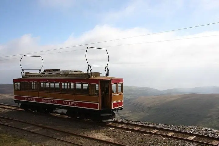
The island wears history on every headland. Celtic crosses at Maughold, Viking place-names, and the industrial scars around Laxey—home to the 1854 Great Laxey Wheel—tell stories of monks, Norse settlers and 19th-century mining. Geology ranges from glacially sculpted cliffs and pebble spits at Point of Ayre to the blocky summit of Snaefell (621 m), where views sweep to England, Scotland and Ireland on a clear day. Local culture is quietly distinct: the Manx language survives in place names, and small harbours still smoke herring and kippers.
Practically, this is a road-first adventure with short walks: coastal strolls, glen paths and hill climbs are optional extras. The guide provides sample itineraries for 3–14 days, pre-populated Google Map pins, parking notes and suggested stops—ideal for travellers who want structure without a strict schedule. Expect narrow single-track lanes, changeable weather, and limited fuel points in rural stretches.
Plan daylight for cliff paths, allow extra time for heritage railways and museum visits, and carry waterproof layers. Use local timetables if you want to add the Manx Electric or steam railways. Drive slowly, respect farmland and bird colonies, and you’ll leave with a compact, varied island journey that feels both old-world and immediately yours.
The route covers about 82 miles (133 km) and is suggested for flexible travel over 3–14 days depending on how many stops and walks you add.
Some attractions—like the Laxey Wheel, heritage railways or seasonal museums—have limited hours; book in summer or bank-holiday periods to guarantee entry.
The plan is web-based (not an app); download or screenshot key map sections and directions for areas with poor signal.
If you arrive by air, you can drive the entire loop; if you bring a vehicle by ferry, check crossing schedules and vehicle reservations in advance.
Uncover Britain Road Trips operates guided outdoor trips and adventures with an emphasis on safety, stewardship, and memorable experiences.
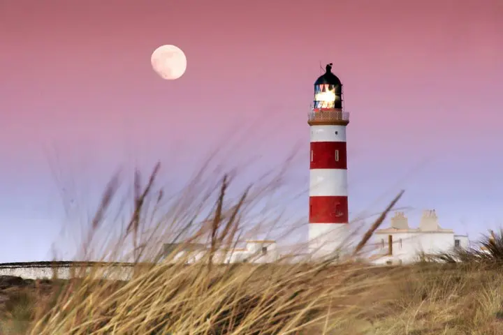


You pull off the main road and the sea widens: wind pushes off the Irish Sea, gulls ride the thermals, and a red-and-white lighthouse punctuates the horizon. This 82-mile (133 km) circular route threads coastal lanes, Victorian promenades and moorland ridges—designed to be driven at your pace and broken into three flexible sections: Douglas & East, Northern, and Western with South.
You pull off the main road and the sea widens: wind pushes off the Irish Sea, gulls ride the thermals, and a red-and-white lighthouse punctuates the horizon. This 82-mile (133 km) circular route threads coastal lanes, Victorian promenades and moorland ridges—designed to be driven at your pace and broken into three flexible sections: Douglas & East, Northern, and Western with South.
The island wears history on every headland. Celtic crosses at Maughold, Viking place-names, and the industrial scars around Laxey—home to the 1854 Great Laxey Wheel—tell stories of monks, Norse settlers and 19th-century mining. Geology ranges from glacially sculpted cliffs and pebble spits at Point of Ayre to the blocky summit of Snaefell (621 m), where views sweep to England, Scotland and Ireland on a clear day. Local culture is quietly distinct: the Manx language survives in place names, and small harbours still smoke herring and kippers.
Practically, this is a road-first adventure with short walks: coastal strolls, glen paths and hill climbs are optional extras. The guide provides sample itineraries for 3–14 days, pre-populated Google Map pins, parking notes and suggested stops—ideal for travellers who want structure without a strict schedule. Expect narrow single-track lanes, changeable weather, and limited fuel points in rural stretches.
Plan daylight for cliff paths, allow extra time for heritage railways and museum visits, and carry waterproof layers. Use local timetables if you want to add the Manx Electric or steam railways. Drive slowly, respect farmland and bird colonies, and you’ll leave with a compact, varied island journey that feels both old-world and immediately yours.