THE ADVENTURE COLLECTIVE® · Independent discovery and booking for outdoor travel

Drive into cool highland air and stand atop Thailand’s highest peak—Doi Inthanon offers short nature trails, twin pagodas, hill-tribe markets, and waterfalls in a single day from Chiang Mai. Ideal for birders and travelers seeking accessible mountain scenery and cultural stops.
Drive into cool highland air and stand atop Thailand’s highest peak—Doi Inthanon offers short nature trails, twin pagodas, hill-tribe markets, and waterfalls in a single day from Chiang Mai. Ideal for birders and travelers seeking accessible mountain scenery and cultural stops.
Morning mist clings to the road as you climb out of Chiang Mai, the air cooling decisively with each contour of the highway. By the time you reach the summit plateau—about 2,565 m (roughly 8,400 ft)—the trees have changed voice: moss and ferns whisper, and wind threads through scrub and rhododendron.
Verified experiences and guided adventures in the surrounding area.
Operated by Panorama Destination Thailand · Chiang Mai, Chiang Mai Province
Morning mist clings to the road as you climb out of Chiang Mai, the air cooling decisively with each contour of the highway. By the time you reach the summit plateau—about 2,565 m (roughly 8,400 ft)—the trees have changed voice: moss and ferns whisper, and wind threads through scrub and rhododendron.
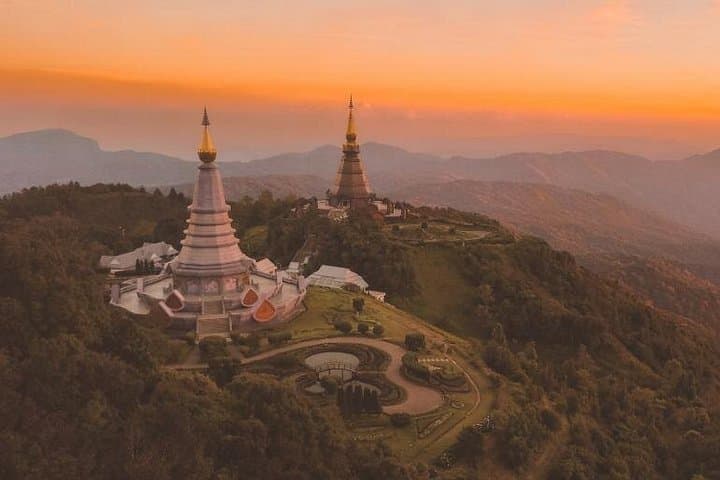
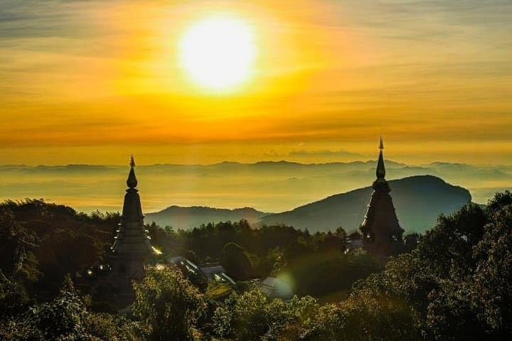
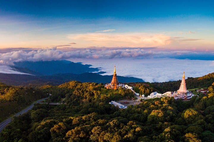
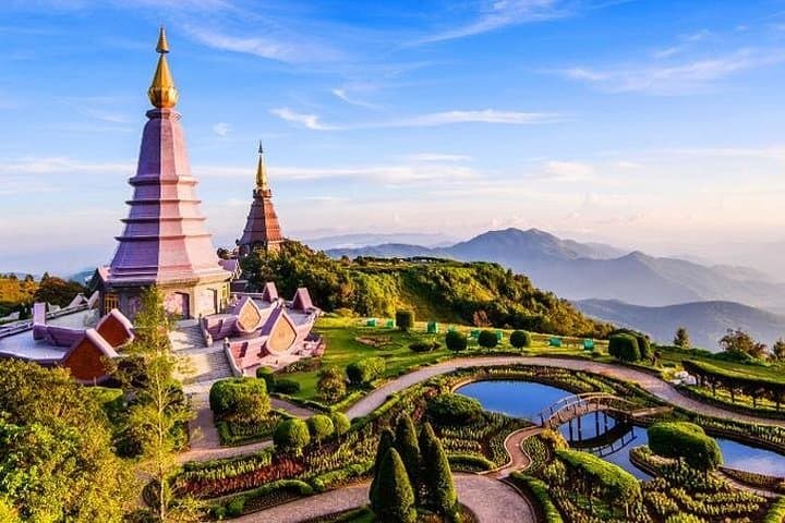
Doi Inthanon is the highest point in Thailand and the southernmost spur of the Himalayan uplift, a granite backbone that supports cool montane forest and nearly 400 recorded bird species. The summit area holds a small stupa honoring Chao Inthawichayanon and the twin King–Queen pagodas built as royal tributes; below, tribal markets and Royal Project farms tell a recent cultural story of crop substitution and community development. Geologically, erosion-carved ridges and deep gullies create microclimates—damp pockets where moss and orchids thrive and open ridgelines that take the wind.
Practically, most visitors experience Doi Inthanon as a guided day trip: a 1.5–2 hour drive each way from Chiang Mai, short paved walks to viewpoints, boardwalk-style nature trails like Ang Kha, and a series of stops at waterfalls and village markets. Expect cool, often windy conditions at the top; bring layers and a rain shell in the wet season. Trails are generally well-marked but can be muddy after rain; stay on designated paths to protect fragile groundcover. If you’re a birder or photographer, arrive early for the best light and quiet.
For a compact, variable mountain day—mixing easy hikes, cultural stops, and clear summit panoramas—Doi Inthanon delivers a clear, accessible highland experience.
The drive is roughly 1.5–2 hours each way depending on traffic and stops; expect a full day (about 8 hours) for guided tours.
No—access to the summit and popular viewpoints involves short, easy walks; steeper trails are optional and short in length.
Peak blooms for white and red rhododendrons are typically in January–February, when higher-elevation wildflower displays are at their best.
Yes—visitor centers, pagoda areas, and restaurants near tourist stops provide toilets and lunch options; carry small change for market purchases.
Panorama Destination Thailand operates guided outdoor trips and adventures with an emphasis on safety, stewardship, and memorable experiences.
Morning mist clings to the road as you climb out of Chiang Mai, the air cooling decisively with each contour of the highway. By the time you reach the summit plateau—about 2,565 m (roughly 8,400 ft)—the trees have changed voice: moss and ferns whisper, and wind threads through scrub and rhododendron.
Morning mist clings to the road as you climb out of Chiang Mai, the air cooling decisively with each contour of the highway. By the time you reach the summit plateau—about 2,565 m (roughly 8,400 ft)—the trees have changed voice: moss and ferns whisper, and wind threads through scrub and rhododendron.
Doi Inthanon is the highest point in Thailand and the southernmost spur of the Himalayan uplift, a granite backbone that supports cool montane forest and nearly 400 recorded bird species. The summit area holds a small stupa honoring Chao Inthawichayanon and the twin King–Queen pagodas built as royal tributes; below, tribal markets and Royal Project farms tell a recent cultural story of crop substitution and community development. Geologically, erosion-carved ridges and deep gullies create microclimates—damp pockets where moss and orchids thrive and open ridgelines that take the wind.
Practically, most visitors experience Doi Inthanon as a guided day trip: a 1.5–2 hour drive each way from Chiang Mai, short paved walks to viewpoints, boardwalk-style nature trails like Ang Kha, and a series of stops at waterfalls and village markets. Expect cool, often windy conditions at the top; bring layers and a rain shell in the wet season. Trails are generally well-marked but can be muddy after rain; stay on designated paths to protect fragile groundcover. If you’re a birder or photographer, arrive early for the best light and quiet.
For a compact, variable mountain day—mixing easy hikes, cultural stops, and clear summit panoramas—Doi Inthanon delivers a clear, accessible highland experience.