THE ADVENTURE COLLECTIVE® · Independent discovery and booking for outdoor travel

Climb Thailand’s highest peak, hike cloud-forest trails and visit a Karen coffee village on a full-day guided tour from Chiang Mai. Expect easy summit loops, a 2-hour village trek, waterfalls and cool mountain air.
Climb Thailand’s highest peak, hike cloud-forest trails and visit a Karen coffee village on a full-day guided tour from Chiang Mai. Expect easy summit loops, a 2-hour village trek, waterfalls and cool mountain air.
Mist clings to the tree crowns as the road winds up from Chiang Mai; by the time you step out at the summit the air feels sharper, a cool punctuation to the city heat below. Doi Inthanon—the roof of Thailand at 2,565 meters—opens with cloud-forest trails, boardwalks through moss-draped trees and the steady roar of waterfalls that dare you closer.
Verified experiences and guided adventures in the surrounding area.
Operated by Private Guide in Chiang Mai · Chiang Mai, Chiang Mai Province
Mist clings to the tree crowns as the road winds up from Chiang Mai; by the time you step out at the summit the air feels sharper, a cool punctuation to the city heat below. Doi Inthanon—the roof of Thailand at 2,565 meters—opens with cloud-forest trails, boardwalks through moss-draped trees and the steady roar of waterfalls that dare you closer.
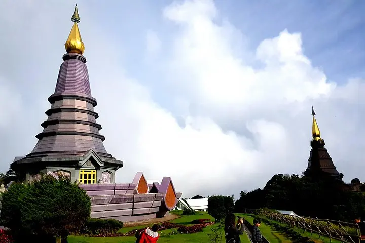
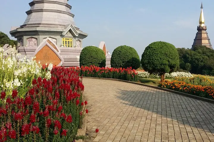
Geology here is old granite and sandstone folded into high ridgelines; the altitude creates montane forest and pockets of subalpine flora, where rhododendrons and orchids persist. The park hosts over 300 bird species and is also home to hill-tribe communities—stop in a Karen village to sample roasted Arabica and see smallholder coffee plots that follow generations of practice. Twin pagodas honor King Rama IX and Queen Sirikit, while the summit houses a royal agricultural research station born of mid-20th-century development projects.
On the ground expect mixed surfaces: short paved sections, boardwalks at Ang Kha, and dirt singletrack that can be muddy after rain. Typical guided itineraries combine a light summit loop (under 1 km), a 2-hour village trek (roughly 4–6 km with modest elevation changes) and waterfall viewpoints like Wachirathan, with time for the Hmong market.
Practical notes: dress in layers, bring a waterproof shell and 2L of water, and carry small bills for market purchases. Altitude affects temperature and stamina—take it steady on climbs and follow your guide’s pace. Stick to trails, ask before photographing people in villages, and you'll leave with rainforest views, coffee-smudged memories and a clear sense of why this place draws both birders and trekkers.
Doi Inthanon’s summit is 2,565 m—most visitors tolerate it well, but you may notice cooler temps and slight breathlessness on climbs; pace yourself and hydrate.
Yes—the summit loop is short and easy; the village trek is moderate (2 hours) with some uneven terrain—guides adjust pace for mixed abilities.
This guided private tour typically includes park admission and lunch—confirm details at booking and carry small cash for souvenirs or extra drinks.
Dry season (November–February) offers the clearest skies and coolest temperatures, but mornings can be cold—expect mist and changing conditions year-round.
Private Guide in Chiang Mai operates guided outdoor trips and adventures with an emphasis on safety, stewardship, and memorable experiences.
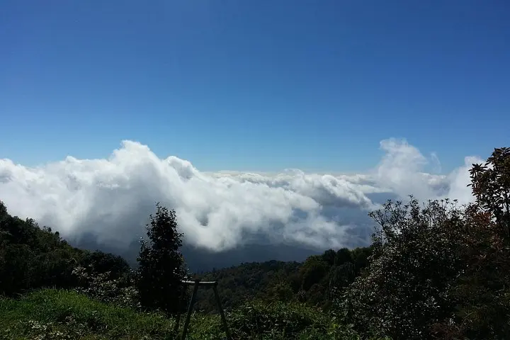
Mist clings to the tree crowns as the road winds up from Chiang Mai; by the time you step out at the summit the air feels sharper, a cool punctuation to the city heat below. Doi Inthanon—the roof of Thailand at 2,565 meters—opens with cloud-forest trails, boardwalks through moss-draped trees and the steady roar of waterfalls that dare you closer.
Mist clings to the tree crowns as the road winds up from Chiang Mai; by the time you step out at the summit the air feels sharper, a cool punctuation to the city heat below. Doi Inthanon—the roof of Thailand at 2,565 meters—opens with cloud-forest trails, boardwalks through moss-draped trees and the steady roar of waterfalls that dare you closer.
Geology here is old granite and sandstone folded into high ridgelines; the altitude creates montane forest and pockets of subalpine flora, where rhododendrons and orchids persist. The park hosts over 300 bird species and is also home to hill-tribe communities—stop in a Karen village to sample roasted Arabica and see smallholder coffee plots that follow generations of practice. Twin pagodas honor King Rama IX and Queen Sirikit, while the summit houses a royal agricultural research station born of mid-20th-century development projects.
On the ground expect mixed surfaces: short paved sections, boardwalks at Ang Kha, and dirt singletrack that can be muddy after rain. Typical guided itineraries combine a light summit loop (under 1 km), a 2-hour village trek (roughly 4–6 km with modest elevation changes) and waterfall viewpoints like Wachirathan, with time for the Hmong market.
Practical notes: dress in layers, bring a waterproof shell and 2L of water, and carry small bills for market purchases. Altitude affects temperature and stamina—take it steady on climbs and follow your guide’s pace. Stick to trails, ask before photographing people in villages, and you'll leave with rainforest views, coffee-smudged memories and a clear sense of why this place draws both birders and trekkers.