THE ADVENTURE COLLECTIVE® · Independent discovery and booking for outdoor travel

Walk the Donkin Reserve at your own pace with an offline audio guide that threads Port Elizabeth’s 19th-century origins through civic architecture and coastal viewpoints. Download the VoiceMap audio, set aside an hour, and follow the city’s stones to the Campanile and beyond.
Walk the Donkin Reserve at your own pace with an offline audio guide that threads Port Elizabeth’s 19th-century origins through civic architecture and coastal viewpoints. Download the VoiceMap audio, set aside an hour, and follow the city’s stones to the Campanile and beyond.
You start on a limestone terrace above the city where the wind from Algoa Bay tugs at your jacket and the Campanile rises like a column of memory. Below, the streets fan out—stone churches, a market square once cluttered with ox-wagons, and a library whose terra-cotta façade arrived by ship—each stop waiting for the next cue on your phone.
Verified experiences and guided adventures in the surrounding area.
Operated by VoiceMap Audio Tours · Port Elizabeth (Gqeberha), Eastern Cape
You start on a limestone terrace above the city where the wind from Algoa Bay tugs at your jacket and the Campanile rises like a column of memory. Below, the streets fan out—stone churches, a market square once cluttered with ox-wagons, and a library whose terra-cotta façade arrived by ship—each stop waiting for the next cue on your phone.
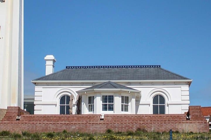
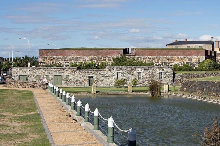
This hour-long self-guided audio tour traces Port Elizabeth’s birth in the 1819 Cape Emigration Scheme, moving through Victorian civic ambition and coastal military outposts. Geology is quiet but present: low coastal shale, the shallow estuary of the Baakens River threading through the urban grid, and Fort Frederick’s rocky headland that watches over Algoa Bay. Architecture and place names tell the cultural story—settler monuments, municipal halls, and public squares that shifted from trading hides to modern markets.
Practically, the path is urban pavement and reserve steps with short inclines; the route is designed for walkers of all fitness levels. Install the VoiceMap app, download offline maps and audio before you leave mobile range, and plan for 60–75 minutes at a relaxed pace. Morning light highlights the Campanile and cooler sea breezes make early visits more comfortable; midday can be busy and hot in summer. Wear sturdy shoes for steps and curbs, bring water, and keep a pocket for your phone and charger. The audio format gives freedom—pause where a bench invites you to watch fishing boats bob on the bay or study a carved stone and let the city’s history speak on its own terms.
Plan for approximately 60–75 minutes at a relaxed pace; you can pause the audio and explore sites longer if you like.
No—download the VoiceMap app and the tour files for offline audio, maps, and geodata before you start.
Yes—the walk is classified as easy, though there are stone steps and some uneven pavement; supervise children on steps.
No—this self-guided audio tour passes public spaces like Donkin Reserve, the Campanile, and city streets with no admission required.
VoiceMap Audio Tours operates guided outdoor trips and adventures with an emphasis on safety, stewardship, and memorable experiences.
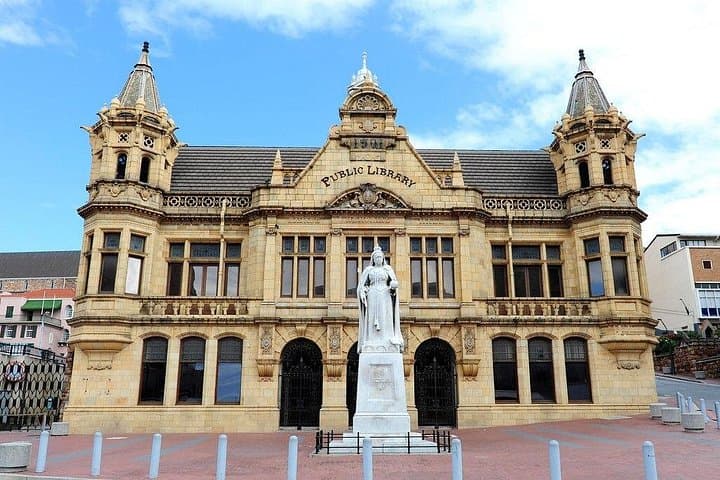

You start on a limestone terrace above the city where the wind from Algoa Bay tugs at your jacket and the Campanile rises like a column of memory. Below, the streets fan out—stone churches, a market square once cluttered with ox-wagons, and a library whose terra-cotta façade arrived by ship—each stop waiting for the next cue on your phone.
You start on a limestone terrace above the city where the wind from Algoa Bay tugs at your jacket and the Campanile rises like a column of memory. Below, the streets fan out—stone churches, a market square once cluttered with ox-wagons, and a library whose terra-cotta façade arrived by ship—each stop waiting for the next cue on your phone.
This hour-long self-guided audio tour traces Port Elizabeth’s birth in the 1819 Cape Emigration Scheme, moving through Victorian civic ambition and coastal military outposts. Geology is quiet but present: low coastal shale, the shallow estuary of the Baakens River threading through the urban grid, and Fort Frederick’s rocky headland that watches over Algoa Bay. Architecture and place names tell the cultural story—settler monuments, municipal halls, and public squares that shifted from trading hides to modern markets.
Practically, the path is urban pavement and reserve steps with short inclines; the route is designed for walkers of all fitness levels. Install the VoiceMap app, download offline maps and audio before you leave mobile range, and plan for 60–75 minutes at a relaxed pace. Morning light highlights the Campanile and cooler sea breezes make early visits more comfortable; midday can be busy and hot in summer. Wear sturdy shoes for steps and curbs, bring water, and keep a pocket for your phone and charger. The audio format gives freedom—pause where a bench invites you to watch fishing boats bob on the bay or study a carved stone and let the city’s history speak on its own terms.